

- Usage in publication:
-
- Scotty Wash quartzite*
- Modifications:
-
- Named
- Dominant lithology:
-
- Quartzite
- Sandstone
- Limestone
- AAPG geologic province:
-
- Great Basin province
Summary:
Named Scotty Wash quartzite. Type locality not designated, but section described 0.5 mi west-northwest of mineral monument No. 225 on western side of valley [Scotty Wash] is 695 feet thick. Another section at Dutch John Mountain north of Pioche district is about 1000 feet thick. Also found south and east of Scotty Spring as shown on map. Consists of red-brown, thin- and thick-bedded quartzitic sandstone with some shaly sandstone. Apparently conformably underlies Bailey Spring limestones; overlies with fault contact Peers Spring formation. Is provisionally correlated with Diamond Spring quartzite of Eureka district. No fossils but age is known to be Mississippian from immediately overlying and underlying fossiliferous limestones.
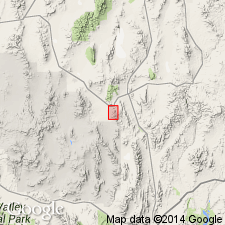
Named from Scotty Wash, which passes thru formation east of Silverhorn, Fairview Range, Bristol Range quadrangle, Pioche district, Lincoln Co., NV.
Source: Modified from GNU records (USGS DDS-6; Menlo GNULEX).
- Usage in publication:
-
- Scotty Wash quartzite*
- Modifications:
-
- Not used
- AAPG geologic province:
-
- Great Basin province
Summary:
On correlation chart Scotty Wash quartzite is replaced by Diamond Peak formation (Pennsylvanian age) in Pioche district which is extended north to include Dutch John Mountains. Overlies Peers Spring formation. "It is probably that Peers Spring formation includes Chainman shale and part of Diamond Peak formation."
Source: GNU records (USGS DDS-6; Menlo GNULEX).
- Usage in publication:
-
- Scotty Wash quartzite*
- Modifications:
-
- Not used
- AAPG geologic province:
-
- Great Basin province
Summary:
Scotty Wash quartzite is in chart under "Other names frequently used for these beds in place of Chainman shale."
Source: GNU records (USGS DDS-6; Menlo GNULEX).
- Usage in publication:
-
- Scotty Wash formation
- Modifications:
-
- Not used
- AAPG geologic province:
-
- Great Basin province
Summary:
Scotty Wash, White Pine, Diamond Peak, Illipah formations, etc. are not recognized as distinct units but are considered as facies within Chainman formation.
Source: GNU records (USGS DDS-6; Menlo GNULEX).
- Usage in publication:
-
- Scotty Wash quartzite*
- Modifications:
-
- Areal extent
- AAPG geologic province:
-
- Great Basin province
Summary:
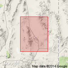
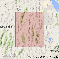
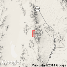
Scotty Wash quartzite of Pioche district and Illipah sandstone of Hamilton district are same lithogenetic units. Scotty Wash quartzite has priority (Westgate and Knopf, 1932); recommended that name Illipah be abandoned. Outcrops of Scotty Wash quartzite (and Illipah sandstone) distributed over area of 9,500 sq. mi. At Scotty Wash Gulch, underlies Bird Spring formation (formerly Bailey Springs limestone). At many localities, overlies thin dense limestone at top of Chainman shale which contains uppermost Chesterian goniatite cephalopod. At Buck Mountain, interfingers with Diamond Peak formation. Considered to be no older than early Springerian and no younger than overlying Morrowan Ely limestone (or Bird Spring formation). Poorly preserved fossils found at Johns Hollow, in southern Snake Range (sec. 9, T. 12 N., R. 68 E., White Pine Co., NV), and in Grant Range (sec. 21, T. 9 N., R. 60 E., Nye Co., NV). Report includes correlation chart.
Source: Modified from GNU records (USGS DDS-6; Menlo GNULEX).
- Usage in publication:
-
- Scotty Wash quartzite*
- Modifications:
-
- Areal extent
- AAPG geologic province:
-
- Great Basin province
Summary:
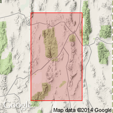
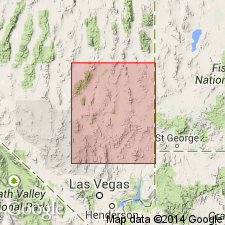
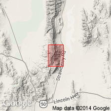
Mapped in Lincoln Co, NV. Consists of varicolored red or brown quartzite or sandstone (35 to 65%) and inconspicuous shale. Thickness 0 to about 800 ft. Silty or sandy varicolored limestone 150 to 300 ft thick occurs at top north of 38 deg N. Quartzite thin or absent in southern half of Co. Eastward grades into shale and then into limestone near Needle Range, UT (Illipah formation of Gould, 1959). Partly equivalent to Diamond Peak formation and Illipah formation of Christiansen (1951). Underlies Pennsylvanian limestone and overlies Chainman shale facies which is equivalent to Peers Spring formation in Pioche district. Assigned Late Mississippian age.
Source: GNU records (USGS DDS-6; Menlo GNULEX).
- Usage in publication:
-
- Scotty Wash quartzite*
- Modifications:
-
- Mapped
- AAPG geologic province:
-
- Great Basin province
Summary:
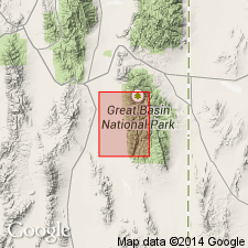
Scotty Wash quartzite and Chainman shale, undivided, are mapped in Wheeler Peak 15' quad, White Pine Co, NV. Scotty Wash quartzite is yellowish-gray to light olive-gray, fine- to medium-grained, thin-to-thick-bedded sandstone and quartzite with minor silty quartzite. Underlies Ely limestone; overlies Joana limestone. Assigned Late Mississippian age.
Source: GNU records (USGS DDS-6; Menlo GNULEX).
- Usage in publication:
-
- Scotty Wash Sandstone
- Modifications:
-
- Redescribed
- AAPG geologic province:
-
- Great Basin province
Summary:
In Egan Range, Scotty Wash Sandstone is olive-gray, pinkish, reddish, or brown, thinly to thickly bedded and cross-bedded, fine- and medium-grained quartz sandstone with some olive-gray flaky shale interbeds. Is 350 to 385 ft thick. Section measured 385 ft north of Silver Spring (sec2 T8N R62E). In lower sandstone at Trough Canyon contains fauna most comparable to Late Mississippian forms. Although age of upper Scotty Wash is much in doubt, considered Late Mississippian (Chesterian) age in this report.
Source: GNU records (USGS DDS-6; Menlo GNULEX).
- Usage in publication:
-
- Scotty Wash Formation
- Modifications:
-
- Redescribed
- AAPG geologic province:
-
- Great Basin province
Summary:
In Pahranagat Range Scotty Wash Formation is represented by about 250 ft of silty calcarenite, olive-gray shale, and brown quartzitic sandstones. Contact with overlying Bird Spring Formation is placed at top of 10-15 ft-thick, brown-weathered, cross-laminated quartzitic siltstone. Contact with underlying Chainman Shale is placed where shale becomes interbedded with sandstone and calcarenite and changes from dark gray to olive gray. Scotty Wash contains abundant Late Mississippian (Chesterian) fauna.
Source: GNU records (USGS DDS-6; Menlo GNULEX).
- Usage in publication:
-
- Scotty Wash Quartzite Member
- Modifications:
-
- Revised
- AAPG geologic province:
-
- Great Basin province
Summary:
Scotty Wash Quartzite is relegated to member status within Chainman Formation and is recognized only in southeastern NV. Underlies Needle Siltstone Member (new). Assigned Carboniferous age.
Source: GNU records (USGS DDS-6; Menlo GNULEX).
- Usage in publication:
-
- Scotty Wash Quartzite*
- Modifications:
-
- Areal extent
- Overview
- AAPG geologic province:
-
- Great Basin province
Summary:
Complete unfaulted sections exposed in southern Egan and Timpahute Ranges and on Dutch John Mountain but extensive exposures found in Fortification and Fairview Ranges. Red limestone facies which Kellogg (1959) includes in Ely Limestone is here considered Scotty Wash. Several localities west of White and north of 38 deg N of alternating dark-red and olive-green cross-bedded quartzite, red fossiliferous limestone, and orange-brown siltstone are tentatively assigned to uppermost part of Scotty Wash. Age is Late Mississippian and Early Pennsylvanian based on fossil collections identified by J.T. Dutro, Jr., Helen Duncan and Mackenzie Gordon, Jr., although map shows Late Mississippian age.
Source: GNU records (USGS DDS-6; Menlo GNULEX).
- Usage in publication:
-
- Scotty Wash Quartzite*
- Modifications:
-
- Areal extent
- AAPG geologic province:
-
- Great Basin province
Summary:
"To the southeast [of Eureka area] the stratigraphic interval represented by Diamond Peak Formation is occupied by similar, but thinner, clastic units, usually referred to as the Scotty Wash Quartzite" [of Late Mississippian age] p.5
Source: GNU records (USGS DDS-6; Menlo GNULEX).
- Usage in publication:
-
- Scotty Wash Quartzite*
- Modifications:
-
- Overview
- AAPG geologic province:
-
- Great Basin province
Summary:
Figure maps and cross sections show Scotty Wash Quartzite in Silverhorn mining district in fault contact with underlying White Pine Group. Underlies Bailey Spring Limestone and Tertiary volcanic rocks. Thickness variations by previous authors probably represent differences in selecting formational boundary. Formation is readily distinguished from Devonian quartzites and Eureka Quartzite by its darker more rusty color; by occurrence of dark colored grains; by its more friable nature; and by its better developed bedding.
Source: GNU records (USGS DDS-6; Menlo GNULEX).
- Usage in publication:
-
- Scotty Wash Sandstone*
- Modifications:
-
- Redescribed
- Dominant lithology:
-
- Sandstone
- AAPG geologic province:
-
- Great Basin province
Summary:
Mapped in Far South Egans Wilderness Study Area, Lincoln and Nye Cos., NV. Scotty Wash consists of 350 ft of brown-weathering cross-bedded sandstone that has a hematitic cememt. Shale and siltstone interbeds present in upper part. Name in this area is Scotty Wash Sandstone. Assigned Late Mississippian age.
Source: GNU records (USGS DDS-6; Menlo GNULEX).
- Usage in publication:
-
- Scotty Wash Quartzite*
- Modifications:
-
- Areal extent
- AAPG geologic province:
-
- Great Basin province
Summary:
(advance copy). Mapped in Tumbled Hills as Scotty Wash Quartzite and Chainman Shale, undivided. Unit geographically extended into report area (Jumbled Hills of Pahranagat area, southern Nevada). Age is Mississippian.
Source: GNU records (USGS DDS-6; Menlo GNULEX).
For more information, please contact Nancy Stamm, Geologic Names Committee Secretary.
Asterisk (*) indicates published by U.S. Geological Survey authors.
"No current usage" (†) implies that a name has been abandoned or has fallen into disuse. Former usage and, if known, replacement name given in parentheses ( ).
Slash (/) indicates name conflicts with nomenclatural guidelines (CSN, 1933; ACSN, 1961, 1970; NACSN, 1983, 2005, 2021). May be explained within brackets ([ ]).