

- Usage in publication:
-
- Sandtrap conglomerate*
- Modifications:
-
- Named
- Dominant lithology:
-
- Conglomerate
- Basalt
- AAPG geologic province:
-
- Plateau sedimentary province
Summary:
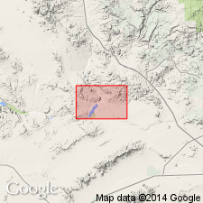
Named as formation in Artillery Mountains manganese area from Sandtrap Wash, Mohave Co, AZ, Plateau sedimentary province. No type locality designated. Formerly part of Lee's (1908) Temple Bar conglomerate (not used). Occurs mainly in central part of valley between Artillery and Rawhide Mountains; crops out in strip on east side Bill Williams River; extends eastward beyond mapped area. Consists of light-red to dark-red, poorly sorted conglomerate of angular to well rounded, generally poorly sorted pebbles 1/4 to 6 inches in diameter, and a few boulders as much as 6 ft in diameter. Discontinuous bedding; includes prominent basalt member similar to Cobwebb basalt (new) in northwest part of area. Basalt partly dense, partly vesicular. Along northeast side of basin, bottom part Sandtrap consists of red to pink sandstone, siltstone, and clay, all in part gravelly. In main part valley, thickness estimated from 300 to possibly 2,000 ft. Unconformably overlies Cobwebb basalt (new), or, where basalt absent, Chapin Wash formation (new); beyond these 2 formations, unconformably overlies Artillery formation (new) and pre-Cambrian rocks. Nonconformably underlies Quaternary? basalt and Quaternary alluvium. Structure map. Geologic maps. Tentatively assigned late Pliocene age because is youngest of 3 supposedly Pliocene formations in manganese basin, and is separated from other two by an erosional unconformity. Deposited in a degradational valley.
Source: GNU records (USGS DDS-6; Denver GNULEX).
For more information, please contact Nancy Stamm, Geologic Names Committee Secretary.
Asterisk (*) indicates published by U.S. Geological Survey authors.
"No current usage" (†) implies that a name has been abandoned or has fallen into disuse. Former usage and, if known, replacement name given in parentheses ( ).
Slash (/) indicates name conflicts with nomenclatural guidelines (CSN, 1933; ACSN, 1961, 1970; NACSN, 1983, 2005, 2021). May be explained within brackets ([ ]).