

- Usage in publication:
-
- San Manuel formation
- Modifications:
-
- First used
- AAPG geologic province:
-
- Basin-and-Range province
Summary:
San Manuel formation is listed in resume of Cenozoic units in AZ. Age is late middle(?) Tertiary.
Source: GNU records (USGS DDS-6; Menlo GNULEX).
- Usage in publication:
-
- San Manuel formation*
- Modifications:
-
- Named
- Dominant lithology:
-
- Conglomerate
- AAPG geologic province:
-
- Basin-and-Range province
Summary:
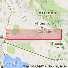
Named as the basal formation of Gila group for the San Manuel mine, sec 34, T8S, R16E, Pinal Co, AZ in Basin-and-Range province. No type locality designated. Is restricted to west side of San Pedro Valley. Divisible into a local basal conglomerate member, Kannally (new) and Tucson Wash (new) members. Composed principally of fragments that range in size from boulders several ft in diameter to pebbles. Fragments are gray quartz monzonite, felsite, and rhyolite. Near the Santa Catalina Mountains the sorting is poor. Away from the mountains the fragment size is smaller, the lenses are well developed, and sorting is fair. Is well consolidated. Well exposed along major washes south and west of Red Hill and on railroad and highway cuts. Overlies Cloudburst formation unconformably or unnamed Tertiary volcanics; underlies Quiburis formation of Gila. Geologic map. Block diagrams. Correlation chart. Estimated to be about 5,000 ft thick. Highly faulted. Assigned to the middle? Tertiary.
Source: GNU records (USGS DDS-6; Denver GNULEX).
- Usage in publication:
-
- San Manuel Formation*
- Modifications:
-
- Age modified
- Revised
- Areal extent
- AAPG geologic province:
-
- Basin-and-Range province
Summary:
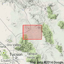
San Manuel Formation. Removed from Gila Group (geographically restricted from Ray-San Manuel area, eastern Pinal County, Arizona). Consists of alluvial, lacustrine(?), and playa deposits. Unconformably underlies Big Dome Formation in Mineral Creek area. Age changed from early(?) Tertiary --to-- early(?) Miocene, based on K-Ar ages (on biotite and sanidine) of 18 and 24 Ma. Samples taken from a rhyolite tuff bed near top of formation (citing Krieger, 1973, USGS Geol. Quad. Map GQ-1107). Considered younger than Whitetail Conglomerate (32 Ma; citing Cornwall and others, 1971, USGS Geol. Quad. Map GQ-1021, Banks and others, 1972, Econ. Geol., v. 67, no. 7, p. 864-878). Shown on stratigraphic chart as a correlative of lower Miocene Galiuro Volcanics, mapped east of San Pedro River. Report includes correlation chart.
San Manuel mapped on west side of San Pedro River, in the Ray-San Manuel area, eastern Pinal County, Arizona (Basin-and-Range province), in Mammoth 7.5- and 15-min quadrangles (Creasey, 1965, USGS Prof. Paper 471; 1967, USGS Bull. 1218), Crozier Peak, Kearny, Lookout Mountain, Putnam Wash, and Winkelman 7.5-min quadrangles. (See Krieger, 1968, USGS Geol. Quad Map GQ-670; 1973, USGS Geol. Quad Maps GQ-1106, 1107, 1109.)
Source: Publication; supplemental information from GNU records (USGS DDS-6; Denver GNULEX).
- Usage in publication:
-
- San Manuel Formation*
- Modifications:
-
- Biostratigraphic dating
- Revised
- AAPG geologic province:
-
- Basin-and-Range province
Summary:
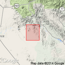
Fossil camel and bear tracks in the tuffaceous sandstone and conglomerate unit in Ripsey Wash (SE1/4 sec 22, T4S, R13E, Pinal Co, AZ) indicate a Miocene age. Consists of alluvial and playa deposits at least 2,000 ft thick. Divisible into (ascending) the Megabreccia of Ruin Granite, lower granitic conglomerate, tuff, tuffaceous sandstone and conglomerate, megabreccia of diabase, and upper granitic conglomerate. Fossil camel and bear tracks in the tuffaceous sandstone and conglomerate unit in Ripsey Wash (SE1/4 sec 22, T4S, R13E, Pinal Co, AZ) indicate a Miocene age.
Source: GNU records (USGS DDS-6; Menlo GNULEX).
For more information, please contact Nancy Stamm, Geologic Names Committee Secretary.
Asterisk (*) indicates published by U.S. Geological Survey authors.
"No current usage" (†) implies that a name has been abandoned or has fallen into disuse. Former usage and, if known, replacement name given in parentheses ( ).
Slash (/) indicates name conflicts with nomenclatural guidelines (CSN, 1933; ACSN, 1961, 1970; NACSN, 1983, 2005, 2021). May be explained within brackets ([ ]).