

- Usage in publication:
-
- San Jose formation
- Modifications:
-
- Original reference
- Dominant lithology:
-
- Clay
- Sandstone
- Conglomerate
- AAPG geologic province:
-
- San Juan basin
Summary:
No. 5, p. 257-282; no. 6, p. 363-385. San Jose formation. Name proposed for the "Wasatch" of authors in San Juan basin. In this region the San Jose is preceded by hiatus representing late Paleocene time. There was gentle regional uplift and probably stronger folding outside present basin between deposition of Nacimiento and that of San Jose, but strong uplift that now defines eastern margin of basin is post-San Jose. In southern Colorado there was nearly continuous deposition through the later Paleocene into the Eocene. As a "specific locality at which the unit is typically developed" the badlands exposures along and near continental divide about 1 mile northwest of Regina in sec. 29, T. 22 N., R. 1 W., are designated. These exposures include only one of several distinguishable facies within formation and do not include either highest or lowest beds assigned to it. Characteristically lithology of formation is highly variable, both vertically and horizontally. There is not any one continuous sequence of exposures where full thickness of all major facies of formation are displayed. It is preferable to speak of type region rather than type locality. Type region herein designated. This enlarged type locality includes good development of lithologic facies considered typical of formation and also includes localities where have been found most of early Eocene mammals which constitute typical, but not only, faunas of formation. In type region, and more generally over much of area of formation, three major facies recognized. These intergrade almost imperceptibly in places but are markedly dissimilar in their typical development. In type region are two distinguishable clay facies, corresponding with Granger's (1914) Almagre and Largo beds. These facies contain mammalian faunas also recognizably different in facies. These faunas are all Wasatchian and probably extend over early and middle parts of that age, rather than middle and later parts as commonly supposed. Total thickness as preserved in type region 1,200 to 1,300 feet. Tiffany fauna of southern Colorado, well known to be of late Paleocene age, is in beds not now separated from the San Jose but probably separable and only tentatively assigned to that formation. Discussion of previous nomenclature, especially term Canyon Largo as used by early workers (Newberry, Holmes, and Keyes) and proposed reinstatement of Canyon Largo by Wood and others (1941, GSA Bull., v. 52, no. 1).
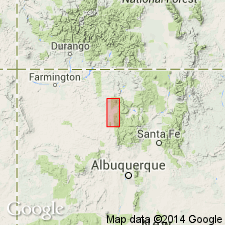
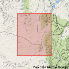
Type region: exposures extending along eastern edge of basin from Yegua Canyon southward about 25 mi to exposed base of formation northwest of Cuba and westward from this front 10 or 15 mi approx. to meridian of settlement of Lindrith. Named from San Jose Valley, northwestern Sandoval Co., NM. Valley is followed by San Jose Creek, or Arroyo, an intermittent stream rising mainly on west flank of San Pedro Mountain, above settlement of Regina, in T. 23 N., R. 1 W., and running southward from Regina near western border of T. 22 N., R. 1 W., to junction with the Rito de los Pinos and Rio Puerco near town of Cuba in T. 21 N., R. 1 W. Formation extends in southwestern CO.
Source: US geologic names lexicon (USGS Bull. 1200, p. 3446-3447).
- Usage in publication:
-
- San Jose Formation*
- Modifications:
-
- Revised
- AAPG geologic province:
-
- San Juan basin
Summary:
Rests on Nacimiento Formation with erosional and angular unconformity. Was called Wasatch Formation by early workers. Divided into: Cuba Mesa Member (new) at base, which is present throughout report area; Regina Member (new) which is present in the southern two-thirds of the area; Llaves Member (new) present in northern part of area; and Tapicitos Member (new) at top in northern part of area. A medial sandstone, recognized but unnamed, separates Regina from Tapicitos in northern part of Tapicitos Plateau. The Llaves intertongues with and grades south into Regina. The Llaves also grades south and west into the Tapicitos. Is the surface formation in the central basin of the San Juan basin. Ranges from 200 ft thick at south to 1,800 ft thick in subsurface on Tapicitos Plateau. Is of early Eocene age; contains Almagre and Largo faunas. Geologic map. Correlation chart. Cross sections. Measured sections.
Source: GNU records (USGS DDS-6; Denver GNULEX).
For more information, please contact Nancy Stamm, Geologic Names Committee Secretary.
Asterisk (*) indicates published by U.S. Geological Survey authors.
"No current usage" (†) implies that a name has been abandoned or has fallen into disuse. Former usage and, if known, replacement name given in parentheses ( ).
Slash (/) indicates name conflicts with nomenclatural guidelines (CSN, 1933; ACSN, 1961, 1970; NACSN, 1983, 2005, 2021). May be explained within brackets ([ ]).