

- Usage in publication:
-
- Salt Lake group*
- Modifications:
-
- Named
- Dominant lithology:
-
- Sandstone
- Marl
- AAPG geologic province:
-
- Wasatch uplift
Summary:
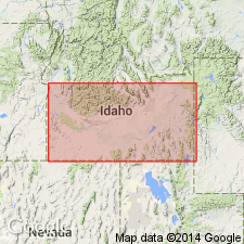
Named for occurrences in the Weber Valley from Morgan City to Devils Gate, and in the Salt Lake Valley, and for remnants along the margins of the mountains enclosing the Salt Lake Valley, Salt Lake Co, UT on the Wasatch uplift. Composed of sands, sandstones, and marls of light color, 1,000 to 1,200 ft thick. One species of helix found. Considered to be of late Tertiary age.
Source: GNU records (USGS DDS-6; Denver GNULEX).
- Usage in publication:
-
- Salt Lake formation*
- Modifications:
-
- Areal extent
- AAPG geologic province:
-
- Snake River basin
- Wasatch uplift
Summary:
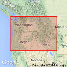
Pg. 44-46, pl. 1. Salt Lake formation. Described in Ammon and Paradise quadrangles, Idaho. As mapped, consists of conglomerate, calcareous grit, sandstone, shale, and marl; includes some bedded volcanic ash and tuff and windblown dust of Pleistocene age. Thickness varies from 0 to as much as 800 feet. Unconformably overlies· rocks of all earlier formations represented. Age is Pliocene(?).
Source: US geologic names lexicon (USGS Bull. 1200, p. 3416-3417).
- Usage in publication:
-
- Salt Lake group
- Modifications:
-
- Revised
- AAPG geologic province:
-
- Wasatch uplift
Summary:
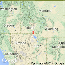
The Tertiary volcanic rock sequence in the Traverse Mountains and the east foothills of the Oquirrh Mountains, UT, is assigned to the Salt Lake group. Geologic map of Jordan Narrows area, Salt Lake Co on the Wasatch uplift, included. Salt Lake divided into (ascending): Traverse volcanics (new, at base), Jordan Narrows (new) and Camp Williams units (new, informal units), Harkers fanglomerate (new), and the travertine unit at top. Ranges in age from early Oligocene through late Pliocene.
Source: GNU records (USGS DDS-6; Denver GNULEX).
- Usage in publication:
-
- Salt Lake formation*
- Modifications:
-
- Overview
- AAPG geologic province:
-
- Great Basin province
Summary:
Salt Lake formation in the Goose Creek district consists largely of friable volcanic ash with several beds of welded rhyolitic tuff near the middle, and at various horizons, lesser amounts of shale, sandstone, conglomerate, lignite, and limestone. Unit has been divided into two unnamed parts at the base of the stratigraphically highest persistent bed of welded tuff. Formation is at least 2300 ft thick, the lower 1200 to 1600 ft of which make up the lower unnamed part. Measured sections included: lower part (near Hardister Creek, sec. 21 T144N R19W, Box Elder Co, UT and secs. 29,30, 31 T47N R70E, Elko Co, NV), upper part (south of Pole Creek in SW/4 sec. 26 and NE/4 sec. 35 T15N R19W, Box Elder Co, UT). Age is early or middle Pliocene based on (vertebrates; NEOHIPPARION); probably early Pliocene (mollusks).
Source: GNU records (USGS DDS-6; Menlo GNULEX).
- Usage in publication:
-
- Salt Lake formation*
- Modifications:
-
- Areal extent
- AAPG geologic province:
-
- Green River basin
Summary:
Salt Lake formation is recognized in western half of Bedford 15' quad, Lincoln Co, WY. Age is Pliocene.
Source: GNU records (USGS DDS-6; Menlo GNULEX).
- Usage in publication:
-
- Salt Lake Formation*
- Modifications:
-
- Areal extent
- AAPG geologic province:
-
- Wasatch uplift
Summary:
Salt Lake Formation is extended to the Paradise 7.5' quad, Cache Co, UT. Age is Pliocene ("May include rocks of Quaternary and older Tertiary age").
Source: GNU records (USGS DDS-6; Menlo GNULEX).
- Usage in publication:
-
- Salt Lake formation
- Modifications:
-
- Not used
Summary:
Salt Lake formation of Mapel and Hail (USGS Bull. 1055-H, 1959), Goose Creek basin area, Cassia County, Idaho. Rocks previously assigned to lower Salt Lake by Mapel and Hail are reallocated to Jenny Creek formation (redescribed) in Idavada volcanics. Rocks previously assigned to upper Salt Lake by Mapel and Hail are reallocated to Cougar Point formation (redescribed) in Idavada volcanics.
Source: Modified from GNU records (USGS DDS-6; Denver GNULEX).
- Usage in publication:
-
- Salt Lake Formation*
- Modifications:
-
- Areal extent
- AAPG geologic province:
-
- Snake River basin
- Wasatch uplift
Summary:
Salt Lake Formation is extended to the Portneuf Range, Bancroft 7.5' quad, Bannock and Caribou Cos, ID. Age is Pliocene.
Source: GNU records (USGS DDS-6; Menlo GNULEX).
- Usage in publication:
-
- Salt Lake Formation*
- Modifications:
-
- Geochronologic dating
- Areal extent
- AAPG geologic province:
-
- Great Basin province
Summary:
Pg. 241. Salt Lake Formation of Piper (1923, Idaho Mines Geol. Bull., no. 6) and of Mapel and Hail (1959, USGS Bull. 1055-H). Glassy and devitrified samples from massive ash flows capping volcanic sequence near Goose Creek, and from a few km east in Albion Range, Cassia Co., eastern Snake River Plain, southern ID, yielded a K-Ar age of 8.5 Ma; [North American land mammal age Hemphillian, =Pliocene (Evernden and others, 1964, Amer. Jour. Sci., v. 262, p. 145-198), =Miocene (Berggren, 1972, Lethaia, v. 5, no. 2, p. 195-215)]. These same rocks were included in Idavada Volcanics by Axelrod (1964, Calif. Pub. Geol. Sci., v. 51, p. 713-734) and Malde and Powers (1962, Geol. Society America Bull., v. 73, p. 1197-1220). Report includes sample locality map, schematic stratigraphic-chronologic diagram, table of K-Ar ages.
Source: Publication.
- Usage in publication:
-
- Salt Lake Formation*
- Modifications:
-
- Revised
- Geochronologic dating
- AAPG geologic province:
-
- Great Basin province
Summary:
Divided in the Raft River basin into lower tuffaceous member, Jim Sage Volcanic Member (a new name), and upper tuffaceous member. Age in this area ranges from more than 11 m.y. to about 2-3 m.y. (based on radiometric and magneto-polarity data) with nearly continuous deposition in center of basin. Youngest age not known, but only dates in this report are Miocene. Is in the Great Basin province.
Source: GNU records (USGS DDS-6; Denver GNULEX).
- Usage in publication:
-
- Salt Lake Formation*
- Modifications:
-
- Geochronologic dating
- AAPG geologic province:
-
- Wasatch uplift
Summary:
Zircon from a tuff in a fan gravel probably in the proximal facies of the Salt Lake Formation exposed in the Harper gravel pit about 4 km northeast of the type locality of the Harkers Alluvium, Salt Lake Co, UT on the Wasatch uplift, gave an age of 4.1 +/-1.0 Ma. The rocks in the pit may correlate with the Harkers Alluvium of the type locality.
Source: GNU records (USGS DDS-6; Denver GNULEX).
- Usage in publication:
-
- Salt Lake Formation*
- Modifications:
-
- Geochronologic dating
- AAPG geologic province:
-
- Snake River basin
- Great Basin province
Summary:
Pg. 11, geologic time scale (inside front cover). Salt Lake Formation. Samples from two basalt flows in roadcut in a new housing development south-southwest of Lava Hot Springs, Lat. 42 deg. 32 min. 16 sec. N., Long. 112 deg. 03 min. 24 sec. W., in NW/4 SE/4 SE/4 sec. 19, T. 10 S., R. 38 E., Lava Hot Springs 7.5-min quadrangle, Bannock County, Idaho. K-Ar ages on whole-rock 7.7 +/-0.3 Ma and 7.2 +/-0.3 Ma; calculated ages are minimum ages for the flows. Ages calculated using decay constants of Steiger and Jager, 1977 (Earth Planet. Sci. Letters, v. 36, p. 359-362). [Age considered Miocene (from Geologic Names Committee, USGS, 1983 ed. geol. time scale, with additions from N.J. Snelling, 1985, The Geol. Soc. Mem., no. 10).]
Source: Publication.
For more information, please contact Nancy Stamm, Geologic Names Committee Secretary.
Asterisk (*) indicates published by U.S. Geological Survey authors.
"No current usage" (†) implies that a name has been abandoned or has fallen into disuse. Former usage and, if known, replacement name given in parentheses ( ).
Slash (/) indicates name conflicts with nomenclatural guidelines (CSN, 1933; ACSN, 1961, 1970; NACSN, 1983, 2005, 2021). May be explained within brackets ([ ]).