

- Usage in publication:
-
- Saddle Mountains Basalt Member
- Modifications:
-
- Original reference
- Dominant lithology:
-
- Basalt
- AAPG geologic province:
-
- Eastern Columbia basin
Summary:
Pg. 26, 27. Saddle Mountains Basalt Member of Ellensburg Formation. A flow that is believed to be continuous over most of Vantage-Priest Rapids area and that was called "Wenas Basalt" by Smith (1903) and in later reports, is here designated Saddle Mountains Basalt Member of Ellensburg Formation. Consists of dense, black, and very fine-grained lava. Underlies unnamed basalt conglomerate. Overlies Beverly Member (new) of Ellensburg Formation. Is perhaps approximately contemporaneous with Wenas Basalt in Yakima East quadrangle. [Age is late Miocene.]
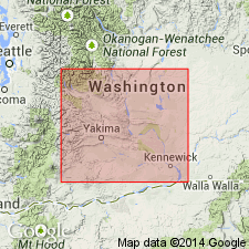
Type locality: scarp on east side of Sentinel Gap, [Beverly quadrangle], southern Grant Co., central southern WA.
Source: US geologic names lexicon (USGS Bull. 1350, p. 652-653); GNU records (USGS DDS-6; Menlo GNULEX).
- Usage in publication:
-
- Saddle Mountains Member*
- Modifications:
-
- Revised
- AAPG geologic province:
-
- Eastern Columbia basin
Summary:
Pg. G11-G12. Saddle Mountains Member of Yakima Basalt of Columbia River Group. On basis of general lithologic similarity, name Wenas Basalt, as used by Smith, 1903 (USGS Geol. Atlas Folio 86) for flows in his Ellensburg Formation, was used for similar rocks in the Sentinel Gap-Saddle Mountains area by Taylor, 1948 (USGS Open-file Rpt.) on Columbia Basin Irrigation Project area. Because the formations are not mapped across the intervening distance the Vantage-Priest Rapids area is considered separate from Yakima River valley, and name Saddle Mountains Member is assigned to all basalt flows overlying Priest Rapids Member in Sentinel Gap area. At type locality, Saddle Mountains Member consists of one flow. One of Saddle Mountains flows (the Pomona flow) and underlying vitric tuff (a part of Beverly Member of the Ellensburg) exposed on the Saddle Mountains have been correlated by Schmincke, 1965 (GSA Spec. Paper 82) with basalt and sedimentary rocks mapped by Smith in Ellensburg and Mount Stuart quadrangles and by Waters, 1955 (GSA Bull., v. 66, no. 6) in Yakima East quadrangle. Also, reconnaissance observations along Wenas Valley have revealed that in Kelley Hollow, Smith (1903) included basalt of Frenchman Springs Member of Yakima with that mapped as Wenas Basalt. Name Wenas Basalt is abandoned and name Saddle Mountains Member is substituted for all flows above Priest Rapids Member in Yakima River valley. Eastward and southward from Sentinel Gap, the Saddle Mountains Member includes several previously unrecognized flows, rather than a single flow overlying the Beverly Member of the Ellensburg. Dillers' logs show that Beverly Member is discontinuous laterally so that the Saddle Mountains Member rests disconformably on Priest Rapids Member or Roza Member rather than on the Beverly in parts of south-central Washington. Hence, the Saddle Mountains Basalt Member of Mackin (1961), considered by him to be part of the Ellensburg, is herein renamed Saddle Mountains Member and reassigned to Yakima Basalt, regardless of whether it overlies or is intercalated in Beverly Member of Ellensburg. At its type locality the Saddle Mountains basalt flow is black, dense, very fine grained, and sparsely porphyritic. Age is late Miocene and early Pliocene.
Source: US geologic names lexicon (USGS Bull. 1350, p. 652-653); Changes in stratigraphic nomenclature, 1966 (USGS Bull. 1254-A, p. A7).
- Usage in publication:
-
- Saddle Mountains Basalt*
- Modifications:
-
- Revised
- Reference
- AAPG geologic province:
-
- Eastern Columbia basin
Summary:
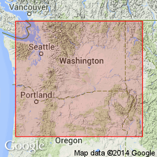
G37-G40. Saddle Mountains Basalt of Yakima basalt subgroup [informal] of Columbia River Basalt Group. Geographically extended from southern Washington into northern Oregon and northwestern Idaho. Divided into ten formal members (ascending): Umatilla, Wilbur Creek (new), Asotin (new), Weissenfels Ridge (new), Esquatzel (new), Pomona, Elephant Mountain, Buford (adopted), Ice Harbor (adopted), and Lower Monumental (new). These flows are of diverse chemistry, age, and magnetic polarity. They erupted between 13.5 +/-0.5 and 6 Ma. Age changed from late Miocene and early Pliocene --to-- middle and late Miocene. Six reference localities designated; all in WA:
(1) roadcuts along Highway 17 in and just north of the village of Mesa, 40 km north of Pasco in Esquatzel Coulee (Swanson and others, 1977; 1979);
(2) in upper part of bluffs on west side of Wallula Gap (see map of Swanson and others, 1977, 1979, and Atlantic Richfield Hanford Company, 1976);
(3) roadcuts along the Mabton-Bickleton road, in SE/4 SE/4 sec. 27, T. 8 N., R. 22 E., and of Umatilla Member in W/2 sec. 35, T. 8 N., R. 22 E. (Schmincke, 1967a, b);
(4) Devils Canyon, in SE/4 sec. 21, T. 13 N., R. 34 E.
(5) Cloverland Grade, 6 km west of Asotin, in secs. 25 and 26, T. 10 N., R. 45 E. (Camp, 1976; Swanson and others, 1977; 1979);
(6) RR cuts about 2 km northeast of Ice Harbor Dam, in sec. 18, T. 9 N., R. 32 E.
[Yakima basalt subgroup considered informal and should not be capitalized. "Subgroup" not recognized as a formal stratigraphic rank term (CSN, 1933; ACSN, 1961, 1970; NACSN, 1983, 2005, 2021). Columbia River Basalt Group adopted by the ID, OR, and WA Geol. Surveys, and the USGS.]
Source: Publication; Changes in stratigraphic nomenclature, 1979 (USGS Bull. 1502-A, p. A66).
- Usage in publication:
-
- Saddle Mountains Basalt
- Modifications:
-
- Revised
- AAPG geologic province:
-
- Eastern Columbia basin
Summary:
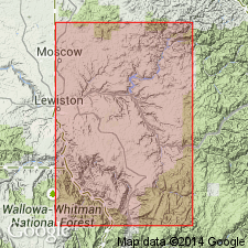
Saddle Mountains Basalt of Columbia River Basalt Group. In Clearwater embayment, western Idaho, revised to include (descending) Swamp Creek Member, Craigmont Member, Icicle Flat Member, and Grangeville Member; all new. Overlies Wanapum Basalt of Columbia River Basalt Group. Age is late Miocene.
Source: US geologic names lexicon (USGS Bull. 1565, p. 78, 122, 139, 314); GNU records (USGS DDS-6; Denver GNULEX).
- Usage in publication:
-
- Saddle Mountains Basalt*
- Modifications:
-
- Geochronologic dating
- Dominant lithology:
-
- Basalt
- AAPG geologic province:
-
- Eastern Columbia basin
Summary:
Pg. 59-61. Saddle Mountains Basalt of Columbia River Basalt Group. Age is considered ca. 15 Ma to ca. 6 Ma (Miocene). K-Ar ages recalculated using decay constants of Renne and others, 2010 (Geochimica et Cosmochimica Acta, v. 74, p. 5349-5367).
Source: Publication.
For more information, please contact Nancy Stamm, Geologic Names Committee Secretary.
Asterisk (*) indicates published by U.S. Geological Survey authors.
"No current usage" (†) implies that a name has been abandoned or has fallen into disuse. Former usage and, if known, replacement name given in parentheses ( ).
Slash (/) indicates name conflicts with nomenclatural guidelines (CSN, 1933; ACSN, 1961, 1970; NACSN, 1983, 2005, 2021). May be explained within brackets ([ ]).