

- Usage in publication:
-
- Roza Basalt Member
- Modifications:
-
- Original reference
- Dominant lithology:
-
- Basalt
- AAPG geologic province:
-
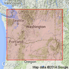
- Eastern Columbia basin
Summary:
Pg. 5, 8 (fig. 2), 21-23, 26. Roza Basalt Member of Yakima Basalt. Chiefly basalt with evenly distributed transparent 1 cm long lath-shaped plagioclase phenocrysts; weathers deep red-brown; zones of distinctive swirly platy jointing. Thickness in Roza-Squaw Creek area 100 +/-10 feet; averages 150 feet. Overlies Frenchman Springs Basalt Member (new). At type locality overlies Squaw Creek diatomite (new) in Frenchman Springs Basalt [now called Lmuma Creek Member of Ellensburg Formation]. Underlies Priest Rapids Basalt Member (new). [Age is late Miocene.]
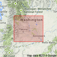
Type locality: scarp on east side of Yakima River opposite Roza Station [in sec. 16, T. 15 N., R. 19 E., Badger Pocket 15-min quadrangle], Kittitas Co., south-central WA.
Source: Publication; US geologic names lexicon (USGS Bull. 1350, p. 646-647); GNU records (USGS DDS-6; Menlo GNULEX).
- Usage in publication:
-
- Roza Member*
- Modifications:
-
- Areal extent
- Redefined
- Adopted
- AAPG geologic province:
-
- Columbia basin
Summary:
Pg. C87-C90. Roza Member of Yakima Basalt of Columbia River Group. Name modified to Roza Member (adopted by the USGS). Geographically extended into Whitman and eastern Franklin Counties, southeastern Washington; sections in Yakawawa Canyon southwest of Pullman, [in SW/4 sec. 26 and NW/4 sec. 35, T. 13 N., R. 44 E., Pullman quadrangle (scale 1:125,000), Whitman Co.], and in Devils Canyon near Kahlotus, [in NW/4 sec. 9, T. 13 N., R. 34 E., Kahlotus 7.5-min quadrangle, Franklin Co.]. Is chiefly medium- to coarse-grained, porphyritic basalt, dark blue gray or dark reddish gray where fresh, red-brown where weathered, commonly with large columns. Consists of two flows in Devils Canyon where it is about 160 feet thick and one flow in Yakawawa Canyon where it is about 80 feet thick. A key stratigraphic marker. Overlies Frenchman Springs Member and underlies Priest Rapids Member, both of Yakima Basalt. Age is late Miocene.
Source: Publication; US geologic names lexicon (USGS Bull. 1350, p. 646-647); Changes in stratigraphic nomenclature, 1965 (USGS Bull. 1244-A, p. A10); GNU records (USGS DDS-6; Menlo GNULEX).
- Usage in publication:
-
- Roza Member*
- Modifications:
-
- Revised
- Age modified
- AAPG geologic province:
-
- Eastern Columbia basin
Summary:
Pg. G8-G9. Roza Member of Yakima Basalt of Columbia River Group. Consists of two unnamed basalt flows; total thickness 200+ feet. Lower flow (= Roza Basalt Member of Mackin, 1961, at type) is a key stratigraphic marker throughout Columbia Basin Irrigation Project area. This flow is relatively uniform in thickness and composition. It has been identified as far north as Coulee City in the Grand Coulee, as far south as Pendleton, Oregon, as far west as vicinity of Goldendale, and as far east as Colfax, an area of over 20,000 square miles. Basalt is dark blue gray, weathers deep red brown, is medium- to coarse-grained, porphyritic, and columnar, average thickness 100 feet. Upper flow, identified from Drumheller Channels to as far east as Colfax, is a dark-reddish-gray and porphyritic basalt, 55 to 100 feet thick; contains feldspar phenocrysts similar to lower flow, thus is included in the Roza (see Bingham and Walters, 1965, p. 89). Roza Member overlies Frenchman Springs Member and underlies Priest Rapids Member, both of Yakima Basalt. Age is considered late Miocene based on stratigraphic relations of Yakima Basalt.
Source: Publication; US geologic names lexicon (USGS Bull. 1350, p. 646-647); GNU records (USGS DDS-6; Menlo GNULEX).
- Usage in publication:
-
- Roza Member*
- Modifications:
-
- Revised
- Reference
- Age modified
- Areal extent
- AAPG geologic province:
-
- Eastern Columbia basin
Summary:
G33-G34. Roza Member of Wanapum Basalt of Yakima basalt subgroup [informal] of Columbia River Basalt Group. Geographically extended from southeastern Washington into northern Oregon. Includes all flows between the Frenchman Springs (below) and the Priest Rapids (above) Members. Each flow is characterized by numerous plagioclase crystals averaging more than 5 mm that are evenly distributed throughout the flow. Total thickness about 50 m. Has transitional magnetic polarity. Age is middle Miocene. Seven reference localities designated:
(1) head of Frenchman Springs Coulee [Frenchman Coulee] (Mackin, 1961, pls. 5B and 6);
(2) head of Devils Canyon (Bingham and Walters, 1965, Swanson and Wright, 1976b);
(3) head of Horton Grade, in sec. 11, T. 14 N., R. 40 E., near Penawawa;
(4) north part of Colfax, along Highway 195;
(5) Highway 12 at Alpowa Summit, 15 km southeast of Pomeroy;
(6) Anatone Butte along the vent system (Swanson and others, 1975, table 1, No. 17); and
(7) the lower Grand Coulee area, in which Lefebvre (1970) conducted a detailed investigation of the Roza.
[Yakima basalt subgroup considered informal and should not be capitalized. "Subgroup" not recognized as a formal stratigraphic rank term (CSN, 1933; ACSN, 1961, 1970; NACSN, 1983, 2005, 2021). Columbia River Basalt Group adopted by the ID, OR, and WA Geol. Surveys, and the USGS.]
Source: Publication; Changes in stratigraphic nomenclature, 1979 (USGS Bull. 1502-A, p. A65).
For more information, please contact Nancy Stamm, Geologic Names Committee Secretary.
Asterisk (*) indicates published by U.S. Geological Survey authors.
"No current usage" (†) implies that a name has been abandoned or has fallen into disuse. Former usage and, if known, replacement name given in parentheses ( ).
Slash (/) indicates name conflicts with nomenclatural guidelines (CSN, 1933; ACSN, 1961, 1970; NACSN, 1983, 2005, 2021). May be explained within brackets ([ ]).