

- Usage in publication:
-
- Ripgut Formation*
- Modifications:
-
- Named
- Dominant lithology:
-
- Tuff
- Breccia
- Siltstone
- Conglomerate
- AAPG geologic province:
-
- Great Basin province
Summary:
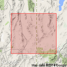
Named as the upper formation of the Needles Range Group for Ripgut Springs 1/2 mi east of the NV-UT state line, NE1/4 sec 35, T29S, R20W, White Rock Peak 7 1/2 min quad, Beaver Co, UT, Great Basin province. Type area is on west slope of Mt. Wilson, secs 25, 26, 35, and 36, T5N, R67E, Lincoln Co, NV where the unnamed breccia and tuff members are intercalated along the northern wall of the Mt. Wilson caldera (source of the tuff), and where they overlie the Lund Formation and underlie Shingle Pass Tuff, or locally the Blawn Formation. Reference section for tuff member designated at 38 deg 25 min 10 sec N, 114 deg 22 min 5 sec W. Above and west of Ripgut Springs, only tuff member is present. East of Mt. Wilson, bedded tuff, siltstone, and conglomerate just a few meters thick assigned to clastic unit of Ripgut. This sedimentary unit overlies intracaldera tuff and represents a post-rhyolite eruptive hiatus. Consists of rhyolite tuff, similar petrographically to Marsden Tuff Member of Escalante Desert Formation and to Greens Canyon Tuff Member of Ryan Spring Formation. As many as three ash-flows. As much as 2 km thick make up the cooling unit on White Rock Peak. Stratigraphic table. Areal extent maps. [Mapped as informal tuff of Ripgut Spring 4 km southwest of Modena, UT (Best, 1987, USGS Misc. Inv. Map I-1774.] Oligocene age.
Source: GNU records (USGS DDS-6; Denver GNULEX).
- Usage in publication:
-
- Ripgut Formation*
- Modifications:
-
- Mapped 1:50k
- Dominant lithology:
-
- Tuff
- AAPG geologic province:
-
- Great Basin province
Summary:
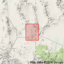
Mapped in small area at northern edge of map in northeast part of study area; outcrop strikes north-south along UT-NV border, Lincoln and Iron Cos, Great Basin province. Is a crystal-poor, pumice-rich, partially to densely welded rhyolite tuff with sparse, small phenocrysts of feldspar and quartz; locally includes overlying lava flows of same composition as tuff. Thickness is 200 m; to north in Rice Mountain quad Ripgut is 650 m thick. Unconformably overlies Lund Formation; conformably underlies Isom Formation. Oligocene age.
Source: GNU records (USGS DDS-6; Denver GNULEX).
For more information, please contact Nancy Stamm, Geologic Names Committee Secretary.
Asterisk (*) indicates published by U.S. Geological Survey authors.
"No current usage" (†) implies that a name has been abandoned or has fallen into disuse. Former usage and, if known, replacement name given in parentheses ( ).
Slash (/) indicates name conflicts with nomenclatural guidelines (CSN, 1933; ACSN, 1961, 1970; NACSN, 1983, 2005, 2021). May be explained within brackets ([ ]).