

- Usage in publication:
-
- Reston Member*
- Modifications:
-
- Named
- Dominant lithology:
-
- Sand
- Conglomerate
- AAPG geologic province:
-
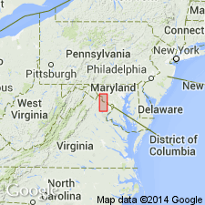
- Piedmont-Blue Ridge province
- Culpeper basin
Summary:
The lower part of the Manassas Sandstone is here named the Reston Member for exposures near Reston Avenue, Fairfax Co., Va., of dark-red to purple, pink, and gray semicompact sand and fragments of schist, quartz, quartzite, greenstsone, and gneiss in a clayey schist matrix. It unconformably overlies pre-Triassic crystalline rocks and grades into and intertongues with the overlying sandstone member of the Manassas. Thickness at the type section is 5.5 m (18 ft). Age is Late Triassic.
Source: GNU records (USGS DDS-6; Reston GNULEX).
- Usage in publication:
-
- Reston Formation
- Modifications:
-
- Revised
- AAPG geologic province:
-
- Piedmont-Blue Ridge province
- Culpeper basin
Summary:
The Reston Member of the Manassas Sandstone as defined by Lee (1977), is here revised as the Reston Formation of the Culpeper Group, and underlies the Manassas Sandstone. This usage conforms more closely to Roberts' (1928) original description of the stratigraphy, retaining the name Manassas solely for the sandstone overlying the basal conglomerate.
Source: GNU records (USGS DDS-6; Reston GNULEX).

- Usage in publication:
-
- Reston Member*
- Modifications:
-
- Revised
- AAPG geologic province:
-
- Piedmont-Blue Ridge province
- Culpeper basin
Summary:
The Reston Member of Lee (1977) is here revised as the basal stratigraphic unit of the revised Manassas Sandstone where it is exposed in the drainage areas of the Rappahannock and Potomac Rivers along the eastern border of the Culpeper basin in Va., and Md. It is composed of poorly sorted pebble clasts of igneous and metamorphic rocks in a dusky- to dark-red arkosic sand and clayey silt matrix, with interbedded coarse-grained, massive, red sandstone. It unconformably overlies pre-Triassic crystalline rocks and is locally truncated by faults along the basin border. It is laterally and vertically gradational with arkosic sandstone of the overlying Poolesville Member of the Manassas. Thickness is generally less than 30 m (100 ft). Age is probably late Carnian based on palynoflora from the overlying Poolesville Member.
Source: GNU records (USGS DDS-6; Reston GNULEX).
For more information, please contact Nancy Stamm, Geologic Names Committee Secretary.
Asterisk (*) indicates published by U.S. Geological Survey authors.
"No current usage" (†) implies that a name has been abandoned or has fallen into disuse. Former usage and, if known, replacement name given in parentheses ( ).
Slash (/) indicates name conflicts with nomenclatural guidelines (CSN, 1933; ACSN, 1961, 1970; NACSN, 1983, 2005, 2021). May be explained within brackets ([ ]).