

- Usage in publication:
-
- Rennie shale*
- Modifications:
-
- Named
- Dominant lithology:
-
- Shale
- AAPG geologic province:
-
- Idaho Mountains province
Summary:
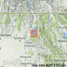
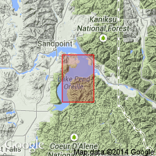
Named for Rennie Ridge, one of the spurs on south side of Packsaddle Mountain, south side of Pend Oreille Lake, Bonner Co, ID in the Idaho Mountains province. No type locality designated. Consists of "paper shale," a thin, soft, easily weathered, yellowish shale about 50 to 75 ft thick. Mapped (geologic map) with other Cambrian formations in the district. Overlies the newly named Cambrian Gold Creek quartzite. Underlies the newly named Cambrian Lakeview limestone. Contains abundant Middle Cambrian fossils.
Source: GNU records (USGS DDS-6; Denver GNULEX).
- Usage in publication:
-
- Rennie Shale*
- Modifications:
-
- Overview
- AAPG geologic province:
-
- Idaho Mountains province
Summary:
Mapped in a very limited area on west side of Packsaddle Mountain, just south of Pend Oreille Lake, Bonner Co, ID, Idaho Mountains province, where it is in contact with the older Gold Creek Quartzite of Middle? Cambrian age and the younger Lakeview Limestone of Middle Cambrian age. Type locality stated to be at south-central edge of map along east side of sec 30, T54N, R1E. Described as a highly fossiliferous, olive, papery shale about 100 ft thick that is so soft and easily eroded that outcrops are rare. Presence of Rennie noted by abundance of tiny shale chips in float. Trilobites and brachiopods collected near base and at top; these collections correspond to the ALBERTELLA zone of the Middle Cambrian. [Authors give a more complete lithologic description than Sampson did.]
Source: GNU records (USGS DDS-6; Denver GNULEX).
For more information, please contact Nancy Stamm, Geologic Names Committee Secretary.
Asterisk (*) indicates published by U.S. Geological Survey authors.
"No current usage" (†) implies that a name has been abandoned or has fallen into disuse. Former usage and, if known, replacement name given in parentheses ( ).
Slash (/) indicates name conflicts with nomenclatural guidelines (CSN, 1933; ACSN, 1961, 1970; NACSN, 1983, 2005, 2021). May be explained within brackets ([ ]).