- Usage in publication:
-
- Reinecker Ridge Volcanic Member*
- Modifications:
-
- Named
- Geochronologic dating
- Dominant lithology:
-
- Porphyry
- Breccia
- Conglomerate
- AAPG geologic province:
-
- South Park basin
Summary:
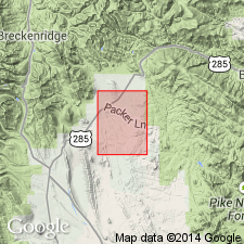
Named as basal member of South Park Formation for Reinecker Ridge (called Basin Ridge in earlier reports), Park Co, CO in South Park basin. Type locality is along the road in sec 20, T9S, R76W, Como 7 1/2 min quad. Composed of brown, gray, green or purple hornblende andesite porphyry flows and breccias in lower part and an overlying part of lenticular conglomerate beds of well-rounded cobbles of porphyry (mostly andesite) in ferruginous tuffaceous matrix and interbedded brown, platy to massive waterlaid tuffaceous sandstone. Is almost indistinguishable from Windy Gap Volcanic Member of Middle Park Formation. Is about 500 ft (150 m) to more than 1,000 ft (305 m) thick. Unconformably overlies Laramie Formation; underlies unnamed conglomerate member of South Park. Is of Paleocene age. Lowest andesite flow has a 56.8 +/-2 m.y. age by whole rock analysis.
Source: GNU records (USGS DDS-6; Denver GNULEX).
For more information, please contact Nancy Stamm, Geologic Names Committee Secretary.
Asterisk (*) indicates published by U.S. Geological Survey authors.
"No current usage" (†) implies that a name has been abandoned or has fallen into disuse. Former usage and, if known, replacement name given in parentheses ( ).
Slash (/) indicates name conflicts with nomenclatural guidelines (CSN, 1933; ACSN, 1961, 1970; NACSN, 1983, 2005, 2021). May be explained within brackets ([ ]).

