

- Usage in publication:
-
- Ramshorn slate*
- Modifications:
-
- Named
- Dominant lithology:
-
- Slate
- Conglomerate
- AAPG geologic province:
-
- Idaho Mountains province
Summary:
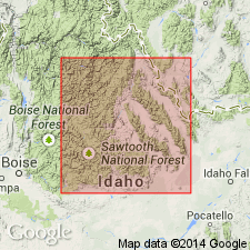
Named for the Ramshorn mine, T13N, R18E, its type locality, Custer Co, ID in the Idaho Mountains province. Overlies Bayhorse dolomite (new). Underlies Kinnikinic quartzite (new). Extends in a band 2 to 5 mi wide from Mill Creek on north border of Bayhorse quad south past Clayton, a distance of 20 miles. Small isolated outcrops occur south to south boundary of quad. Composed of dark-green to purple slate that has well-developed cleavage that cuts at right angles the conspicuously thin banded layers. The banding is due to proportion of calcite and carbon. Local lenses of limestone and quartzite. Basal conglomerate 500 ft thick of well-rounded 3 inch pebbles of quartz and quartzite in a siliceous matrix exposed in north part of quad near Daugherty, Garden, and upper Rattlesnake Creeks. Thickness in quad estimated at 2,000+ ft. Graptolite fossils of Early Ordovician age. Correlation chart.
Source: GNU records (USGS DDS-6; Denver GNULEX).
- Usage in publication:
-
- Ramshorn Slate*
- Modifications:
-
- Areal extent
- Overview
- AAPG geologic province:
-
- Idaho Mountains province
Summary:
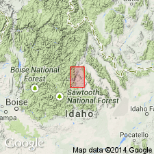
No Ramshorn present in Bayhorse region, Custer Co, ID in the Idaho Mountains province, west of fault in Kinnikinic Creek nor east of Salmon River lineament. North-south limits of Ramshorn determined by overlapping Eocene Challis Volcanics. The slate consists of quartz in grains rarely more than a few hundredths of a mm in diameter, and fine aggregates of chlorite, serpentine, biotite, and other micaceous minerals. The basal conglomerate (Ross, 1934) interfingers with fine sandstone and siltstone of the Ramshorn. Conglomerate thought to be a channel deposit is composed of moderately well rounded clasts of vein quartz and quartzite that range in size from small pebbles to cobbles, rarely more than 3 inches in diameter. The pebbles are so well worn that they may have been derived from an area rich in silica and long exposed to denudation. Conglomerate assigned by Ross (1937) to Ramshorn at Corral Creek is not Ramshorn. Shales and argillites now assigned to the Saturday Mountain Formation in the Clayton quad, and to Phi Kappa Formation in Pioneer Mountains, and to overlying Salmon River assemblage along Pine and Big Lake Creeks, were assigned to Ramshorn by Ross (1937). Assigned an Ordovician age. Columnar sections.
Source: GNU records (USGS DDS-6; Denver GNULEX).
For more information, please contact Nancy Stamm, Geologic Names Committee Secretary.
Asterisk (*) indicates published by U.S. Geological Survey authors.
"No current usage" (†) implies that a name has been abandoned or has fallen into disuse. Former usage and, if known, replacement name given in parentheses ( ).
Slash (/) indicates name conflicts with nomenclatural guidelines (CSN, 1933; ACSN, 1961, 1970; NACSN, 1983, 2005, 2021). May be explained within brackets ([ ]).