

- Usage in publication:
-
- Quiburis formation*
- Modifications:
-
- Named
- Dominant lithology:
-
- Mudstone
- Tuff
- Gypsum
- Sandstone
- Conglomerate
- AAPG geologic province:
-
- Basin-and-Range province
Summary:
Name given to alluvial deposits that underlie most of the San Pedro Valley, Pinal Co, AZ, Basin-and-Range province. Named for Lake Quiburis. No type locality designated. Geologic map. Block diagrams. Correlation chart. Two units can be identified. Lower unit has fine-grained deposits in center of valley that grade laterally into coarser deposits. Upper unit is conglomerate and is recognized only on east side of valley. Characterized by rapid lateral and vertical changes. Large part of formation known from boreholes. Lower unit in center of valley consists of finely laminated very-light-brown to pinkish mudstone, sandy mudstone with stringers of small pebbles, interbedded tuff, some pumiceous and diatomaceous deposits, and gypsum as thin beds and as deposits in seams and fractures. Fine-grained deposits grade outward rapidly into grayish-brown pebbly sandstone and sandy pebble conglomerate. On west side lower unit conglomerate is a mix of quartz monzonite, quartzite, graywacke, and phyllitic rocks, but is predominantly gray felsite; matrix is sandstone of siltstone. Upper unit is a channel-type, cross-bedded, poorly sorted pebbly to bouldery conglomerate. Is 300-700 ft thick on west side of valley. May be 1,700 ft thick in central part of valley. Overlies Tucson Wash member (new) of San Manuel formation (new) of Gila group. Pliocene and Pleistocene age.
Source: GNU records (USGS DDS-6; Denver GNULEX).
- Usage in publication:
-
- Quiburis Formation*
- Modifications:
-
- Revised
- AAPG geologic province:
-
- Basin-and-Range province
Summary:
Quiburis Formation. Removed from Gila Group (geographically restricted from Ray-San Manuel area, eastern Pinal County, Arizona). Consists of lake bed and alluvial deposits; locally deformed. Deposited in a structurally closed basin. Overlies San Manuel Formation (Big Dome Formation (new) is absent). Age is changed to middle Pliocene (Hemphillian), based on vertebrate fossils recovered from upper part of formation [in Mammoth 15-min quadrangle?]; formerly considered Pliocene and Pleistocene. Report includes correlation chart.
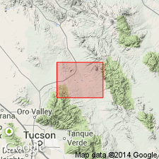
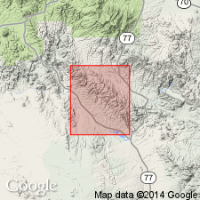
Quiburis mapped on both sides of San Pedro River, in the Ray-San Manuel area, eastern Pinal County, Arizona (Basin-and-Range province), in Mammoth 7.5- and 15-min quadrangles (Creasey, 1965, USGS Prof. Paper 471; 1967, USGS Bull. 1218), Holy Joe Peak (Krieger, 1968, USGS Geol. Quad Map GQ-669), Lookout Mountain (Krieger, 1968, USGS Geol. Quad Map GQ-670), Saddle Mountain (Krieger, 1968, USGS Geol. Quad Map GQ-671), and Winkelman (Krieger, 1973, USGS Geol. Quad Map GQ-1106) 7.5-min quadrangles.
Source: Publication; supplemental information from GNU records (USGS DDS-6; Denver GNULEX).
- Usage in publication:
-
- Quiburis Formation*
- Modifications:
-
- Age modified
- AAPG geologic province:
-
- Basin-and-Range province
Summary:
Age changed from middle Pliocene --to-- late Miocene or early Pliocene based on time scale of Berggren (1972, Lethaia, v. 5, no. 2, p. 195-215). Carries Hemphillian vertebrate fossils. Mapped south and east of San Pedro River, Pinal County, Arizona (Basin-and-Range province).
Source: Modified from GNU records (USGS DDS-6; Denver GNULEX).
For more information, please contact Nancy Stamm, Geologic Names Committee Secretary.
Asterisk (*) indicates published by U.S. Geological Survey authors.
"No current usage" (†) implies that a name has been abandoned or has fallen into disuse. Former usage and, if known, replacement name given in parentheses ( ).
Slash (/) indicates name conflicts with nomenclatural guidelines (CSN, 1933; ACSN, 1961, 1970; NACSN, 1983, 2005, 2021). May be explained within brackets ([ ]).