- Usage in publication:
-
- Putnam formation
- Modifications:
-
- Named
- Dominant lithology:
-
- Limestone
- Shale
- Sandstone
- AAPG geologic province:
-
- Bend arch
Summary:
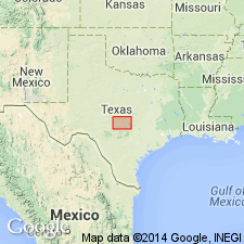
Named for Putnam, Shackelford Co, TX. Is topmost of 6 formations of Pennsylvanian Cisco group (revised). No type locality designated; "typically developed" on the hillside west of town of Putnam, Callahan Co, TX on Bend arch. Overlies Moran formation (revised) of Cisco and underlies newly named Admiral formation of Permian Wichita group. In Brazos River Valley Putnam is divided into the following members (ascending): unnamed shale and thin limestone; and Coleman Junction limestone. In Colorado River Valley members are (ascending): Santa Anna Branch shale; and Coleman Junction limestone. Outcrops in Throckmorton, Shackelford, Callahan, and Coleman Cos, TX on Bend arch. It has not been mapped as yet south of the Colorado River. In Callahan and Shackelford Cos averages 125-175 ft in thickness (4-5 ft wide on outcrop); in Coleman Co averages 125-150 ft in thickness (2 1/2-3 mi wide on outcrop). Putnam consists of Coleman Junction limestone (easily recognized, escarpment-forming) at top, 3-25 ft thick; and a series of 125-175 ft of shale below. Upper layers of the shale are buff, pink, and red, grading downward into blue-gray and dark-blue carbonaceous beds. Shales contain 3 or 4 lentils of buff and dull dirty yellow limestones and 1 or 2 layers of thin, brown, very calcareous sandstone. Fossiliferous in most places. Stratigraphic chart. Measured sections. Pennsylvanian age.
Source: GNU records (USGS DDS-6; Denver GNULEX).
For more information, please contact Nancy Stamm, Geologic Names Committee Secretary.
Asterisk (*) indicates published by U.S. Geological Survey authors.
"No current usage" (†) implies that a name has been abandoned or has fallen into disuse. Former usage and, if known, replacement name given in parentheses ( ).
Slash (/) indicates name conflicts with nomenclatural guidelines (CSN, 1933; ACSN, 1961, 1970; NACSN, 1983, 2005, 2021). May be explained within brackets ([ ]).

