

- Usage in publication:
-
- Prida formation*
- Modifications:
-
- Original reference
- AAPG geologic province:
-
- Great Basin province
Summary:
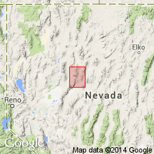
Prida formation. Lithology variable; basal beds locally quartzitic sandstone, elsewhere conglomerate or coarse fanglomerate; above is 50 to 100 feet of interbedded clastics and brown dolomite and shale, then 100 to 200 feet of dark calcareous shale and thin-bedded limestone; at top thicker-bedded limestone. Average thickness about 250 feet. Unconformably overlies Koipato formation; conformably underlies Natchez Pass formation (new). Age is Middle Triassic.
Type locality: East Range west of Prida Ranch, Winnemucca quadrangle, north-central NV.
[See also 1951, "Geology of Winnemucca quadrangle, Nevada," USGS Geol. Quad. Map GQ-11.]
Source: US geologic names lexicon (USGS Bull. 1200, p. 3136).
- Usage in publication:
-
- Prida formation*
- Modifications:
-
- Revised
- AAPG geologic province:
-
- Great Basin province
Summary:
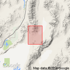
Prida formation in Star Peak group. Lower formation in Star Peak group. In Buffalo Mountain quadrangle, overlies Weaver rhyolite of Koipato group, angular unconformity; underlies Natchez Pass formation. Age is Middle Triassic.
Source: US geologic names lexicon (USGS Bull. 1200, p. 3136).
- Usage in publication:
-
- Prida Formation*
- Modifications:
-
- Revised
- AAPG geologic province:
-
- Great Basin province
Summary:
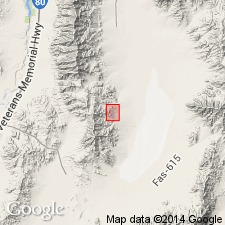
[The following synopsis is from Fossil Hill Member entry.] Fossil Hill Member or Formation of the Star Peak Group is adopted as defined by Nichols and Silberling (1977). Is the upper member of the Favret Formation in the southern Tobin Range and Augusta Mountain; middle member of the Prida Formation in the Humboldt and northern East Ranges; Fossil Hill Formation at China Mountain and in the southern Augusta Mountain. Is composed of fissile to flaggy, dark-gray, calcareous shale with concretionary fossiliferous lime-mudstone interbeds. Thickness is 200 m. Age is Middle Triassic (Anisian) based of fossils [cephalopods].
Source: GNU records (USGS DDS-6; Menlo GNULEX).
For more information, please contact Nancy Stamm, Geologic Names Committee Secretary.
Asterisk (*) indicates published by U.S. Geological Survey authors.
"No current usage" (†) implies that a name has been abandoned or has fallen into disuse. Former usage and, if known, replacement name given in parentheses ( ).
Slash (/) indicates name conflicts with nomenclatural guidelines (CSN, 1933; ACSN, 1961, 1970; NACSN, 1983, 2005, 2021). May be explained within brackets ([ ]).