

- Usage in publication:
-
- Potlatch anhydrite formation
- Modifications:
-
- Named
- Dominant lithology:
-
- Shale
- Gypsum
- Anhydrite
- Limestone
- Dolomite
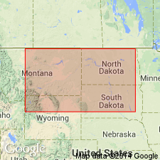
- AAPG geologic province:
-
- Sweetgrass arch
Summary:
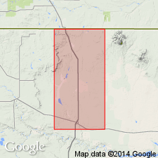
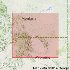
Named for the Potlatch Adams No. 1 well in sec 21, T34N, R1W, Tooele Co, MT on the Sweetgrass arch. The Adams No. 1 not specifically designated as the type well. Lies about 2,500 ft in depth on Sunburst dome. Top selected at top of a 20-ft thick black oil shale beneath the Mississippian Madison limestone. Base placed at top of an unnamed gray limestone 300 ft thick of unknown age. Consists of 940 ft of alternating shale, massive, pure, gray gypsum and anhydrite, mottled limestone, and porous dolomite. Anhydrite and gypsum are cleavable and translucent at some localities. Formation may be limited to the Sweetgrass arch area. Fossils of Late Devonian "character" found in cuttings. Stratigraphic chart. Is probably equivalent to Jefferson formation.
Source: GNU records (USGS DDS-6; Denver GNULEX).
- Usage in publication:
-
- Potlatch member*
- Modifications:
-
- Areal extent
- Revised
- AAPG geologic province:
-
- Sweetgrass arch
Summary:
An evaporite unit and breccias and associated shales are interbedded with shale typical of Three Forks formation; these rocks are recognized in the subsurface north of Logan, MT and are thought to represent a tongue of the upper part of the Potlatch anhydrite formation of Perry (1928) and to be inseparable from the Three Forks Formation east of the 111th meridian in MT on the Sweetgrass arch and in the Williston basin. They are designated Potlatch member, basal member of Three Forks formation. Correlated with part of the unnamed breccias and shales, the basal unit of the Three Forks to south. Cross section. Correlation chart. Overlies Birdbear formation (new), upper formation of Jefferson group. Underlies upper unnamed part of Three Forks. Of Late Devonian age.
Source: GNU records (USGS DDS-6; Denver GNULEX).
- Usage in publication:
-
- Potlatch member
- Modifications:
-
- Areal extent
- Overview
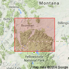
- AAPG geologic province:
-
- Montana folded belt
Summary:
In western portion of study area, which includes southern part of Montana folded belt province, Three Forks formation divided into Potlatch in lower part and green shale member in upper part. In eastern portion of study area Three Forks consists only of a carbonate member. Eastward pinchout of Potlatch occurs from a few miles east of Bridger Range extending south-southwest toward West Yellowstone. Thickness, where Potlatch is present, ranges from 50-130 ft. Overlies Jefferson formation. Isopach map. Correlation chart. Several measured sections in cross sections. Devonian age.
Source: GNU records (USGS DDS-6; Denver GNULEX).
- Usage in publication:
-
- Potlatch member
- Modifications:
-
- Revised
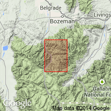
- AAPG geologic province:
-
- Montana folded belt
Summary:
Three Forks Formation divided into two informal members, Potlatch member in lower part and carbonate member in upper part. [In previous report (McMannis, 1962), which included area of this report, author did not refer to Potlatch as an informal unit]. Area of report is within Montana folded belt province. Thickness of Potlatch ranges from 90-130 ft except where tectonically thinned to 50 ft near Timber Butte on Squaw Creek. Late Devonian age.
[NOTE: The Department of the Interior's Secretarial Order 3404, issued on November 19, 2021, formally identifies the term “squaw” as derogatory. That Order will create a federal Derogatory Geographic Names Task Force, to find replacement names for geographic features in use by federal agencies. We’re awaiting guidance from the Task Force, and will then take the appropriate actions.]
Source: GNU records (USGS DDS-6; Denver GNULEX).
- Usage in publication:
-
- Potlatch Member†
- Potlatch Anhydrite*
- Modifications:
-
- Areal extent
- AAPG geologic province:
-
- Montana folded belt
- Sweetgrass arch
Summary:
N12. Potlatch Member of Three Forks Formation of Sandberg and Hammond (1958) and McMannis (1962), in Montana, Wyoming, North Dakota, and South Dakota, is abandoned. Replaced with Logan Gulch Member (new). Subsurface Potlatch Anhydrite of Sweetgrass arch area, northwestern Montana, still in good standing. Age is Late Devonian.
Source: Publication; Changes in stratigraphic nomenclature, 1964 (USGS Bull. 1224-A, p. A22).
For more information, please contact Nancy Stamm, Geologic Names Committee Secretary.
Asterisk (*) indicates published by U.S. Geological Survey authors.
"No current usage" (†) implies that a name has been abandoned or has fallen into disuse. Former usage and, if known, replacement name given in parentheses ( ).
Slash (/) indicates name conflicts with nomenclatural guidelines (CSN, 1933; ACSN, 1961, 1970; NACSN, 1983, 2005, 2021). May be explained within brackets ([ ]).