

- Usage in publication:
-
- Pomeroy member*
- Modifications:
-
- Named
- Dominant lithology:
-
- Sandstone
- Conglomerate
- AAPG geologic province:
-
- Alaska Southwestern region
Summary:
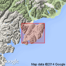
[Probably named for Mt. Pomeroy] as member of Naknek Formation. Occurs on southwest slope of Mt. Pomeroy, on Oil Bay, south shore of Chinitna Bay and east shore of Iniskin Bay, southwestern AK. Comprises sandstone facies and conglomerate facies. Sandstone facies is approximately 400 ft thick on Oil Bay and 1300 ft thick on south shore of Chinitna Bay. Conglomerate facies is approximately 500 ft thick on east shore of Iniskin Bay where it forms northwest facing cliff and hogback ridge extending to Mt. Pomeroy. Has conformable contacts with unnamed underlying siltstone member and overlying upper sandstone member (both of Naknek formation). Age is Late Jurassic.
Source: GNU records (USGS DDS-6; Menlo GNULEX).
- Usage in publication:
-
- Pomeroy Arkose Member*
- Modifications:
-
- Revised
- Redescribed
- Biostratigraphic dating
- Overview
- AAPG geologic province:
-
- Alaska Southwestern region
Summary:
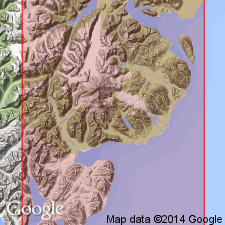
Pomeroy Member of Kirschner and Minard (1948) is redescribed as Pomeroy Arkose Member of Naknek Formation and redefined to include upper sandstone unit of Kirschner and Minard (1948). Composite type section on north and south sides of Chinitna Bay is 2400 feet thick. Conformably overlies Snug Harbor Siltstone Member (new) of Naknek Formation and unconformably underlies Tertiary deposits. BUCHIA collected from beds in middle of member suggest age is probably not younger than early Kimmeridgian.
Source: GNU records (USGS DDS-6; Menlo GNULEX).
For more information, please contact Nancy Stamm, Geologic Names Committee Secretary.
Asterisk (*) indicates published by U.S. Geological Survey authors.
"No current usage" (†) implies that a name has been abandoned or has fallen into disuse. Former usage and, if known, replacement name given in parentheses ( ).
Slash (/) indicates name conflicts with nomenclatural guidelines (CSN, 1933; ACSN, 1961, 1970; NACSN, 1983, 2005, 2021). May be explained within brackets ([ ]).