

- Usage in publication:
-
- Point Hey sandstone member
- Modifications:
-
- Original reference
- Dominant lithology:
-
- Sandstone
- Conglomerate
- Shale
- AAPG geologic province:
-
- Alaska Southern region
Summary:
Pg. 773+. Point Hey sandstone member of Redwood formation. Basal member of Redwood formation. Consists of 1,100 feet of sandstones and conglomerates with thin shale beds, and with heavy conglomerates at top. Lower part is pebbly sandstone and fine-grained, thin-bedded, shaly sandstone with intercalations of dark sandy shale. This passes up into flaggy sandstones and sandy shales with thin beds of sandy limestone and with abundant plant fragments. Lenses of conglomerate are numerous, and upper part consists of a fairly heavy conglomerate with pebbles and cobbles up to 6 or 8 inches diameter. Conformably underlies Puffy shale member and conformably overlies Burls Creek shale member of Katall formation [restricted]. Assigned to upper Oligocene on basis of lithologic correlation with fossiliferous rocks in Yakataga district that are assigned to upper Oligocene by B.L. Clark.
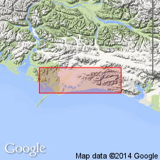
[Recognized in Katalla district, Controller Bay region, southeastern AK.]
[GNC remark (ca. 1936, US geologic names lexicon, USGS Bull. 896, p. 1691): The USGS classifies typical Katalla formation as Miocene(?).]
Source: US geologic names lexicon (USGS Bull. 896, p. 1691).
- Usage in publication:
-
- Point Hey sandstone member*
- Modifications:
-
- Adopted
- Revised
- Dominant lithology:
-
- Sandstone
- AAPG geologic province:
-
- Alaska Southern region
Summary:
Pg. 7 (table), 12-13, geol. map. Point Hey sandstone member of Katalla formation. East of Long 144 deg. 19 min. W. member consists of at least several hundred feet of gray to nearly black partly sandy shale and fine- to medium-grained gray sandstone. Sandstone beds range in thickness from 1 to 100 feet. Near Long 144 deg. 19 min. W., member is about 850 feet thick. West of Long 144 deg. 19 min. W., member includes a lower division mostly of shale which thickens westward to more than 2,000 feet and an upper division of thick sandstone beds and thin shale beds. Lies conformably between unnamed organic shale member below and Puffy member above. In unpublished manuscript by oil-company geologists, Point Hey shale and Point Hey sandstone are treated as two distinct units in Redwood formation. Age is Oligocene.
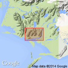
Named from excellent outcrops in vicinity of Point Hey, Katalla district, Controller Bay region, southeastern AK.
Source: US geologic names lexicon (USGS Bull. 1200, p. 3079).
- Usage in publication:
-
- Point Hey member*
- Modifications:
-
- Mapped
- AAPG geologic province:
-
- Alaska Southern region
Summary:
Pg. 23 (table 1), 34-36, pls. Point Hey member of Katalla formation [= classification of Miller and others, 1945, USGS OF-45-103]. Shale and sandstone, 850 to 2,100+ feet thick. Tentatively correlated with Poul Creek formation of adjacent Yakataga district and Blakeley age rocks of Oregon and Washington. Conformably overlies unnamed organic shale member of Katalla formation. Conformably underlies Puffy member of Katalla formation. Fossils. Some of pelecypods, particularly LUCINA HANNABALI (Clark), indicate age of late Oligocene.
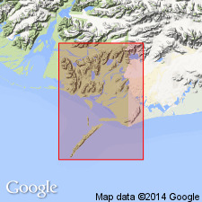
Recognized in Katalla and Nichawak areas, Controller Bay region, southeastern AK.
Source: Publication; GNU records (USGS DDS-6; Menlo GNULEX).
- Usage in publication:
-
- Point Hey Member†
- Modifications:
-
- Abandoned
- AAPG geologic province:
-
- Alaska Southern region
Summary:
†Point Hey Member abandoned; its rocks being reassigned to upper unit of Burls Creek Shale Member of Katalla Formation and unnamed sandstone member in lower part of Redwood Formation. [See correlation chart.]
Source: GNU records (USGS DDS-6; Menlo GNULEX); Changes in stratigraphic nomenclature, 1976 (USGS Bull. 1435-A, p. A83).
For more information, please contact Nancy Stamm, Geologic Names Committee Secretary.
Asterisk (*) indicates published by U.S. Geological Survey authors.
"No current usage" (†) implies that a name has been abandoned or has fallen into disuse. Former usage and, if known, replacement name given in parentheses ( ).
Slash (/) indicates name conflicts with nomenclatural guidelines (CSN, 1933; ACSN, 1961, 1970; NACSN, 1983, 2005, 2021). May be explained within brackets ([ ]).