- Usage in publication:
-
- Plentywood formation*
- Modifications:
-
- Named
- Dominant lithology:
-
- Gravel
- AAPG geologic province:
-
- Williston basin
Summary:
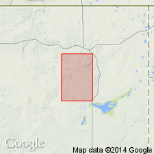
Named for exposures along Big Muddy Creek which are exposed conspicuously in several pits north of this quad near Plentywood, Sheridan Co, MT in the Williston basin. Has been traced beyond the quad boundaries. No type locality designated. Overlies the Paleocene Fort Union formation and till. Is overlain by alluvium, colluvium, pond and eolian deposits. Ranges from 0 to 135 ft thick. Consists of poorly sorted and bedded gravel of cobbles and boulders (1+ ft in diameter). The cobbles and boulders are about 15 percent limestone, dolomite, and granite erratics; 70 percent Flaxville-type pebbles, and 15 percent miscellaneous. However, most of the formation consists of sand- and pea-size material. Is a remnant deposit laid down during the retreat and melting of the Cary? ice sheet. Geologic map. Pleistocene age.
Source: GNU records (USGS DDS-6; Denver GNULEX).
For more information, please contact Nancy Stamm, Geologic Names Committee Secretary.
Asterisk (*) indicates published by U.S. Geological Survey authors.
"No current usage" (†) implies that a name has been abandoned or has fallen into disuse. Former usage and, if known, replacement name given in parentheses ( ).
Slash (/) indicates name conflicts with nomenclatural guidelines (CSN, 1933; ACSN, 1961, 1970; NACSN, 1983, 2005, 2021). May be explained within brackets ([ ]).

