

- Usage in publication:
-
- Pitchfork formation*
- Modifications:
-
- Named
- Dominant lithology:
-
- Sandstone
- Siltstone
- Conglomerate
- AAPG geologic province:
-
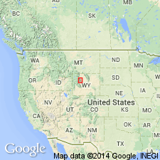
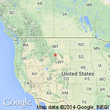
- Bighorn basin
Summary:
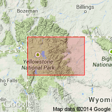
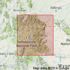
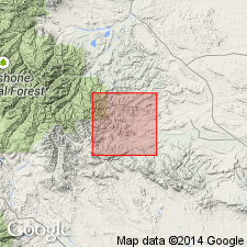
Named for Pitchfork P.O., Greybull valley. No single section encompasses lithologic variety in formation but exposures on east side Francs Fork on south side Greybull valley, sec 4, fig 6 center sec 9, T47N, R103W nearly approaches a type section. Term early basic breccia previously applied to rocks assigned to Pitchfork. Name early basic breccia inappropriate because most of the sequence is nonpyroclastic and many beds are dacitic, or acid rather than basic. Consists largely of volcanic sandstones, siltstones, and conglomerates, both andesitic (80 percent) and dacitic (20 percent). Ranges from 200 to 1,200 ft thick. Pinches out against axis of Owl Creek Range. Many beds are lenticular. Most of the sandstone is poorly sorted. Conglomerate may have well rounded andesite pebbles and cobbles, some granite and other Precambrian rock pebbles. Andesitic beds are horizontal to contorted. Most of the volcanic debris was transported by streams and deposited in stream channels and floodplains in a warm, humid climate. Overlies Willwood formation. Underlies early basalt sheets. Correlates with Aycross formation. Vertebrate and plant fossils indicate a probable middle Eocene age. Columnar sections. Correlation chart.
Source: GNU records (USGS DDS-6; Denver GNULEX).
- Usage in publication:
-
- Pitchfork Formation
- Modifications:
-
- Overview
- AAPG geologic province:
-
- Bighorn basin
Summary:
A detrital facies of the early basic breccia was named Pitchfork Formation (Hay, 1956). Is slightly younger [age not given] than Cathedral Cliffs Formation (new name) of Park Co in the Bighorn basin. Is a detrital facies of the early acid breccia in the south fork of Shoshone River, Park Co., Bighorn basin, WY. thought to be slightly younger than Cathedral Cliffs Formation (new name) of the Clarks Fork area.
Source: GNU records (USGS DDS-6; Denver GNULEX).
- Usage in publication:
-
- Pitchfork formation
- Modifications:
-
- Revised
Summary:
Pitchfork in the Bighorn basin of northwest WY, unconformably overlies Willwood formation, and possibly thin remnants of Tatman formation. Unconformably underlies Early Basalt flows at some localities, and Blue Point member (named in this report) of Wiggins formation at other localities. Is the stratigraphic equivalent of Aycross formation of Masursky (1952) and of the Aycross and Tepee Trail formations of Love (1939). Correlation chart. Ranges between less than 100 ft thick to 1,200 ft thick. Faunal studies of lower 600 ft show middle Eocene age. Fauna from landslide material probably derived from the upper part of Pitchfork indicate early middle Eocene age.
Source: GNU records (USGS DDS-6; Denver GNULEX).
- Usage in publication:
-
- Pitchfork Formation*
- Modifications:
-
- Revised
- AAPG geologic province:
-
- Bighorn basin
Summary:
Included in Sunlight Group (new) of Absaroka Volcanic Supergroup (new). Considered to be the fine-grained alluvial facies that interfingers with and grades into Wapiti Formation of Sunlight along South Fork Shoshone River near Carter Mountain in the Bighorn basin. Is of early Bridgerian, middle Eocene age.
Source: GNU records (USGS DDS-6; Denver GNULEX).
- Usage in publication:
-
- Pitchfork Formation*†
- Modifications:
-
- Abandoned
Summary:
Pitchfork Formation of Sunlight Group of Absaroka Volcanic Supergroup abandoned. Some of the rocks formerly called Pitchfork assigned to Aycross Formation and some to lower part of Tepee Trail Formation.
Source: GNU records (USGS DDS-6; Denver GNULEX).
- Usage in publication:
-
- Pitchfork Formation†
- Modifications:
-
- Abandoned
Summary:
Based on paleomagnetic studies flows on Ptarmigan and Carter Mountains belong to the Jim Mountain? Member of Wapiti Formation and an unnamed sequence rather than Trout Peak Trachyandesite. Previous authors have suggested abandonment or discontinued use.
Source: GNU records (USGS DDS-6; Denver GNULEX).
For more information, please contact Nancy Stamm, Geologic Names Committee Secretary.
Asterisk (*) indicates published by U.S. Geological Survey authors.
"No current usage" (†) implies that a name has been abandoned or has fallen into disuse. Former usage and, if known, replacement name given in parentheses ( ).
Slash (/) indicates name conflicts with nomenclatural guidelines (CSN, 1933; ACSN, 1961, 1970; NACSN, 1983, 2005, 2021). May be explained within brackets ([ ]).