

- Usage in publication:
-
- Phosphoria formation*
- Modifications:
-
- Named
- Dominant lithology:
-
- Limestone
- Shale
- Phosphorite
- Chert
- AAPG geologic province:
-
- Wasatch uplift
Summary:
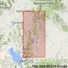
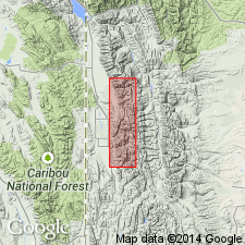
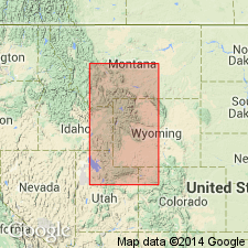
Named for Phosphoria Gulch which joins Georgetown Canyon 2.5 mi N 16 degrees W of Meade Peak, Bear Lake Co, ID on the Wasatch uplift. No type locality designated, but a section 415 ft thick measured in sec 12, T10S, R44E and in sec 7, T10S, R45E, Bear Lake Co, ID described. Divisible into a phosphate shale part (lower part) 175 ft 2 1/2 in thick and the Rex chert member (new, at top) 240 ft thick. Phosphatic part consists of interbedded brown to black shale, gray dense limestone, dark brown oolitic phosphate, and minor white calcareous sandstone, pebbly or concretionary beds and yellow clay. Some shale beds may be calcareous, some sandy, some phosphatic, some finely oolitic, some contorted, some concretionary, some thin bedded. Some limestone beds are lenticular. Overlying Rex consists of gray limestone (base), black chert, and black cherty shale. Overlies Wells formation (new). Underlies Woodside shale in report area. Is equivalent to part of Park City and Embar formations. Has sponge spicules, crinoid stems, brachiopods. Recognized in southeast ID, northeast UT, and western WY. Assigned to the Permian?, Carboniferous.
Source: GNU records (USGS DDS-6; Denver GNULEX).
- Usage in publication:
-
- Phosphoria formation*
- Modifications:
-
- Areal extent
- AAPG geologic province:
-
- Green River basin
Summary:
Extended eastward from Phosphoria Gulch, Bear Lake Co, ID. Mapped (reconnaissance map) in the Salt River Range, Lincoln Co, WY in the Greater Green River basin where it overlies Wells formation and underlies Woodside shale. Is 450 ft thick in area where it is divisible into a lower unit of phosphatic shales and the Rex chert member at top. Is fossiliferous. Of Permian? age. [Name Park City formation applied to these rocks in earlier reports.]
Source: GNU records (USGS DDS-6; Denver GNULEX).
- Usage in publication:
-
- Phosphoria formation
- Modifications:
-
- Revised
- AAPG geologic province:
-
- Green River basin
- Wind River basin
Summary:
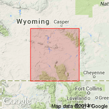
Unconformably overlies Tensleep sandstone. Is 200-300 ft thick in the Wind River Mountains, Fremont Co, WY in the Wind River basin, where it consists of alternating shale and limestone beds and bedded chert and phosphate. From the south end of Wind River Mountains south to Green Mountains, southeast Fremont Co, phosphate beds are absent but the formation maintains same general thickness. South and east of Green Mountains to Sybille Springs, Albany Co, Greater Green River basin, a buff fossiliferous sandstone that tongues into Satanka shale is named Sybille tongue of Phosphoria. South and east from Green Mountains to Red Mountain, southern Albany Co, Greater Green River basin, a distinct [limestone], redesignated Forelle limestone tongue lies between and intertongues with Satanka (below) and Freezeout tongue (new) of Chugwater formation. East of Green Mountains to Alcova, Natrona Co, Wind River basin, a pink to gray limestone conformably beneath the Triassic Dinwoody formation named Ervay tongue of Phosphoria tongues into Freezeout tongue. Age of Phosphoria is in doubt, but is probably Permian. Measured sections; cross sections. Fossils from Ervay listed.
Source: GNU records (USGS DDS-6; Denver GNULEX).
- Usage in publication:
-
- Phosphoria group
- Modifications:
-
- Revised
- Overview
- Areal extent
- AAPG geologic province:
-
- Denver basin
- Powder River basin
Summary:
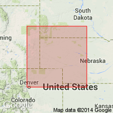
Raised to group rank [intent to designate as a group not stated]. Recognized in the Denver basin, north to Laramie Range, and as far north as La Bonte Post Office [sec. 5, T. 29 N., R. 72 W.] Converse County, Wyoming, in the Powder River basin. Divided into (ascending order): Opeche shale, Minnekahta limestone, Glendo shale (new), Forelle limestone, and Freezeout shale. Age is Permian. Report includes measured sections.
Source: Modified from GNU records (USGS DDS-6; Denver GNULEX).
- Usage in publication:
-
- Phosphoria formation*
- Modifications:
-
- Revised
- Overview
- AAPG geologic province:
-
- Snake River basin
- Montana folded belt
- Wasatch uplift
- Green River basin
Summary:
Is a cyclic marine deposit known in southeast ID (Snake River basin) and adjacent MT (Montana folded belt province), UT (Wasatch uplift), and WY (Greater Green River basin, Yellowstone province, Bighorn and Wind River basins). Consists of phosphatic, carbonaceous, and cherty rocks deposited in a marine environment modified by several transgressions and regressions. Lower boundary marked by thin phosphorite that contains abundant fish scales and bones above the carbonate rocks of Grandeur tongue or member of Park City formation. Upper boundary placed at top of phosphorite of Phosphoria and below tan calcareous siltstone of Dinwoody formation. Intertongues with Park City and with Shedhorn sandstone. Divided into: lower chert member, Meade Peak phosphatic shale member, Rex chert member, cherty shale member, Retort phosphatic, and Tosi chert members.
Source: GNU records (USGS DDS-6; Denver GNULEX).
- Usage in publication:
-
- Phosphoria formation*
- Modifications:
-
- Overview
- AAPG geologic province:
-
- Montana folded belt
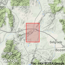
Summary:
Crops out in four small areas in Gallatin, Jefferson, and Broadwater Cos, MT in the Montana folded belt province. Topographic expression varies with dominant lithology. Geologic map. Measured sections described in 1) NE cor sec 25, T2N, R1W (120 ft thick), 2) SE1/4 sec 20, T3N, R1E (150 ft thick), 3) SW1/4 SW1/4 sec 29 and NE1/4 NW1/4 sec 32, T3N, R2E (200 ft thick), and 4) NW1/4 SE1/4 sec 34, T1N, R1W (150 ft thick). [Compare with Peale, 1893, 1896 and Berry, 1943] Overlies Quadrant Formation; underlies Ellis Formation. Fusulinids indicative of middle or late Wolfcamp, or possibly early Leonard age identified. Assignable to Early Permian.
Source: GNU records (USGS DDS-6; Denver GNULEX).
- Usage in publication:
-
- Phosphoria Formation*
- Modifications:
-
- Overview
- AAPG geologic province:
-
- Snake River basin
- Idaho Mountains province
Summary:
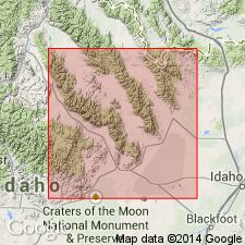
Pg. 32-34, 38, figs. 1-4, 6. Phosphoria Formation. Partial section described from type section of newly named Gallagher Peak Sandstone and Juniper Gulch Members of Snaky Canyon Formation in southern Beaverhead Mountains, Snaky Canyon 7.5-min quadrangle, Clark County, Idaho; thickness about 230 feet. Includes (descending) Tosi Chert Member, chert with limestone at base, 90 feet; Retort Phosphatic Shale Member, phosphorite, dolomite, and siltstone, 115 feet; and Meade Peak(?) Member, covered, 23 feet. Retort separated from underlying Meade Peak(?) by 56 feet of interbedded limestones and dolomites of Franson(?) Tongue of Park City Formation. Phosphoria separated from underlying Snaky Canyon Formation by covered intervals. In Snaky Canyon itself, conformably overlies Snaky Canyon Formation. Presumably conformably (contact not exposed) underliesTriassic Dinwoody Formation. In southern Lemhi Range, Phosphoria includes Rex(?) Chert Member and overlies Snaky Canyon Formation. Age is Early Permian, based on fossils (mainly brachiopods). Report includes correlation chart, measured sections, fossil list, geologic sketch map.
Source: Publication.
- Usage in publication:
-
- Phosphoria Formation*
- Modifications:
-
- Age modified
- Biostratigraphic dating
- AAPG geologic province:
-
- Snake River basin
- Wasatch uplift
Summary:
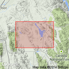
Includes (in lower part), Meade Peak Phosphatic Shale Member and Rex Chert Member in Caribou Co (Wasatch uplift) and Bingham Co (Snake River basin), southeastern ID. Overlies Grandeur Member of Park City Formation. Leonardian-Guadalupian North American series boundary changed on basis of conodont biostratigraphy; placed within upper part of Meade Peak Member. Three conodont zones are recognized in the Meade Peak Member and sub- and superjacent units. NEOSTREPTOGNATHODUS SULCOPLICATUS Zone (Roadian) identified in Grandeur Member and lowermost part of Meade Peak. NEOGONDOLELLA GRACILIS-N. SERRATA Zone (late Roadian) occurs entirely in the Meade Peak. N. PHOSPHORIENSIS Zone (early Wordian) found in uppermost Meade Peak and most of Rex Chert Member. Zonal transition of N. GRACILIS-N. SERRATA to N. PHOSPHORIENSIS is correlated with currently accepted Leonardian-Guadalupian series boundary (Roadian-Wordian stage boundary) of the Early Permian.
Source: GNU records (USGS DDS-6; Denver GNULEX).
For more information, please contact Nancy Stamm, Geologic Names Committee Secretary.
Asterisk (*) indicates published by U.S. Geological Survey authors.
"No current usage" (†) implies that a name has been abandoned or has fallen into disuse. Former usage and, if known, replacement name given in parentheses ( ).
Slash (/) indicates name conflicts with nomenclatural guidelines (CSN, 1933; ACSN, 1961, 1970; NACSN, 1983, 2005, 2021). May be explained within brackets ([ ]).