

- Usage in publication:
-
- Phonodoree Formation*
- Modifications:
-
- Named
- Reference
- Dominant lithology:
-
- Mudstone
- Sandstone
- Conglomerate
- AAPG geologic province:
-
- Basin-and-Range province
Summary:
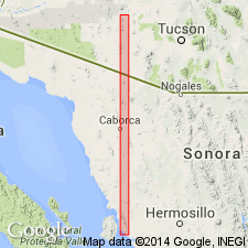
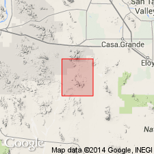
Named as formation for the Phonodoree shaft in Vekol Mountains, southwestern Pinal Co, AZ in the Basin-and-Range province. Formerly called the lower red sandstone unit (Hadley, 1944) in Reward Mine area and the lower part of the Cretaceous red beds (Carpenter, 1947) southeast of Copperosity Mine; the two areas constitute type and reference localities respectively. Consists of red, brick-red, and light-brown mudstone, red feldspathic sandstone, white to gray quartzite, and white, gray, and orangish-brown pebble conglomerate. Bluish-gray basal quartzitic conglomerate, which contains smooth chert and quartzite pebbles rarely more than 1 in long, is generally only a few inches to a few ft thick, but is as much as 20 ft thick where it fills channels in underlying Paleozoic rocks. Finer beds range from siltstone to sandy mudstone. Sand grains are mostly well-rounded quartz; most quartzite beds are fairly pure but a few are arkosic. Conglomerate beds contain smooth, almost ellipsoidal pebbles as much as 4 in long; most pebbles are chert and quartzite, but some are limestone. Coarse beds commonly grade upward into finer material. Is as much as 300 ft thick. Rests with angular unconformity on rocks as young as Horquilla Limestone (Pennsylvanian). Unconformably overlain by Vekol Formation. Is probably a floodplain deposit. Assigned a Mesozoic age. Is probably Cretaceous age.
Source: GNU records (USGS DDS-6; Denver GNULEX).
- Usage in publication:
-
- Phonodoree Formation*
- Modifications:
-
- Age modified
- AAPG geologic province:
-
- Basin-and-Range province
Summary:
Is assigned a Cretaceous? age.
Source: GNU records (USGS DDS-6; Denver GNULEX).
For more information, please contact Nancy Stamm, Geologic Names Committee Secretary.
Asterisk (*) indicates published by U.S. Geological Survey authors.
"No current usage" (†) implies that a name has been abandoned or has fallen into disuse. Former usage and, if known, replacement name given in parentheses ( ).
Slash (/) indicates name conflicts with nomenclatural guidelines (CSN, 1933; ACSN, 1961, 1970; NACSN, 1983, 2005, 2021). May be explained within brackets ([ ]).