

- Usage in publication:
-
- Perkasie shales
- Modifications:
-
- Named
- Dominant lithology:
-
- Shale
- AAPG geologic province:
-
- Newark basin
Summary:
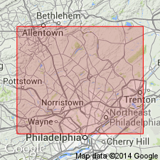
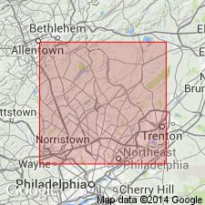
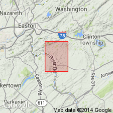
Hard green and dark red, gray, and black shales overlying the Lansdale shales and underlying the Pottstown shales in the New Red series are here named the Perkasie shales. They form a ridge extending from the Delaware River near Milford, NJ, around Stony Point and south of Haycock Mountain, over the Perkasie tunnel, to Lederachsville and Sanatoga on the Schuylkill River. Thickness is 2,000 ft.
Source: GNU records (USGS DDS-6; Reston GNULEX).
- Usage in publication:
-
- Perkasie shales*
- Modifications:
-
- Overview
- AAPG geologic province:
-
- Newark basin
Summary:
The Triassic series in the Philadelphia district is represented by the Norristown, Gwynedd, Lansdale, Perkasie, and Pottstown shales. It is footnoted that N. H. Darton divides the Triassic into the Stockton formation, corresponding to the Norristown, the Lockatong formation, corresponding to the Gwynedd, and the Brunswick shale, corresponding to the Lansdale, Perkasie, and Pottstown shales.
Source: GNU records (USGS DDS-6; Reston GNULEX).
- Usage in publication:
-
- Perkasie member
- Modifications:
-
- Revised
- AAPG geologic province:
-
- Newark basin
Summary:
Thick gray argillite that forms the Perkasie ridge is here designated the Perkasie Member in the lower part of the Brunswick Formation in New Jersey and Pennsylvania. It is described in the Delaware River section. Where it extends northeastward along strike it passes into fanglomerate near the border of the Triassic. To the southwest it extends into Montgomery Co., Pennsylvania, where in places it is merged with the hornfels aureole beneath diabase sills.
Source: GNU records (USGS DDS-6; Reston GNULEX).
- Usage in publication:
-
- Perkasie member
- Modifications:
-
- Revised
- AAPG geologic province:
-
- Newark basin
Summary:
The Perkasie Shales of Lyman (1895) is here revised as the Perkasie Member of the Brunswick lithofacies and is here restricted to a belt of hornfels or gray argillite which forms a prominent ridge from Ottsville to Sellersville, PA. It is separated from the altered shales exposed at the Perkasie tunnel by a belt of red shale. North of Milford, NJ, at the same stratigraphic level, are two gray argillite members, each 50 ft thick, separated by 50 ft of red shale; at Tohickon Creek the Perkasie is 144 ft thick with 10 ft of red shale 40 ft above its base. Similar gray argillite members occur at the same stratigraphic level at Lederachsville and Schwenksville, Montgomery Co., PA. The members at Perkasie, Milford, and Lederachsville are probably the same.
Source: GNU records (USGS DDS-6; Reston GNULEX).
- Usage in publication:
-
- Perkasie Member*
- Modifications:
-
- Revised
- AAPG geologic province:
-
- Newark basin
Summary:
The Perkasie Member of the Brunswick Formation is here revised. North of Milford, NJ it consists of a lower gray unit 38 ft thick, a middle red unit 56 ft thick, and an upper gray unit 50 ft thick. It is 1,470 ft above the Graters Member of the Brunswick and grades upward and along strike into quartzite fanglomerate. Fossil footprints are found in siltstone of the upper gray unit in quarries near Milford.
Source: GNU records (USGS DDS-6; Reston GNULEX).
- Usage in publication:
-
- Perkasie Member
- Modifications:
-
- Revised
- AAPG geologic province:
-
- Newark basin
Summary:
The Perkasie Member is reassigned from the Brunswick Formation, here abandoned, to the here named Passaic Formation, which replaces the lower part of the Brunswick as defined by Kummel (1897).
Source: GNU records (USGS DDS-6; Reston GNULEX).
- Usage in publication:
-
- Perkasie Member
- Modifications:
-
- Age modified
- AAPG geologic province:
-
- Newark basin
Summary:
The Age of the Perkasie Member of the Passaic Formation is Norian, based on spores in the Passaic.
Source: GNU records (USGS DDS-6; Reston GNULEX).
- Usage in publication:
-
- Perkasie Member*
- Modifications:
-
- Revised
- AAPG geologic province:
-
- Newark basin
Summary:
The rank of the Brunswick Formation is here raised to Group. It includes the Passaic Formation of Olsen (1980) in NJ and NY, which corresponds to the lower part of the Brunswick Group in PA. [The Perkasie Member is in these units.]
Source: GNU records (USGS DDS-6; Reston GNULEX).
For more information, please contact Nancy Stamm, Geologic Names Committee Secretary.
Asterisk (*) indicates published by U.S. Geological Survey authors.
"No current usage" (†) implies that a name has been abandoned or has fallen into disuse. Former usage and, if known, replacement name given in parentheses ( ).
Slash (/) indicates name conflicts with nomenclatural guidelines (CSN, 1933; ACSN, 1961, 1970; NACSN, 1983, 2005, 2021). May be explained within brackets ([ ]).