

- Usage in publication:
-
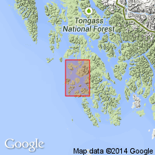
- Peratrovich Formation*
- Modifications:
-
- Named
- Biostratigraphic dating
- Dominant lithology:
-
- Chert
- Limestone
- AAPG geologic province:
-
- Alaska Southeastern region
Summary:
Named for exposures at type locality on southern end of Peratrovich Island about 1.6 km north of village of Klawock, southeast AK. Formation is exposed on Klawak Island, east shore of Klawak Inlet, island along west side of Port Bagial, Toti Island, parts of Madre de Dios Island, Ladrones Islands, Point Bocas, Ridge Island, several small islands north of Ulloa Island, and underlies Shelikof Island. Divided into three informal map units (ascending): chert member, limestone and chert member, and limestone member. Composed of thin-bedded grayish-black chert with rare limestone and dolomite; limestone with minor grayish-black chert interbeds; and thick-bedded massive limestone. Chert member is about 200 ft thick, limestone and chert member is about 300-450 ft thick, limestone member is about 250-300 ft thick, and overall formation is about 1000 ft thick. Overlies Wadleigh Limestone (new) or Port Refugio Formation (new). Conformably underlies Klawak Formation (new) or Ladrones Formation (new). Bed-by-bed fossil collections indicate that age ranges from Early Mississippian (Kinderhookian or early Osagean) to Late Mississippian (Meramac and Chester) as indicated by presence of MILLERELLA sp. and BRADYINA sp. (Armstrong and others oral communication, 1968).
Source: GNU records (USGS DDS-6; Menlo GNULEX).
For more information, please contact Nancy Stamm, Geologic Names Committee Secretary.
Asterisk (*) indicates published by U.S. Geological Survey authors.
"No current usage" (†) implies that a name has been abandoned or has fallen into disuse. Former usage and, if known, replacement name given in parentheses ( ).
Slash (/) indicates name conflicts with nomenclatural guidelines (CSN, 1933; ACSN, 1961, 1970; NACSN, 1983, 2005, 2021). May be explained within brackets ([ ]).