

- Usage in publication:
-
- Penyon Blanco agglomerates
- Modifications:
-
- First used
- AAPG geologic province:
-
- Sierra Nevada province
Summary:
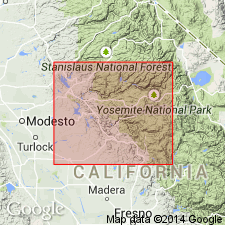
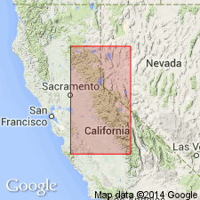
On Merced River and southward into Indian Gulch 15-min quadrangle, Mariposa County, California, Penon Blanco agglomerates, 9,000 feet thick, are included in Tuolumne [later Amador] group. Underlie Agua Fria formation (new) and overlie Hunter Valley cherts (new). Age is probably early Mesozoic.
Source: GNU records (USGS DDS-6; Menlo GNULEX).
- Usage in publication:
-
- Penon Blanco volcanics
- Modifications:
-
- [First used]
- Dominant lithology:
-
- Volcanics
- AAPG geologic province:
-
- Sierra Nevada province
Summary:
Pg. 283, 284. Penon Blanco volcanics of Amador group. In Merced River section (=southern type section of Amador), Penon Blanco volcanics underlie Agua Fria formation and overlie Hunter Valley cherts (both of Amador group). Thickness about 9,000 feet. Correlates with Logtown Ridge agglomerates (new) of Amador group in its northern type section on Cosumnes River. Age of Amador group is believed to be late Middle to early Late Jurassic.
Present in southern type section of Amador group along Merced River. [Name probably derived from Penon Blanco Ridge, Penon Blanco Peak 7.5-min quadrangle, Tuolumne and Mariposa Cos., CA.]
[According to L.D. Clark, 1964 (USGS Prof. Paper 410, p. 17), Taliaferro provided only very brief descriptions of units and did not indicate where contacts are to be placed.]
Source: US geologic names lexicon (USGS Bull. 1200, p. 2981); GNU records (USGS DDS-6; Menlo GNULEX).
- Usage in publication:
-
- Penon Blanco volcanics*
- Modifications:
-
- Named
- Overview
- Dominant lithology:
-
- Porphyry
- Amphibolite
- Tuff
- AAPG geologic province:
-
- Sierra Nevada province
Summary:
Pg. 22-23, pls. 1-11. Penon Blanco volcanics. Were "named" by Taliaferro (1943, California Div. Mines Bull., no. 125) who provided only very brief descriptions of units and did not indicate where contacts are to be placed. He included (in ascending order) the Hunter Valley cherts, Penon Blanco volcanics, and Agua Fria formation in his southern type section of Amador group (Merced River section), but was unable at that time to establish complete correlation with his northern type section (Cosumnes River section). In this report, the Amador is restricted to its northern area, around Cosumnes River, in El Dorado and Amador Counties, and includes only Logtown Ridge and Cosumnes formations. Name Penon Blanco volcanics is applied to sequence of volcanic rocks that underlies Mariposa formation, from the south end of mapped area (see pl. 1) to a point west of town of Melones. Consists almost entirely of dark-green mafic rocks. At type (15,000 feet thick) tuff, lapilli tuff and breccia constitute upper part with lava and pillow structure in lower part. These rocks were mapped as porphyrite and amphibolite by Turner (1897, USGS Geol. Atlas of the US, Sonora folio, no. 41) and were included in Logtown Ridge formation by Eric and others (1955, California Div. Mines Spec. Rpt., no. 41). Penon Blanco is distinguished from Logtown Ridge because two are not continuous in exposures, nor are epiclastic rocks that overlie Logtown Ridge formation continuous with Mariposa formation. No fossils. Probably same age as Logtown Ridge formation (Late Jurassic).
Type section: along Merced River (=southern type section of Amador Group of Taliaferro, 1943), Tuolumne and Mariposa Cos., CA. Named from outcrops underlying Penon Blanco Ridge between Merced and Tuolumne Rivers [Penon Blanco Peak 7.5-min quadrangle, Tuolumne and Mariposa Cos., CA].
[Author does not capitalize rank terms; however, units are considered formal.]
Source: Publication; GNU records (USGS DDS-6; Menlo GNULEX).
- Usage in publication:
-
- Penon Blanco Volcanics*
- Modifications:
-
- Age modified
- AAPG geologic province:
-
- Sierra Nevada province
Summary:
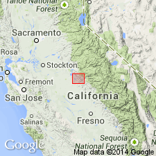
Mapped in Chinese Camp 7.5' and Moccasin 7.5' quads, Tuolumne Co, CA in northwest-southeast trending central belt which includes area around Don Pedro Reservoir and northern part of Penon Blanco Ridge. Map show three lithologies: (1) andesite pillow breccia (2) massive flows with fine-grained phenocrysts and (3) breccias and flows with coarse-grained phenocrysts. Intruded by diorite of Don Pedro (U/Pb age 182 Ma, Jurassic). Underlies Mariposa Formation (Late Jurassic). Age given as Triassic or Jurassic.
Source: GNU records (USGS DDS-6; Menlo GNULEX).
- Usage in publication:
-
- Penon Blanco Volcanics*
- Modifications:
-
- Age modified
- AAPG geologic province:
-
- Sierra Nevada province
Summary:
Sketch maps and tectonostratigraphic columns in Tuolumne River area show basal aphyric pillow-basalt (1000 m) and overlying radiolarian chert (30 m) of Penon Blanco Volcanics. Chert grades upward into fine crystal and lapilli tuff. Unit runs N from Tuolumne region into central belt melange. Radiolaria from chert are early Mesozoic age (D.L. Jones, pers. commun., 1979). Pb/U ages on zircon in pyroxene and hornblende diorite from intrusive body (located on sketch map) yield 200 +/-2 Ma to 196 +/-2 Ma. Age is Triassic to Jurassic.
Source: GNU records (USGS DDS-6; Menlo GNULEX).
- Usage in publication:
-
- Penon Blanco Formation*
- Modifications:
-
- Redescribed
- Revised
- Age modified
- AAPG geologic province:
-
- Sierra Nevada province
Summary:
Divided into 6 lithologic units. Upper four units (desc.) (tuffaceous turbidite, tuff breccia, augite-plag. porphyry, and fine tuff, tuffaceous turbidite) retained in Penon Blanco Formation. Type section is retained on Merced River. Two underlying units (desc.) (radiolarian chert and pillow basalt) are herein named Jasper Point Formation (Jurassic and Triassic). Mapped in Penon Blanco Peak, Coulterville, Bear Valley and Hornitos 7.5' quads with stratigraphic columns. Intruded by Don Pedro pluton which cuts all units except youngest tuff. Underlies Mariposa Formation. Gradationally overlies Jasper Point Formation (new). Is Early Jurassic age based on U/Pb zircon age of 192 +/-2 Ma from pyroxene diorite in augite-porphyry unit (Saleeby, 1982).
Source: GNU records (USGS DDS-6; Menlo GNULEX).
For more information, please contact Nancy Stamm, Geologic Names Committee Secretary.
Asterisk (*) indicates published by U.S. Geological Survey authors.
"No current usage" (†) implies that a name has been abandoned or has fallen into disuse. Former usage and, if known, replacement name given in parentheses ( ).
Slash (/) indicates name conflicts with nomenclatural guidelines (CSN, 1933; ACSN, 1961, 1970; NACSN, 1983, 2005, 2021). May be explained within brackets ([ ]).