

- Usage in publication:
-
- Passaic Formation
- Modifications:
-
- Named
- Dominant lithology:
-
- Siltstone
- Sandstone
- Conglomerate
- AAPG geologic province:
-
- Piedmont-Blue Ridge province
Summary:
Red siltstone, sandstone, and conglomerate conformably overlying the Lockatong Formation and underlying the Orange Mountain Basalt are here named the Passaic Formation of the Newark Supergroup. It replaces the lower part of the Brunswick Formation of Kummel (1897) which is here abandoned. The Graters and Perkasie Members of the Brunswick are assigned to the Passaic. Age is Late Triassic and Early Jurassic.
Source: GNU records (USGS DDS-6; Reston GNULEX).
- Usage in publication:
-
- Passaic Formation
- Modifications:
-
- Biostratigraphic dating
- Revised
- AAPG geologic province:
-
- Piedmont-Blue Ridge province
Summary:
McLaughlin's (1933, 1959) members of the Brunswick (now Passaic) Formation represent the gray and black portions of 100 m cycles, which are present throughout the entire thickness of the Passaic. Two informal members are described in the Sand Brook syncline where the Passaic is 3,500 m (1,150 ft) thick. These are the Metlars and Ukranian, prominent gray and black sequences similar in scale to the Perkasie Member. The age of the Passaic Formation, based on spore assemblages is as follows: lower Passaic--late Carnian; middle Passaic--early and middle Norian; upper Passaic--late Norian; uppermost Passaic--early Hettangian.
Source: GNU records (USGS DDS-6; Reston GNULEX).
- Usage in publication:
-
- Passaic Formation*
- Modifications:
-
- Revised
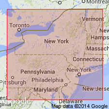
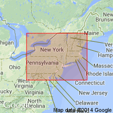
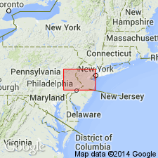
- Areal extent
- AAPG geologic province:
-
- Piedmont-Blue Ridge province
Summary:
The Passaic Formation of Olsen (1980) is here assigned to the lower part of the revised Brunswick Group in NJ and NY. Equivalent rocks in PA, where textural differences make the use of the name Passaic questionable, are assigned to the lower part of the Brunswick Group. The Passaic unconformably overlies older basement rocks or conformably and gradationally overlies and interfingers laterally with the Lockatong Formation. Interfingers laterally with the Hammer Creek Formation in the narrow neck near the Schuylkill River. Underlies the Orange Mountain Basalt. The Triassic-Jurassic boundary lies within the uppermost 100 m (300 ft) of the Passaic.
Source: GNU records (USGS DDS-6; Reston GNULEX).
- Usage in publication:
-
- Passaic Formation*
- Modifications:
-
- Overview
- Dominant lithology:
-
- Mudstone
- AAPG geologic province:
-
- Piedmont-Blue Ridge province
Summary:
The Passaic Formation of Olsen (1980) of the Brunswick Group is here adopted for use by the USGS in NJ and NY. In the central Newark basin, where it is a red-gray mudstone and siltstone deposited in cyclic lacustrine to mudflat sequences, it gradationally overlies the Lockatong Formation. In the northern Newark basin the Passaic becomes significantly coarser grained, and north of the pinchout of the Lockatong, it directly overlies the Stockton Formation and the boundary is defined where the rocks are dominantly light-tan to white arkosic sandstone below and dominantly red sandstone and siltstone above. The Stockton includes about 300 m of beds that had been mapped as Passaic (Brunswick) by Savage (1968). It is divided into four mappable lithofacies units: unit 1: siltstone, mudstone, sandstone facies; unit 2: mudstone facies; unit 3: pebbly sandstone facies; unit 4: conglomeratic sandstone facies. The coarsening of fluvial facies of the Passaic in the north may reflect the availability of coarse material, higher stream velocities, or higher stream gradient.
Source: GNU records (USGS DDS-6; Reston GNULEX).
- Usage in publication:
-
- Passaic Formation*
- Modifications:
-
- Biostratigraphic dating
- AAPG geologic province:
-
- Piedmont-Blue Ridge province
Summary:
A new palynomorph species, FROELICHSPORITES TRAVERSEI, occurs throughout Newark Supergroup of eastern United States and Canada, Dockum Group of TX and NM, and Chinle Formation of NM, AZ, and UT. It is restricted geologically to strata deposited during upper Carnian and Norian Stages of the Upper Triassic. It occurs in the following formations of the Newark Supergroup: Passaic Formation (NJ), Gettysburg Formation (PA and MD), Manassas Sandstone (MD), Balls Bluff Siltstone (VA), Cow Branch Formation (NC), and Stoneville Formation (NC).
Source: GNU records (USGS DDS-6; Reston GNULEX).
For more information, please contact Nancy Stamm, Geologic Names Committee Secretary.
Asterisk (*) indicates published by U.S. Geological Survey authors.
"No current usage" (†) implies that a name has been abandoned or has fallen into disuse. Former usage and, if known, replacement name given in parentheses ( ).
Slash (/) indicates name conflicts with nomenclatural guidelines (CSN, 1933; ACSN, 1961, 1970; NACSN, 1983, 2005, 2021). May be explained within brackets ([ ]).