

- Usage in publication:
-
- Pancake Summit Tuff
- Modifications:
-
- First used
- Geochronologic dating
- AAPG geologic province:
-
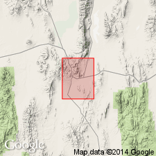
- Great Basin province
Summary:
First use of the Pancake Summit Tuff. Age is Tertiary based on radiometric (K-Ar; biotite) age of 33.9 +/-0.7 Ma.
Source: GNU records (USGS DDS-6; Menlo GNULEX).
- Usage in publication:
-
- Pancake Summit Tuff*
- Modifications:
-
- Named
- Dominant lithology:
-
- Tuff
- AAPG geologic province:
-
- Great Basin province
Summary:
Unit is named the Pancake Summit Tuff [first use by Armstrong, 1970, Geochemica et Cosmochimica Acta, v. 34]. Consists of light-gray to reddish-brown crystal-rich ash-flow tuff. Thickness is 60 m at type, ranges from 30 to 60 m. Unconformably underlies the Magpie Hill Basalt. Age is Oligocene. (B1520)
Source: GNU records (USGS DDS-6; Menlo GNULEX).
For more information, please contact Nancy Stamm, Geologic Names Committee Secretary.
Asterisk (*) indicates published by U.S. Geological Survey authors.
"No current usage" (†) implies that a name has been abandoned or has fallen into disuse. Former usage and, if known, replacement name given in parentheses ( ).
Slash (/) indicates name conflicts with nomenclatural guidelines (CSN, 1933; ACSN, 1961, 1970; NACSN, 1983, 2005, 2021). May be explained within brackets ([ ]).