

- Usage in publication:
-
- Palisade trap
- Modifications:
-
- Original reference
- Dominant lithology:
-
- Diabase
- AAPG geologic province:
-
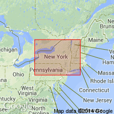
- Piedmont-Blue Ridge province
- Newark basin
Summary:
Palisade trap. An intrusive diabase sheet and dike structure. Best exposed instance of intrusion on large scale in New Jersey. In greater part an essentially conformable sheet throughout. Exposed for 30 miles along west side of Hudson River in contact with underlying strata. Intrudes Newark sedimentary rocks. Age is Jurassic. [In USGS Bull. 67, 1890, Darton gave thickness 30 to 850 feet.]
Source: US geologic names lexicon (USGS Bull. 896, p. 1591); supplemental information from GNU records (USGS DDS-6; Reston GNULEX).
- Usage in publication:
-
- Palisade diabase
- Modifications:
-
- Revised
- AAPG geologic province:
-
- Piedmont-Blue Ridge province
- Newark basin
Summary:
Palisade diabase. Juratrias.
Source: US geologic names lexicon (USGS Bull. 896, p. 1591).
- Usage in publication:
-
- Palisade diabase*
- Modifications:
-
- Areal extent
- AAPG geologic province:
-
- Piedmont-Blue Ridge province
- Newark basin
Summary:
Palisade diabase. A great sheet of igneous rock intruded among the lower sandstones and shales of Newark group, forms the Palisades of the Hudson.
[GNC remark (ca. 1936, US geologic names lexicon, USGS Bull. 896, p. 1591): The USGS treats this intrusive formation as distinct from Newark group. That group, however, includes some interbedded basalt flows.]
Source: US geologic names lexicon (USGS Bull. 896, p. 1591).
- Usage in publication:
-
- Palisade Diabase*
- Modifications:
-
- Age modified
- AAPG geologic province:
-
- Piedmont-Blue Ridge province
- Newark basin
Summary:
Age changed from Late Triassic to Early Jurassic based on 40Ar/39Ar incremental release ages by Dallmeyer (1975, Geology, v. 3, no. 5, p. 243-245).
Source: GNU records (USGS DDS-6; Reston GNULEX).
- Usage in publication:
-
- Palisades sill
- Modifications:
-
- Overview
- AAPG geologic province:
-
- Piedmont-Blue Ridge province
- Newark basin
Summary:
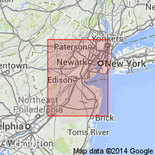
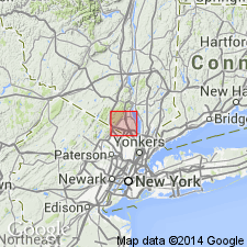
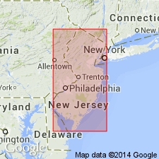
Palisades sill forms conspicuous ridge that lies along the eastern margin of the Mesozoic Newark basin from Staten Island to Rockland Co., NY, where it intruded sedimentary rocks of the basin. Southern margin extends beneath the Cretaceous sediments of the Atlantic Coastal Plain near Carteret, NJ. The Rocky Hill diabase lies 30 km southwest along strike of the Palisades. A gravity survey and well log analysis show that these two sills are continuous and can be considered a single unit and that the buried portion of the Palisades is faulted and fragmented allowing the Late Cretaceous Atlantic Ocean to breach the sill.
Source: GNU records (USGS DDS-6; Reston GNULEX).
- Usage in publication:
-
- Palisades Diabase
- Modifications:
-
- Areal extent
- Overview
- AAPG geologic province:
-
- Piedmont-Blue Ridge province
Summary:
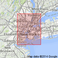
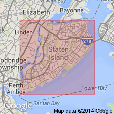
Palisades [Palisade] Diabase occurs in a belt that stretches northeast to southwest in the northwest portion of western Staten Island, NY, adjacent to a belt of Lockatong Formation. It is a gray, white, and black dense rock composed mostly of plagioclase feldspar, augite, and quartz, and exhibits very little weathering and fracturing.
Source: GNU records (USGS DDS-6; Reston GNULEX).
For more information, please contact Nancy Stamm, Geologic Names Committee Secretary.
Asterisk (*) indicates published by U.S. Geological Survey authors.
"No current usage" (†) implies that a name has been abandoned or has fallen into disuse. Former usage and, if known, replacement name given in parentheses ( ).
Slash (/) indicates name conflicts with nomenclatural guidelines (CSN, 1933; ACSN, 1961, 1970; NACSN, 1983, 2005, 2021). May be explained within brackets ([ ]).