

- Usage in publication:
-
- Osha Canyon Formation
- Modifications:
-
- Named
- Biostratigraphic dating
- Dominant lithology:
-
- Limestone
- Shale
- AAPG geologic province:
-
- San Juan basin
Summary:
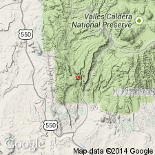
Named--probably for Osha Canyon, which is near type section measured along top of ridge on east side of Guadalupe Box, lat. 35 deg. 44' N, long. 106 deg. 45' 45'' W, just east of State Rd 485, 1.2 mi north of Gilman, Sandoval Co, NM. Exposed at several locations in southern Nacimiento and Jemez Mountains, including Pinos and Penasco Canyons, and in and near Guadalupe Box (all in Sandoval Co, NM, San Juan basin). Formation not observed outside this area. 70.9 ft thick at type and consists of two parts: 1) lower 31 ft of highly fossiliferous, light-gray to white, slightly arenaceous, bioclastic, ledge-forming limestone in 1- to 7-in beds, intercalated with fossiliferous, calcareous, light-gray shale; fragments and whole specimens of corals and bryozoans common; and 2) upper light-gray to light-tan shale 40 ft thick which contains abundant small nodules of gray limestone near top; less fossiliferous than lower part; forms slopes. Lithologically and faunally distinct from units above and below. Formerly referred to as unnamed carbonate rocks (Armstrong, 1967; Armstrong and Mamet, 1974). Unconformably underlies Sandia Formation (or Madera Formation, where Sandia is absent); unconformably overlies Log Springs Formation. Dating mostly from brachiopods, which indicate a Morrowan--probably late Morrowan--age for entire formation. Time equivalent to small part of Lower Pennsylvanian La Pasada Formation. Fossil list (brachiopods, corals).
Source: GNU records (USGS DDS-6; Denver GNULEX).
For more information, please contact Nancy Stamm, Geologic Names Committee Secretary.
Asterisk (*) indicates published by U.S. Geological Survey authors.
"No current usage" (†) implies that a name has been abandoned or has fallen into disuse. Former usage and, if known, replacement name given in parentheses ( ).
Slash (/) indicates name conflicts with nomenclatural guidelines (CSN, 1933; ACSN, 1961, 1970; NACSN, 1983, 2005, 2021). May be explained within brackets ([ ]).