

- Usage in publication:
-
- Omak Lake Granodiorite*
- Modifications:
-
- Named
- Geochronologic dating
- Dominant lithology:
-
- Granodiorite
- AAPG geologic province:
-
- Okanogan province
Summary:
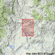
Named for exposures at Omak Lake. Type locality designated as exposures in roadcuts along west side of Omak Lake Road, about 9 mi south of Omak along west shore of Omak Lake, sec.3 and E/2 sec.4 T32N R27E, Omak Lake 15' quad, Okanogan Co, WA. Consists of coarse-grained porphyritic granodiorite that contains pink to gray K-feldspar megacrysts. Intrudes Salmon Creek Schists and Gneisses. K-Ar determination on biotite from unit yielded 53.4 +/-1.3 Ma (Atwater and Rinehart, 1984). Provisionally assigned Cretaceous or Eocene age.
Source: GNU records (USGS DDS-6; Menlo GNULEX).
For more information, please contact Nancy Stamm, Geologic Names Committee Secretary.
Asterisk (*) indicates published by U.S. Geological Survey authors.
"No current usage" (†) implies that a name has been abandoned or has fallen into disuse. Former usage and, if known, replacement name given in parentheses ( ).
Slash (/) indicates name conflicts with nomenclatural guidelines (CSN, 1933; ACSN, 1961, 1970; NACSN, 1983, 2005, 2021). May be explained within brackets ([ ]).