

- Usage in publication:
-
- Ohanapecosh formation
- Modifications:
-
- First used
- Dominant lithology:
-
- Lava
- Mudflows
- AAPG geologic province:
-
- Cascades province
Summary:
Pg. 39, 48-52, 56. Ohanapecosh formation. Consists of thick lensoid accumulations of lavas and mudflows surrounded by larger volumes of water-laid clastic rocks, mainly massive tuff-breccias interstratified with thin-bedded volcanic silts, volcanic graywackes, and gritty pumice conglomerates. Thickness is over 10,000 feet. Unconformably underlies Stevens Ridge formation (new). Formation has been folded and faulted and metamorphosed to zeolite facies. Was uplifted, extensively eroded, and locally weathered to a thick red saprolite before the Stevens Ridge was deposited. Name credited to Fiske, Hopson, and Waters (in press) [1963]. Age is late Eocene.
Source: US geologic names lexicon (USGS Bull. 1350, p. 539).
- Usage in publication:
-
- Ohanapecosh Formation*
- Modifications:
-
- Named
- Biostratigraphic dating
- Dominant lithology:
-
- Lava
- Mudflow
- Rhyolite
- AAPG geologic province:
-
- Cascades province
Summary:
Pg. 4-20, pl. 1. Ohanapecosh Formation. Formal proposal of name. Volcanic clastic rocks and lava flows comprise bulk of formation. For purposes of description the formation is divided into three parts: (1) lava flow-mudflow complexes, (2) adjacent accumulations of volcanic clastic rocks, and (3) ash flows and rhyolite. Two major complexes of lava flows recognized and mapped. Sarvent complex, well exposed in cirque walls of Sarvent Glaciers, is as much as 3,800 feet thick. Mount Wow complex, in Mount Wow-Satulick Mountain area, is at least 7,000 feet thick. Neither base nor original uneroded top of formation seen in Mount Rainier National Park. Original thickness probably exceeded 15,000 feet. Thickness more than 10,000 feet, measured across strike from Cascade crest to Stevens Canyon; more than 9,000 feet in Mount Wow-Satulick Mountain area. West of park, the formation rests upon and intertongues with arkoses and siltstones of Puget Group. Along Mowich and Puyallup Rivers, Ohanapecosh volcanic clastic rocks are interbedded with and grade into arkoses and carbonaceous shales. This junction is not time line; in area just west of park the arkose intertongues higher and higher into Ohanapecosh section toward north. East of park, rocks of formation are in fault contact with highly sheared shales, graywacke, and basic lavas of Mesozoic(?) age. Within the park, the formation is unconformably overlain by Stevens Ridge Formation. Age is late Eocene based on fossils [plants].
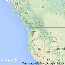
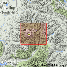
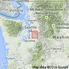
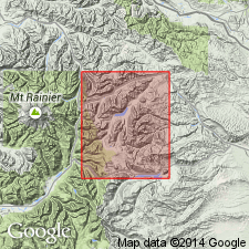
Named from Ohanapecosh Hot Springs, a small park community located on WA Highway 5 in southeast corner of Mount Rainier National Park, [Ohanapecosh Hot Springs 7.5-min quadrangle] Lewis Co., WA. Ohanapecosh Hot Springs lies near center of a thick westward-dipping section of Ohanapecosh rocks.
Source: US geologic names lexicon (USGS Bull. 1350, p. 539); supplemental information from GNU records (USGS DDS-6; Menlo GNULEX).
- Usage in publication:
-
- Ohanapecosh Formation*
- Modifications:
-
- Age modified
- Biostratigraphic dating
- AAPG geologic province:
-
- Cascades province
Summary:
Age of the Ohanapecosh Formation is revised from late Eocene to: Oligocene based on fossils [plants].
Source: GNU records (USGS DDS-6; Menlo GNULEX).
- Usage in publication:
-
- Ohanapecosh Formation*
- Modifications:
-
- Age modified
- AAPG geologic province:
-
- Cascades province
Summary:
Age of the Ohanapecosh Formation is modified from Oligocene to Eocene based on stratigraphic relations [Eocene age of overlying Fifes Peak Formation].
Source: GNU records (USGS DDS-6; Menlo GNULEX).
- Usage in publication:
-
- Ohanapecosh Formation*
- Modifications:
-
- Age modified
- Areal extent
- AAPG geologic province:
-
- Cascades province
Summary:
Ohanapecosh Formation is geographically extended into the report area. Age in this area is considered to be Oligocene.
Source: GNU records (USGS DDS-6; Menlo GNULEX).
For more information, please contact Nancy Stamm, Geologic Names Committee Secretary.
Asterisk (*) indicates published by U.S. Geological Survey authors.
"No current usage" (†) implies that a name has been abandoned or has fallen into disuse. Former usage and, if known, replacement name given in parentheses ( ).
Slash (/) indicates name conflicts with nomenclatural guidelines (CSN, 1933; ACSN, 1961, 1970; NACSN, 1983, 2005, 2021). May be explained within brackets ([ ]).