

- Usage in publication:
-
- Oatka Creek shale member
- Modifications:
-
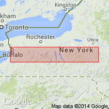
- Named
- Dominant lithology:
-
- Shale
- AAPG geologic province:
-
- Appalachian basin
Summary:
Name Oatka Creek shale proposed for upper member of Marcellus shale from Cayuga Lake westward to Seneca Lake. Underlies Mottville member of Skaneateles shale and overlies Cherry Valley limestone member of Marcellus. West of Seneca Lake, the Oatka Creek member comprises all of Marcellus and includes time equivalents of (ascending) Union Springs member, Cherry Valley limestone member, Chittenango member and Cardiff member. In the area west of Cayuga Lake, the Oatka Creek member is overlain by Stafford limestone, the equivalent of the Mottville member. The Oatka Creek consists of black shale, distinctly calcareous and fossiliferous, and thus differing from the black Chittenango shale, which overlies the Cherry Valley limestone in eastern part of the State. Thickness is 30 ft at type section at Le Roy where whole section is exposed. Thickens to the east and to the west to over 50 ft. Other exposures are in bed of Conesus Creek at Ashantee, Genesee Valley, and in Flint Creek 1.5 mi northeast of Orleans. At all these localities it is overlain by a thin Stafford limestone. Age is Middle Devonian.
Source: GNU records (USGS DDS-6; Reston GNULEX).
- Usage in publication:
-
- Oatka Creek shale member
- Modifications:
-
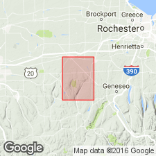
- Areal extent
- AAPG geologic province:
-
- Appalachian basin
Summary:
Named by Cooper as upper member of Marcellus from Cayuga Lake westward to Seneca Lake, being overlain by Mottville member of Skaneateles shale, and underlain by Cherry Valley limestone member of Marcellus. To west of Seneca Lake, comprises all of Marcellus. In Batavia quad, only upper part of member is exposed. Underlies Stafford limestone member of Skaneateles.
Source: GNU records (USGS DDS-6; Reston GNULEX).
- Usage in publication:
-
- Oatka Creek Formation
- Modifications:
-
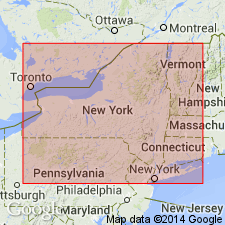
- Revised
- AAPG geologic province:
-
- Appalachian basin
Summary:
Marcellus Formation will be "formally" raised to subgroup status within the Hamilton Group and be divided into a lower Union Springs Formation and an upper Mount Marion Formation (in eastern New York), and an upper Oatka Creek Formation (in central and western New York), in a publication by Ver Straeten and others (in prep). Union Springs Formation will incorporate three members across New York: the Bakoven Member (geographically extended across the State of New York), the Stony Hollow Member (restricted), and the Hurley Member (new). The Hurley underlies the Cherry Valley Member at the base of the laterally equivalent Mount Marion and Oatka Creek Formations. In its present status, the Oatka Creek Member incorporates all strata of the proposed formation except for the Cherry Valley Member, which is locally missing at the Oatka Creek type section. Black shales of the Oatka Creek above the Cherry Valley Member and below the Stafford Member of the Skaneateles Formation in western New York remain unnamed at this time. However, they are partly equivalent to the type Chittenango Shale Member of west-central New York.
["Subgroup" not recognized as a formal stratigraphic rank term (CSN, 1933; ACSN, 1961, 1970; NACSN, 1983, 2005, 2021). Considered informal and should not be capitalized.]
Source: Modified from GNU records (USGS DDS-6; Reston GNULEX).
For more information, please contact Nancy Stamm, Geologic Names Committee Secretary.
Asterisk (*) indicates published by U.S. Geological Survey authors.
"No current usage" (†) implies that a name has been abandoned or has fallen into disuse. Former usage and, if known, replacement name given in parentheses ( ).
Slash (/) indicates name conflicts with nomenclatural guidelines (CSN, 1933; ACSN, 1961, 1970; NACSN, 1983, 2005, 2021). May be explained within brackets ([ ]).