

- Usage in publication:
-
- Norristown shales
- Modifications:
-
- Named
- Dominant lithology:
-
- Shale
- AAPG geologic province:
-
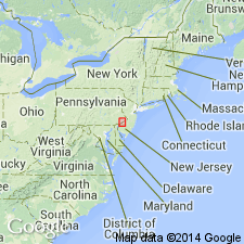
- Piedmont-Blue Ridge province
Summary:
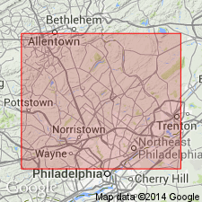
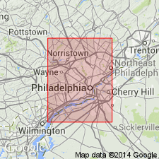
Red calcareous shales, the lowest unit of the New Red series, are named the Norristown shales. Underlies the Gwynedd shales. Extends from Lumberville on the Delaware River, southwest to Norristown on the Schuylkill River. Thickness is 6,100 ft.
Source: GNU records (USGS DDS-6; Reston GNULEX).
- Usage in publication:
-
- Norristown shales*
- Modifications:
-
- Overview
- AAPG geologic province:
-
- Piedmont-Blue Ridge province
Summary:
The Triassic series in the Philadelphia district consists of the Norristown, Gwynedd, Lansdale, Perkasie, and Pottstown shales. It is footnoted that N. H. Darton divides the Triassic into the Stockton formation, corresponding to the Norristown, the Lockatong formation, corresponding to the Gwynedd, and the Brunswick shale, corresponding to the Lansdale, Perkasie, and Pottstown.
Source: GNU records (USGS DDS-6; Reston GNULEX).
- Usage in publication:
-
- Norristown†
- Modifications:
-
- Abandoned
- AAPG geologic province:
-
- Piedmont-Blue Ridge province
Summary:
The classification of the Newark group established in NJ is here adopted by the USGS in PA. It comprises the Stockton formation, Lockatong formation, and Brunswick shale, approximately equivalent to the Norristown, Gwynedd, and Lansdale shales, respectively, which have not been found acceptable because of their indefinite application.
Source: GNU records (USGS DDS-6; Reston GNULEX).
For more information, please contact Nancy Stamm, Geologic Names Committee Secretary.
Asterisk (*) indicates published by U.S. Geological Survey authors.
"No current usage" (†) implies that a name has been abandoned or has fallen into disuse. Former usage and, if known, replacement name given in parentheses ( ).
Slash (/) indicates name conflicts with nomenclatural guidelines (CSN, 1933; ACSN, 1961, 1970; NACSN, 1983, 2005, 2021). May be explained within brackets ([ ]).