

- Usage in publication:
-
- Nerola [Neroly] formation
- Modifications:
-
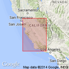
- Areal extent
- AAPG geologic province:
-
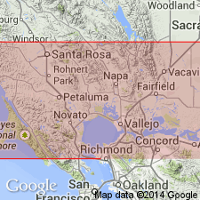
- Northern Coast Range province
- Sacramento basin
Clark, B.L., and Woodford, A.O., 1927, The geology and paleontology of the type section of the Meganos formation (lower middle Eocene) of California: University of California, Bulletin of the Department of Geology, v. 17, no. 2, p. 63-142, (incl. geologic map)
Summary:
Pg. 69. Nerola formation [Neroly formation] of San Pablo group. "Unconformably on the San Lorenzo deposits is the San Pablo group, divided into two formations, the Cierbo and the Nerola. Unconformably on the San Pablo is a series of tuffs and sandstones; the tuffs have generally been referred to the Pinole tuff, the sandstones to the Orinda formation." Age is Miocene.
[Notable exposures in Mount Diablo region, central western CA.]
Source: US geologic names lexicon (USGS Bull. 896, p. 1477); CA names (USGS Bull. 826, p. 53).
- Usage in publication:
-
- Neroly formation*
- Modifications:
-
- Adopted
- AAPG geologic province:
-
- Northern Coast Range province
- Sacramento basin
Summary:
Pg. 764-767, pls. 15, 20. Neroly formation of San Pablo group. (ASTRODAPSIS TUMIDUS zone.) Sandstone, conglomerate, shale, 4,000 feet thick west and south of Mount Diablo; 250 feet thick north of Mount Diablo. On south side of Mount Diablo it unconformably underlies 1,000+/- feet of sandstones and conglomerates, mostly marine, correlated by writer with Jacalitos formation, and it overlies Cierbo formation. Is of [late] Miocene age, and included in San Pablo group. [This is present (ca. 1936) definition of the USGS.]
Source: US geologic names lexicon (USGS Bull. 896, p. 1477).
- Usage in publication:
-
- Neroly sandstone*
- Modifications:
-
- Redescribed
- Biostratigraphic dating
- Mapped
- Dominant lithology:
-
- Sandstone
- Conglomerate
- Shale
- AAPG geologic province:
-
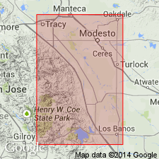
- Northern Coast Range province
- Sacramento basin
Summary:
Pg. 18 (table 3), 80-85, pls. 7-8, 11-13 (geol. maps). Neroly sandstone of San Pablo group. Described in Coast Ranges, San Francisco Bay region. Consists of sandstones, conglomerate, and shale. Thickness 100 to 1,250 feet. Is uppermost formation in San Pablo group. Overlies Cierbo sandstone of San Pablo group. Unconformably underlies Lawlor tuff, Pleistocene terrace deposits, and Sonoma volcanics. Rocks previously referred to as Santa Margarita formation; name Santa Margarita now applied to sandstone in upper part of Monterey group. Fossils, notably echinoderm ASTRODAPSIS TUMIDUS; [echinoderms, pelecypods, gastropods listed, specimens mostly from Carquinez quadrangle]. Age is late Miocene. Origin of name stated.
Named from Neroly Station on Southern Pacific RR, northeast of Mount Diablo, in extreme northwest corner of Byron 15-min quadrangle, [Contra Costa Co.], western CA. (Name proposed by Clark [privately published 1929] as replacement for upper division B of San Pablo group.)
[Notable exposures discussed and mapped: area east of Rodeo, southwestern corner Carquinez quadrangle, Contra Costa Co.; Los Medanos hills (local name), southwestern corner Antioch quadrangle, Contra Costa Co.; Potrero Hills area, western Antioch and eastern Carquinez quadrangles, Solano Co.; Vacaville hills (local name; now called English Hills), western Vacaville and eastern Mt. Vaca quadrangles, Solano Co.; Carneros Creek area, west of Napa, southern Sonoma quadrangle, Napa Co.; Calabazas Creek area, about sec. 35, T. 7 N., R. 6 W., western edge Sonoma quadrangle, Sonoma and Napa Cos.]
Source: Publication; GNU records (USGS DDS-6; Menlo GNULEX); US geologic names lexicon (USGS Bull. 1200, p. 2705-2706).
- Usage in publication:
-
- Neroly Sandstone*
- Modifications:
-
- Areal extent
- Biostratigraphic dating
- AAPG geologic province:
-
- California Coast Ranges province
Summary:
Rocks previously assigned to San Pablo Formation by Anderson and Pack (1915) on east flank of Diablo Range in Tesla 15' quad are reassigned to Poverty Flat Sandstone (new), Valley Springs Formation, and Neroly Sandstone. Here the Neroly unconformably overlies the Valley Springs or older units; conformably underlies upper Miocene and lower Pliocene(?) fanglomerates. Clarendonian age vertebrates from Neroly (Raymond, 1969) indicate late Miocene age.
Source: GNU records (USGS DDS-6; Menlo GNULEX).
For more information, please contact Nancy Stamm, Geologic Names Committee Secretary.
Asterisk (*) indicates published by U.S. Geological Survey authors.
"No current usage" (†) implies that a name has been abandoned or has fallen into disuse. Former usage and, if known, replacement name given in parentheses ( ).
Slash (/) indicates name conflicts with nomenclatural guidelines (CSN, 1933; ACSN, 1961, 1970; NACSN, 1983, 2005, 2021). May be explained within brackets ([ ]).