

- Usage in publication:
-
- Negaunee formation*
- Modifications:
-
- Named
- Dominant lithology:
-
- Iron-formation
- Slate
- Schist
- Chert
- AAPG geologic province:
-
- Lake Superior region
Summary:
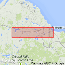
Is Algonkian formation (uppermost of 6) named in Lower Marquette series and mapped (pl XIII) in broad area southwest of Marquette, MI (Lake Superior region) comprising part of a great westward-plunging syncline. "The Lower Marquette iron-bearing formation is given the distinctive name Negaunee because in this town and to the southward are extensive typical exposures of the formation." Conformably overlies Siamo slate (new) or Ajibik quartzite (new) with gradational contact; unconformably overlain by Ishpeming quartzite (new) of Upper Marquette series; may be greater than 1,000 ft thick, but estimates are difficult due to structural complications. Lithologically the "iron-bearing formation comprises sideritic slates, which may be gruneritic, magnetitic, hematitic, or limonitic; grunerite-magnetite-schists; ferruginous slates; ferruginous cherts; and jaspilite. The ferruginous cherts and jaspilite are frequently brecciated; the other kinds less frequently." Ferruginous chert is abundant in lower and middle parts of unit; jaspilite occurs at the present top of the unit, just below Ishpeming quartzite; schist occurs in lower part, below ferruginous chert and jaspilite, at or near sideritic slate horizon and frequently below intrusive diorite. Ferruginous slate, ferruginous chert, and jasper appear to form in zone of weathering; schist appears to develop in zone of deep-seated alteration.
Source: GNU records (USGS DDS-6; Reston GNULEX).
- Usage in publication:
-
- Negaunee iron-formation
- Modifications:
-
- Not used
- Areal extent
- AAPG geologic province:
-
- Lake Superior region
Summary:
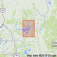
Is not used in the Kiernan quad, eastern Iron Co, MI (Lake Superior region). Magnetic quartzite at Michigamme Mountain in south-central part of Kiernan quad was formerly called Groveland formation by Clements and Smyth (1899) and Negaunee iron-formation by Van Hise and Leith (1911). These strata are mapped as Goodrich quartzite (Middle Precambrian) in this report. Platy fragments of jasplite and oolitic iron-formation and pebble size and smaller fragments of tan chert and steel-gray hematitic rock lithologically similar to parts of the Negaunee elsewhere do occur in the Goodrich at Michigamme Mountain and may have been derived from the Negaunee. It is thought that iron-rich sediment and silica (chert) of the Negaunee were probably deposited in the Kiernan area, and that all or most of the Negaunee was removed from the area by erosion with some of the remaining rubble accumulating in the Goodrich quartzite. Elsewhere in the quad, iron-formation causing a belt of magnetic anomaly on the east side of the Amasa oval is younger than the iron-rich Goodrich quartzite at Michigamme Mountain and therefore is an "Upper Huronian" formation; formerly it was correlated with the "Middle Huronian" Negaunee iron-formation; it is named the Fence River formation in this report.
Source: GNU records (USGS DDS-6; Reston GNULEX).
- Usage in publication:
-
- Negaunee Iron-Formation*
- Modifications:
-
- Overview
- AAPG geologic province:
-
- Lake Superior region
Summary:
Pg. 2845 (fig. 2, stratigraphic chart compiled from Leith and others, 1935; James, 1958; Gair and Thaden, 1968). Negaunee Iron-Formation of Menominee Group of Marquette Range Supergroup (new; replaces †Animikie series of James, 1958, south of Lake Superior, in Michigan and Wisconsin). Present in Marquette Range, northwestern Michigan. Overlies Siamo Slate of Menominee Group. Underlies Goodrich Quartzite of Baraga Group with unconformity or disconformity in places. Age is middle Precambrian.
Source: Publication.
- Usage in publication:
-
- Negaunee Iron-formation*
- Modifications:
-
- Overview
- AAPG geologic province:
-
- Lake Superior region
Summary:
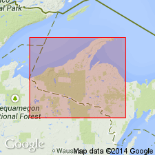
Is mapped as uppermost formation of Menominee Group in Marquette Range Supergroup, Marquette Co, MI (Lake Superior region). On north limb of synclinorium: no exposures; known only from diamond drilling; completely oxidized and partly leached, banded chert and massive hematite-goethite mixtures, with numerous bodies of high-grade soft ore. On south limb near Greenwood mine: no exposures; known from drilling and underground mine workings; mostly banded cherty iron-oxide iron-formation with thin magnetite-grunerite unit near base. On south limb north of Lake Lory: mostly banded grunerite-magnetite-garnet iron-formation with highly variable amounts of metachert; layers with magnetite and grunerite in varying proportions alternate with layers of nearly pure metachert; garnet-rich layers are widespread and small patches of carbonate are also common; silicate-rich layers light brown; metachert layers light gray; bedding thickness from fine laminations (few mm) to several cm; nearly vertical cleavage common, especially in grunerite-rich rocks; grains size of chert about 0.05 mm, magnetite 0.05-0.10 mm, grunerite and garnet as much as 3 mm; magnetite occurs as euhedra disseminated in grunerite beds, more rarely in carbonate or chert patches, and comprises 15-20 percent of rock. Chemical analyses and modes given in table 1. Occurs in belt as wide as 1600 ft exclusive of interlayered metadiabase. Precambrian X.
Source: GNU records (USGS DDS-6; Reston GNULEX).
- Usage in publication:
-
- Negaunee Iron-Formation*
- Modifications:
-
- Overview
- Dominant lithology:
-
- Iron-formation
- AAPG geologic province:
-
- Lake Superior region
Summary:
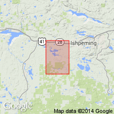
Is middle Precambrian formation at top of Menominee Group of Marquette Range Supergroup. Is mapped in an area of about 2 sq mi in southwest part of Negaunee quadrangle, Marquette Co, MI (Lake Superior region). Is only exposed in a few places; most knowledge of the unit comes from diamond-drill cores and mines. Gradational contact with underlying Siamo Slate. Is older than Michigamme Slate of Baraga Group; overlying formation not present, and top of Negaunee is not known in this quad. Map unit described as dark-brown thin-bedded chert-hematite-goethite iron-formation. Red and gray jaspilite near west border of quadrangle. Poorly exposed. Contains important iron ore deposits. Greater than 2,000 ft thick.
Source: GNU records (USGS DDS-6; Reston GNULEX).
- Usage in publication:
-
- Negaunee Iron Formation
- Modifications:
-
- Overview
- AAPG geologic province:
-
- Wisconsin arch
Summary:
The Negaunee Iron Formation, more than 1,000 m thick in the southern limb of the Marquette synclinorium, is composed of varying mineral assemblages, which include magnetite, hematite, siderite, chert, and iron-silicate minerals. There are no formally named subdivisions, but Mancuso and others (1990) subdivided the formation into five informal units . The lowermost unit consists of 300 m of magnetite-chert-carbonate-silicate iron formation with intercalated beds of coarse, epiclastic material. Overlying this is a silicate unit, 100 to 125 m thick, consisting of magnetite-carbonate-silicate-chert iron formation. The carbonate unit, 100 to 125 m thick overlies the silicate unit and consists of magnetite-chert-carbonate iron formation. Above is the clastic unit comprising 60 to 100 m of iron formation with coarse clastic interbeds. Uppermost unit comprises more than 300 m of iron formation which has not yet been described in detail. The Tilden Mine is located in this upper undifferentiated unit of the Negaunee. The dominant mineral assemblage is hematite-chert, although remnant, unoxidized magnetite-carbonate bodies exist. Martite is the main ore mineral, but magnetite, siderite, fine red hematite, and goethite are also recovered.
Source: GNU records (USGS DDS-6; Reston GNULEX).
For more information, please contact Nancy Stamm, Geologic Names Committee Secretary.
Asterisk (*) indicates published by U.S. Geological Survey authors.
"No current usage" (†) implies that a name has been abandoned or has fallen into disuse. Former usage and, if known, replacement name given in parentheses ( ).
Slash (/) indicates name conflicts with nomenclatural guidelines (CSN, 1933; ACSN, 1961, 1970; NACSN, 1983, 2005, 2021). May be explained within brackets ([ ]).