

- Usage in publication:
-
- Nanushuk series*
- Modifications:
-
- Named
- Biostratigraphic dating
- Dominant lithology:
-
- Sandstone
- Limestone
- Shale
- Quartzite
- Coal
- AAPG geologic province:
-
- Alaska Northern region
Summary:
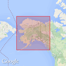
Named for Nanushuk River on Arctic Slope, AK. Extends in north and south direction for about 30 mi. Consists mainly of thin-bedded gray and brown sandstone, generally fine-grained and sometimes friable; slate-colored arenaceous and impure fossiliferous limestone, dark shale or mud rock, soft uncleaved slate, fine-grained gray quartzite, drab-colored chert, and bituminous coal. Unconformably overlies Anaktoovuk series (new); unconformably underlies Tertiary rocks to the north. Fossils identified by Stanton indicate Late Cretaceous age.
Source: GNU records (USGS DDS-6; Menlo GNULEX).
- Usage in publication:
-
- Nanushuk group*
- Modifications:
-
- Revised
- AAPG geologic province:
-
- Alaska Northern region
Summary:
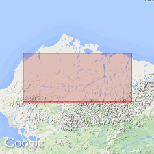
Nanushuk "series" of Schrader (1902) included rocks of Late Cretaceous age now included in Colville group. Nanushuk group is described as group of rocks of Early Cretaceous and Early(?) Cretaceous age exposed along Nanushuk River where river cuts across Arctic Foothills of northern AK. Type section (described by Schrader) is belt of rocks beginning 5 mi north of junction of Colville and Anaktuvuk Rivers and extending south for 30 mi. Crops out in foothills north of Brooks Range from Sagavanirktok River west as far as Kukpowruk River. Divided into two new intertonguing formations --Chandler (nonmarine) and Umiat (marine). Consists of shale, sandstone, conglomerate, and coal beds with little or no bentonite or tuff. Estimated thickness is 5750 ft. Overlies with gradational contact Torok formation (new); unconformably underlies Colville group.
Source: GNU records (USGS DDS-6; Menlo GNULEX).
- Usage in publication:
-
- Nanushuk group*
- Modifications:
-
- Revised
- AAPG geologic province:
-
- Alaska Northern region
Summary:
Divided into four formations: Tuktu (redefined -marine) at base, Grandstand and Ninuluk (new -marine) and Chandler (nonmarine) which intertongues with and grades into two upper marine formations. Two major tongues of Chandler formation are recognized, Killik and Niakogon tongues. Age of Nanushuk group is Early Cretaceous and early Late Cretaceous.
Source: GNU records (USGS DDS-6; Menlo GNULEX).
- Usage in publication:
-
- Nanushuk group*
- Modifications:
-
- Revised
- AAPG geologic province:
-
- Alaska Northern region
Summary:
In Utukok-Corwin area Nanushuk Group is divided into two formations, Kukpowruk (new) and Corwin (redefined). Can be mapped eastward in foothills north of Colville River from Utukok River as far as Ikpikpuk River and mouth of Etivluk River. Group thickens southwestward from about 6500 ft on lower Utukok River to more than 15,000 ft at Corwin Bluff. Kukpowruk and Corwin formations have gradational and intertonguing relationship as does Kukpowruk with underlying Torok formation.
Source: GNU records (USGS DDS-6; Menlo GNULEX).
- Usage in publication:
-
- Nanushuk group*
- Modifications:
-
- Areal extent
- AAPG geologic province:
-
- Alaska Northern region
Summary:
In Naval Petroleum Reserve No.4, Titaluk test well 1 penetrated Ninuluk, Chandler, Grandstand, and Topagoruk formations (all of Nanushuk group). Knifeblade test wells penetrated only Chandler and Grandstand formations. Age given as Early and Late Cretaceous for the group.
Source: GNU records (USGS DDS-6; Menlo GNULEX).
- Usage in publication:
-
- Nanushuk Group*
- Modifications:
-
- Areal extent
- AAPG geologic province:
-
- Alaska Northern region
Summary:
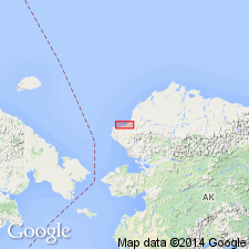
In northeastern AK in western Sadlerochit Mountains rocks formerly included in lower part of Ignek Formation are now considered part of Nanushuk Group. Shown on correlation chart.
Source: GNU records (USGS DDS-6; Menlo GNULEX).
- Usage in publication:
-
- Nanushuk Group*
- Modifications:
-
- Age modified
- Biostratigraphic dating
- AAPG geologic province:
-
- Alaska Northern region
Summary:
Age determinations of Nanushuk Group based on faunal and floral megafossil, pollen, dinoflagellate, and foraminiferal zonations indicate range from early Albian to Cenomanian. Facies of group are time transgressive becoming younger to north and northeast away from Brooks Range.
Source: GNU records (USGS DDS-6; Menlo GNULEX).
- Usage in publication:
-
- Nanushuk Formation*
- Modifications:
-
- Revised
- Reference
- AAPG geologic province:
-
- Alaska Northern region
Summary:
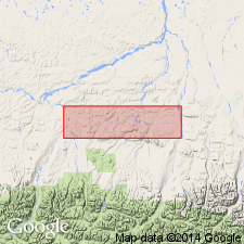
Pg. 5 (fig. 4), 6-8 (table 1), 12+. Nanushuk Formation. Nanushuk Group (Detterman, 1956; Sable, 1956; Chapman and others, 1964; Molenaar, 1985) reduced in rank. As revised, consists of: (1) upper, dominantly nonmarine unit of sandstone, conglomerate, siltstone, shale, and coal, includes rocks previously assigned to †Corwin, †Chandler, †Ninuluk, and †Grandstand Formations (all abandoned); and (2) lower, dominantly marine unit of sandstone, siltstone, and shale, includes rocks previously assigned to †Kukpowruk and †Tuktu Formations (both abandoned). Thickness about 4,600 feet in western Chandler Lake quadrangle (scale 1:250,000); thins to northeast to about 775 feet. Overlies and interfingers with Torok Formation. Disconformably underlies Seebee Formation. Fossils. Age is late Early to early Late Cretaceous (middle Albian to Cenomanian).
Reference sections:
(1) transition from upper Torok Formation into overlying lower marine part of Nanushuk Formation exposed along eastern bank of Nanushuk River on south flank of Arc Mountain anticline, in NW/4 sec. 19, T. 9 S., R. 7 E. [Chandler Lake C-1 quadrangle, scale 1:63,360], northern AK;
(2) marine to marginal-marine part of Nanushuk Formation exposed on west bank of Nanushuk River at east end of Rooftop Ridge, in SW/4 sec. 7, T. 7 S., R. 7 E. [Chandler Lake D-1 quadrangle, scale 1:63,360], northern AK;
(3) nonmarine part of Nanushuk Formation exposed in the axis of Arc Mountain syncline east of the Nanushuk River, in secs. 19 and 30, T. 9 S., R. 7 E. [Chandler Lake C-1 quadrangle, scale 1:63,360], northern AK.
Source: Publication.
For more information, please contact Nancy Stamm, Geologic Names Committee Secretary.
Asterisk (*) indicates published by U.S. Geological Survey authors.
"No current usage" (†) implies that a name has been abandoned or has fallen into disuse. Former usage and, if known, replacement name given in parentheses ( ).
Slash (/) indicates name conflicts with nomenclatural guidelines (CSN, 1933; ACSN, 1961, 1970; NACSN, 1983, 2005, 2021). May be explained within brackets ([ ]).