

- Usage in publication:
-
- Naco limestone*
- Modifications:
-
- Named
- Dominant lithology:
-
- Limestone
- AAPG geologic province:
-
- Pedregosa basin
Summary:
Naco limestone. Chiefly light-colored, regularly stratified fossiliferous beds, consisting essentially of calcium carbonate; compact, nearly aphanitic, breaking with splintery fracture; granular crinoidal beds not uncommon. Beds range in thickness from a few inches to 10 feet; but are usually thinner than those of Escabrosa limestone. Chert not uncommon; occurs in irregular bunches and nodules. Thickness on west edge of Bisbee quadrangle at least 1,500 feet and probably 2,000 feet. Original thickness, before erosion, probably 3,000 feet. Rests conformably on Escabrosa limestone. Is unconformably overlain by Glance conglomerate, basal Cretaceous. Deposited in moderately deep water. Age is Pennsylvanian; abundant fossils (brachiopods). Report includes geologic map, cross sections, columnar section.
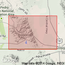
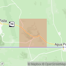
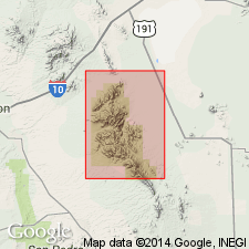
Composes Naco Hills, in T. 23 and 24 S., R. 23 E., near west edge of Bisbee quadrangle, Cochise Co., southeastern AZ. [According to GNU records (USGS DDS-6; Denver GNULEX, April 5, 1988), type locality not designated.]
Source: US geologic names lexicon (USGS Bull. 896, p. 1456); supplemental information from GNU records (USGS DDS-6; Denver GNULEX).
- Usage in publication:
-
- Naco limestone*
- Modifications:
-
- Areal extent
- Overview
- AAPG geologic province:
-
- Pedregosa basin
Summary:
Extended to Tombstone area, AZ in the Pedregosa basin. Overlies Escabrosa limestone; underlies Cretaceous rocks. Is of Pennsylvanian age. Contains a fauna that represents an "early" and "later" Pennsylvanian time that includes brachiopods (e.g., DERBYA, PRODUCTUS, SPIRIFER, etc.), mollusks (e.g., ECHINOCRINUS, BELLERPHON, etc.), and fusulinids.
Source: GNU records (USGS DDS-6; Denver GNULEX).
- Usage in publication:
-
- Naco limestone*
- Modifications:
-
- Areal extent
- Age modified
- AAPG geologic province:
-
- Pedregosa basin
Summary:
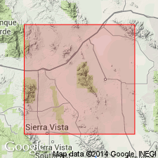
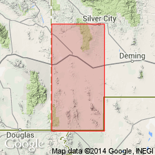
Observed in Dragoon, Little Dragoon, Whetstone, and other ranges in southeastern AZ in the Pedregosa basin. Fossils from high in Naco near Tombstone are Permian. Is of Pennsylvanian and Permian age.
Source: GNU records (USGS DDS-6; Denver GNULEX).
- Usage in publication:
-
- Naco limestone*
- Modifications:
-
- Areal extent
- AAPG geologic province:
-
- Pedregosa basin
Summary:
Extended to Chiricahua Mountains, AZ in the Pedregosa basin. Overlies Paradise formation (Mississippian). Is of Pennsylvanian age.
Source: GNU records (USGS DDS-6; Denver GNULEX).
- Usage in publication:
-
- Naco limestone
- Modifications:
-
- Revised
- Areal extent
- AAPG geologic province:
-
- Pedregosa basin
- Basin-and-Range province
Summary:
Proposes restricting term to lower (Pennsylvanian) part of original formation in southeastern AZ in the Pedregosa basin and Basin-and-Range province.
Source: GNU records (USGS DDS-6; Denver GNULEX).
- Usage in publication:
-
- Naco limestone
- Modifications:
-
- Areal extent
- AAPG geologic province:
-
- Basin-and-Range province
Summary:
Naco limestone. Present in Superior area, Arizona. Thickness 800 feet. Age is Pennsylvanian.
Source: Modified from GNU records (USGS DDS-6; Denver GNULEX).
- Usage in publication:
-
- Naco formation*
- Modifications:
-
- Areal extent
- AAPG geologic province:
-
- Black Mesa basin
- Basin-and-Range province
Summary:
Extended to Mogollon Rim and to subsurface to north in the Basin-and-Range province and Black Mesa basin. Overlies Redwall limestone and overlain by Supai formation. Is of Pennsylvanian age.
Source: GNU records (USGS DDS-6; Denver GNULEX).
- Usage in publication:
-
- Naco limestone*
- Modifications:
-
- Areal extent
- AAPG geologic province:
-
- Basin-and-Range province
Summary:
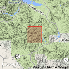
Accepted in Miami-Globe area, AZ by USGS [apparently to replace upper part of Tornado limestone]. Is of Pennsylvanian age.
Source: GNU records (USGS DDS-6; Denver GNULEX).

- Usage in publication:
-
- Naco limestone
- Modifications:
-
- Areal extent
- AAPG geologic province:
-
- Basin-and-Range province
Summary:
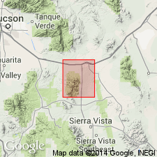
Extended to Sierrita Mountains, AZ in the Basin-and-Range province. Overlies Escabrosa limestone (Mississippian). Overlain by Snyder Hill limestone (Permian). The rocks in both the Naco limestone and Snyder Hill limestone as used here are now included in the Naco group. Possibly as much as 1,200 feet thick at Twin Buttes.
Source: GNU records (USGS DDS-6; Denver GNULEX).
- Usage in publication:
-
- Naco limestone
- Modifications:
-
- Age modified
- AAPG geologic province:
-
- Pedregosa basin
Summary:
Called Permian in Bisbee area, AZ in the Pedregosa basin.
Source: GNU records (USGS DDS-6; Denver GNULEX).
- Usage in publication:
-
- Naco group*
- Modifications:
-
- Revised
- Overview
- AAPG geologic province:
-
- Pedregosa basin
Summary:
Elevated to group rank in central Cochise Co, AZ in the Pedregosa basin. Sections measured in Tombstone Hills, Dragoon Mountains and Gunnison Hills. Divided into six newly named formations. These are, in ascending order: Horquilla limestone, Earp formation, Colina limestone, Epitaph dolomite, Scherrer formation, and Concha limestone. Overlies Black Prince limestone (new). Is of Middle and Late Pennsylvanian and Early Permian age.
Source: GNU records (USGS DDS-6; Denver GNULEX).
- Usage in publication:
-
- Naco limestone*
- Modifications:
-
- Revised
- AAPG geologic province:
-
- Basin-and-Range province
Summary:
Stratigraphically restricted in Santa Rita Mountains, AZ in Basin-and-Range province to Pennsylvanian rocks, those beds containing a "typical Lower Pennsylvanian fauna" [however, no Pennsylvanian fauna described in report]. Underlain by Escabrosa limestone; overlain by unnamed Permian rocks.
Source: GNU records (USGS DDS-6; Denver GNULEX).
- Usage in publication:
-
- Naco group
- Modifications:
-
- Areal extent
- AAPG geologic province:
-
- Pedregosa basin
Summary:
Naco group. Present in Chiricahua-Dos Cabezas Mountains, Cochise County, southeastern Arizona. Comprised of (ascending) Horquilla limestone, Earp formation, Colina limestone, Scherrer formation, and Concha limestone. Correlated with Supai formation and Coconino sandstone. Fossiliferous. Age is Pennsylvanian (Morrow, Lampasas, Des Moines, Missouri, Virgil) and Permian (Wolfcamp, Leonard, Guadalupe).
Source: Modified from GNU records (USGS DDS-6; Denver GNULEX).
- Usage in publication:
-
- Naco group
- Modifications:
-
- Areal extent
- Overview
- AAPG geologic province:
-
- Pedregosa basin
Summary:
Extended to central Peloncillo Mountains, Hidalgo Co, NM in Pedregosa basin where it is made up of (ascending): Horquilla limestone, Earp formation, Colina limestone, Scherrer formation, and Chiricahua limestone (rather Concha limestone). Measured sections of the Horquilla, Earp, and Colina described. Geologic map included. Is of Pennsylvanian and Permian age.
Source: GNU records (USGS DDS-6; Denver GNULEX).
- Usage in publication:
-
- Naco limestone*
- Modifications:
-
- Overview
- AAPG geologic province:
-
- Basin-and-Range province
Summary:
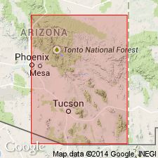
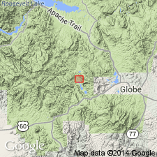
Formational status is retained for Haunted Canyon quad, AZ in the Basin-and-Range province where only the lower part of the unit remains as erosional remnants. Contains fusulinids, horn corals, and brachiopods. Is of Pennsylvanian age.
Source: GNU records (USGS DDS-6; Denver GNULEX).
- Usage in publication:
-
- Naco Group*
- Modifications:
-
- Not used
Summary:
[Although citing the work of Gilluly et al. (1954), which defines the Naco Group to include the Concha Limestone, the units treated herein--Concha Limestone and Rainvalley Formation (new)--are not affiliated with Naco in the study area of Pima and Santa Cruz Cos, AZ in the Basin-and-Range province and Cochise Co, AZ in the Pedregosa basin.]
Source: GNU records (USGS DDS-6; Denver GNULEX).
- Usage in publication:
-
- Naco Formation
- Modifications:
-
- Areal extent
- AAPG geologic province:
-
- Plateau sedimentary province
Summary:
Shown underlying Supai Formation at the Grand Canyon, AZ in the Plateau sedimentary province. [An improper extension of term.]
Source: GNU records (USGS DDS-6; Denver GNULEX).
- Usage in publication:
-
- Naco Formation
- Modifications:
-
- Contact revised
- AAPG geologic province:
-
- Black Mesa basin
- Basin-and-Range province
Summary:
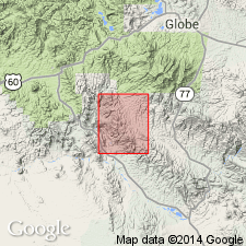
Upper contact revised in that Naco Formation underlies the newly named Amos Wash Member of Supai Formation. Report area is the Fort Apache area of Gila and Navajo Cos, AZ in the Basin-and-Range province and Black Mesa basin. Correlation chart. Of Pennsylvanian, Desmoinesian, Missourian and Virgilian age.
Source: GNU records (USGS DDS-6; Denver GNULEX).

- Usage in publication:
-
- Naco group*
- Modifications:
-
- Overview
- AAPG geologic province:
-
- Pedregosa basin
Summary:
Includes Horquilla limestone, Earp formation, Colina limestone, Epitaph dolomite, Scherrer formation, and Concha limestone in quad, Pedregosa basin. Geologic map. Measured sections of Horquilla, Earp, Colina, Scherrer, and Concha described. Ranges from Middle Pennsylvanian to Early Permian in report area, Pedregosa basin.
Source: GNU records (USGS DDS-6; Denver GNULEX).
- Usage in publication:
-
- Naco Group*
- Modifications:
-
- Overview
- AAPG geologic province:
-
- Pedregosa basin
Summary:
In area of report (type area of original Naco Formation) only three lower formations of Naco Group--Horquilla Limestone, Earp Formation, and Colina Limestone--are exposed. Overlies Escabrosa Limestone with disconformable contact. Overlain unconformably by Glance Conglomerate (Early Cretaceous) or by alluvial deposits (late Cenozoic). Age of exposed part of Naco is Middle Pennsylvanian (late Atokan) to Early Permian on basis of fusulinids identified by R. C. Douglass. Fossils listed.
Source: GNU records (USGS DDS-6; Denver GNULEX).
- Usage in publication:
-
- Naco Group
- Modifications:
-
- Overview
- AAPG geologic province:
-
- Pedregosa basin
Summary:
Extended as a group to Big Hatchet Mountains, NM in the Pedregosa basin. Contains (in ascending order): Horquilla Limestone, Earp Formation, Colina Limestone, Epitaph Dolomite, Scherrer Formation, and Concha Limestone. Term Concha used in preference to Chiricahua Limestone. Is of Pennsylvanian and Permian age. May be as old as Late Mississippian (Chester) and is as young as Early Permian (Leonard). Overlain by newly named Hell-to-Finish Formation. Underlain by Paradise Formation.
Source: GNU records (USGS DDS-6; Denver GNULEX).
- Usage in publication:
-
- Naco Group*
- Modifications:
-
- Areal extent
- Revised
- Overview
- AAPG geologic province:
-
- Basin-and-Range province
- Pedregosa basin
Summary:
Used in Whetstone Mountains, AZ in the Pedregosa basin and Basin-and-Range province where it is made up of (ascending): Horquilla Limestone, Earp Formation, Colina Limestone, Epitaph Formation, Scherrer Formation, Concha Limestone, and Rainvalley Formation. Rainvalley included in Naco as the uppermost formation [No explanation for inclusion given]. Measured sections of each unit, except for Rainvalley, described. Is of Pennsylvanian and Permian age.
Source: GNU records (USGS DDS-6; Denver GNULEX).
- Usage in publication:
-
- Naco Limestone*
- Modifications:
-
- Age modified
- AAPG geologic province:
-
- Basin-and-Range province
Summary:
Accepted as Middle Pennsylvanian age in and near Sonora quad, Pinal Co., AZ in the Basin-and-Range province. Fusulinids, brachiopods, corals, crinoids, bryozoans, and ostracods are present.
Source: GNU records (USGS DDS-6; Denver GNULEX).
- Usage in publication:
-
- Naco Group*
- Modifications:
-
- Areal extent
- AAPG geologic province:
-
- Basin-and-Range province
Summary:
Extended to Santa Rita Mountains, Pima Co, AZ in Basin-and-Range province where made up of (ascending): Horquilla Limestone, Earp Formation, Colina Limestone, Epitaph Dolomite, Scherrer Formation, Concha Limestone, and Rainvalley Formation. Is of Pennsylvanian and Permian age.
Source: GNU records (USGS DDS-6; Denver GNULEX).
- Usage in publication:
-
- Naco Limestone*
- Modifications:
-
- Age modified
- Areal extent
- AAPG geologic province:
-
- Basin-and-Range province
- Black Mesa basin
Summary:
Accepted as Middle and Late Pennsylvanian in age in east-central AZ in the Basin-and-Range province and Black Mesa basin.
Source: GNU records (USGS DDS-6; Denver GNULEX).
- Usage in publication:
-
- Naco Group*
- Modifications:
-
- Areal extent
- AAPG geologic province:
-
- Basin-and-Range province
Summary:
Extended to Patagonia Mountains, Santa Cruz Co, AZ in Basin-and-Range province where it is divided into the Middle and Upper Pennsylvanian Horquilla Limestone, Upper Pennsylvanian and Lower Permian Earp Formation, Lower Permian Colina Limestone, Epitaph Dolomite, Scherrer Formation, and Concha Limestone.
Source: GNU records (USGS DDS-6; Denver GNULEX).
- Usage in publication:
-
- Naco Group*
- Modifications:
-
- Areal extent
- AAPG geologic province:
-
- Pedregosa basin
Summary:
Extended to Rincon Mountains, Cochise Co, AZ in Pedregosa basin where it is divided into Horquilla Limestone, Earp Formation, Colina Limestone, Epitaph Dolomite, Scherrer Formation, and Concha Limestone. Ranges from Middle Pennsylvanian to Early Permian age.
Source: GNU records (USGS DDS-6; Denver GNULEX).
- Usage in publication:
-
- Naco Group
- Modifications:
-
- Revised
- AAPG geologic province:
-
- Pedregosa basin
Summary:
Includes Black Prince Limestone at base in central Dragoon Mountains, AZ in the Pedregosa basin. [As originally defined, the group rested on the Black Prince.] Is of Pennsylvanian and Permian age.
Source: GNU records (USGS DDS-6; Denver GNULEX).
- Usage in publication:
-
- Naco Group*
- Modifications:
-
- Areal extent
- AAPG geologic province:
-
- Pedregosa basin
Summary:
Component formations mapped in central Peloncillo Mountains, Hidalgo Co, NM in Pedregosa basin. Contains (ascending): Horquilla Limestone, Earp Formation, Colina Limestone, Scherrer Formation, and Concha Limestone. Unconformably overlies Paradise Formation. Unconformably overlain by Bisbee Group. Is of Pennsylvanian and Early Permian age; [apparently on basis of previous work].
Source: GNU records (USGS DDS-6; Denver GNULEX).
- Usage in publication:
-
- Naco Group
- Modifications:
-
- Areal extent
- AAPG geologic province:
-
- Basin-and-Range province
- Black Mesa basin
Summary:
Includes Horquilla Limestone and Earp Formation. Used in Fossil Creek, Colcord, and Corrizo Creek-Ft. Apache areas and subsurface of Holbrook basin in the Mogollon Rim region, AZ (Basin-and-Range province and Black Mesa basin). Is exposed from Fossil Creek to the Salt River. Suggested logical break in terminology in subsurface between Naco and Hermosa Groups at Little Colorado River. Assigned to Atokan, Desmoinesian, Missourian, and Virgilian (Pennsylvanian).
Source: GNU records (USGS DDS-6; Denver GNULEX).
- Usage in publication:
-
- Naco Group*
- Modifications:
-
- Overview
- AAPG geologic province:
-
- Pedregosa basin
Summary:
Divided into (ascending): Horquilla Limestone, Earp Formation, Colina Limestone, Epitaph Dolomite, Scherrer Formation, and Concha Limestone in central Peloncillo Mountains, NM in the Pedregosa basin. [Armstrong and others (1978) mapping in same area did not recognize the Epitaph Dolomite.] Is of Pennsylvanian and Early Permian age.
Source: GNU records (USGS DDS-6; Denver GNULEX).
- Usage in publication:
-
- Naco Group*
- Modifications:
-
- Mapped 1:24k
- Dominant lithology:
-
- Limestone
- Dolomite
- Sandstone
- Marlstone
- Shale
- AAPG geologic province:
-
- Pedregosa basin
Summary:
Naco Group. Includes (descending) Lower Permian Scherrer Formation, Epitaph Dolomite, Colina Limestone, and Earp Formation, and Lower Permian and Pennsylvanian Horquilla Limestone; all separately mapped.
[Horquilla interpreted here as basal formation of Naco Group; Description of Map Units unclear.]
Source: Publication.
- Usage in publication:
-
- Naco Formation
- Naco Group
- Modifications:
-
- Overview
- AAPG geologic province:
-
- Plateau sedimentary province
Summary:
Naco Formation of Desmoinesian, Missourian, and Virgilian age recognized on the Mogollon Rim and adjacent subsurface Fossil Creek eastward, AZ in the Plateau sedimentary province. Unconformities present at top of Naco at its contact with the Supai Formation and at base of Naco at its contact with Escabrosa Limestone. Lower part of upper part of Supai Group is equivalent to the newly named Schnebly Hill Formation of the Sedona area, Yavapai Co. Correlation chart shows relationship of entire group to rocks of the Mogollon Rim, Defiance Plateau, Grand Canyon, southeast UT and northeast AZ areas. Cross sections. Naco Formation of the Mogollon Rim is equivalent to part of the Horquilla Limestone of Naco Group of southeast AZ. Supai Formation of the Mogollon Rim is equivalent to the Earp Formation of Naco Group of southeast AZ. Schnebly Hill Formation and Coconino Sandstone of the Mogollon Rim are equivalent to the Colina Limestone, Epitaph Dolomite, Scherrer Formation, and Concha Limestone of Naco Group of southeast AZ.
Source: GNU records (USGS DDS-6; Denver GNULEX).
For more information, please contact Nancy Stamm, Geologic Names Committee Secretary.
Asterisk (*) indicates published by U.S. Geological Survey authors.
"No current usage" (†) implies that a name has been abandoned or has fallen into disuse. Former usage and, if known, replacement name given in parentheses ( ).
Slash (/) indicates name conflicts with nomenclatural guidelines (CSN, 1933; ACSN, 1961, 1970; NACSN, 1983, 2005, 2021). May be explained within brackets ([ ]).