

- Usage in publication:
-
- Munger granite porphyry
- Modifications:
-
- First used
- Dominant lithology:
-
- [Granite]
- [Porphyry]
- AAPG geologic province:
-
- Midcontinent region
Summary:
Munger granite porphyry (new) of Musco group (new). Briefly summarized in report by W.C. Hayes, Precambrian rock units in Missouri, p. 83 (table 1), this volume. New names are credited to Tolman and Robertson (in prep.) [1969, Missouri Div. Geol. Survey Water Res. Rpt. Inv., no. 44 (Contrib. to Precambrian Geol., no. 1)]. Age is Precambrian.
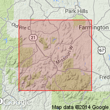
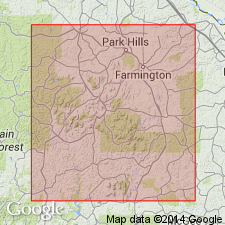
Occurs in St. Francois Mountain area. Munger Village and Munger School are in T. 33 N., R. 2 E., Reynolds Co., southeastern MO.
Source: Modified from US geologic names lexicon (USGS Bull. 1350, p. 515).

- Usage in publication:
-
- Munger Granite Porphyry
- Modifications:
-
- Geochronologic dating
- AAPG geologic province:
-
- Midcontinent region
Summary:
Whole rock Rb-Sr age determined to be 1260 +/-30 m.y. Study area in St. Francois Mountains, southeast MO, Midcontinent region. Same age as Magee granite; Munger and Magee are youngest rocks dated in this study. Older dated rocks include Silvermine and Butler Hill granites (1400-1450 m.y.); Hogan Mountain and Royal Gorge rhyolites, rhyolite of Johnson Shut-ins, and Pilot Knob felsite (1420 +/-30 m.y.); and Stout's Creek rhyolite (1315 +/-35 m.y.).
Source: GNU records (USGS DDS-6; Denver GNULEX).
- Usage in publication:
-
- Munger granite porphyry
- Modifications:
-
- Principal reference
- Dominant lithology:
-
- Granite
- Porphyry
- AAPG geologic province:
-
- Midcontinent region
Summary:
Pg. 38. Munger Creek granite porphyry of Musco group. A granite porphyry. Is brownish-red with greenish mottling. Composition very similar to Buford granite porphyry of Musco group, but is generally coarser grained with orthoclase phenocrysts up to 8 mm long and quartz phenocrysts up to 4 mm in diameter. Exposed in St. Francois Mountains, southeastern Missouri. Thickness ranges from about 100 to 500+ feet. Age is Precambrian.
Origin of name not stated but probably named from town of Munger, Reynolds Co., southeastern MO. (Type locality not designated.)
See C.E. Robertson, 1995, Precambrian rocks, IN T.L. Thompson, Stratigraphic succession in Missouri (revised-1995), Missouri Division of Geology and Land Survey, 2nd series, v. 40 Revised, p. 5-14.
[GNU remark (Feb. 16, 1990, USGS DDS-6; Denver GNULEX): Stratigraphic relationships of units of Musco not discussed in text; geologic map (plate 1) missing from library copy of report.]
Source: Strat. succession in Missouri (Thompson, 1995, p. 13-14); GNU records (USGS DDS-6; Denver GNULEX).
- Usage in publication:
-
- Munger Granite
- Modifications:
-
- Geochronologic dating
- AAPG geologic province:
-
- Midcontinent region
Summary:
U-Pb age of 1450 +/-30 m.y. determined on zircon; Rb-Sr age of 1280 +/-40 m.y. determined on whole rock/mineral separates. Rb-Sr ages on some rocks are consistently lower than U-Pb ages probably due to removal of Sr from rock. Age of most rocks studied is about 1500 m.y., but a real event as recorded by Rb-Sr occurred about 1300 m.y. ago. Samples are taken from St. Francois Mountains, southeast MO, Midcontinent region.
Source: GNU records (USGS DDS-6; Denver GNULEX).
- Usage in publication:
-
- Munger Granite Porphyry
- Modifications:
-
- Geochronologic dating
Summary:
U-Pb age on zircons determined to be 1408 +/-12 m.y. and Rb-Sr data on whole-rock samples and on mineral separates yielded an apparent age of 1280 +/-44 m.y. and 1130 +/-44 m.y. respectively. The mineral data indicates that rock was disturbed after 1280 m.y. probably at or near time indicated by mineral isochron. Samples taken in T33N, R2E, Reynolds Co, MO, Midcontinent region (appendix 3). Analytical data in appendices 2 and 4.
Source: GNU records (USGS DDS-6; Denver GNULEX).
- Usage in publication:
-
- Munger Granite Porphyry
- Modifications:
-
- Geochronologic dating
- AAPG geologic province:
-
- Midcontinent region
Summary:
Whole rock Rb-Sr age of 1280 +/-50 m.y. and zircon U-Pb age of 1408 +/-12 m.y. on Munger in St. Francois Mountains, MO, Midcontinent region. U-Pb age is probably more reliable than Rb-Sr age because of less analytical scatter and more consistent results for U-Pb data and probable lowering of Rb-Sr age due to loss of Sr.
Source: GNU records (USGS DDS-6; Denver GNULEX).

- Usage in publication:
-
- Munger Granite Porphyry
- Modifications:
-
- Revised
- AAPG geologic province:
-
- Midcontinent region
Summary:
Munger Granite Porphyry, one of four Precambrian Y hypabyssal rock units assigned to the /St. Francois Mountains Intrusive Suite (revised). [Previously assigned to Musco Group by Tolman and Robertson (1969); status of Musco not discussed.] Present in St. Francois Mountains, southeast Missouri (Midcontinent region). Older than Buford Granite Porphyry (revised) of St. Francois Mountains; younger than Carver Creek Granite Porphyry (revised) of St. Francois Mountains. Nomenclature listed in table 1.
[Conflicts with nomenclature guidelines (ACSN, 1970; NACSN, 1983, 2005, 2021): name St. Francois Mountains applied concurrently to two different units in same area.]
Source: Modified from GNU records (USGS DDS-6; Denver GNULEX).
- Usage in publication:
-
- Munger granite porphyry
- Modifications:
-
- Overview
- AAPG geologic province:
-
- Midcontinent region
Summary:
Mapped undivided with Carver Creek granite porphyry as "Hypabyssal Intrusives of Western St. Francois Mountains" in southeast MO, Midcontinent region. [Not clear if authors intended stratigraphic units within study area to be formal or informal.] Map unit represents small intrusive bodies in area of Taum Sauk Mountain. Munger is an extensively altered, fine-grained prophyritic rock with phenocrysts of quartz, microcline-perthite, and plagioclase. Shown on map explanation to be older than Graniteville granite. However, authors state that Munger has yielded zircon U-Pb age of 1380 m.y. which is younger than all other rocks dated (1485 m.y.) in study area (Bickford and Mose, 1975, G.S.A. Spec. Paper 165). Proterozoic age.
[Authors' intentions are unclear as to which, if any, of the geologic units discussed should have formal status.]
Source: GNU records (USGS DDS-6; Denver GNULEX).
For more information, please contact Nancy Stamm, Geologic Names Committee Secretary.
Asterisk (*) indicates published by U.S. Geological Survey authors.
"No current usage" (†) implies that a name has been abandoned or has fallen into disuse. Former usage and, if known, replacement name given in parentheses ( ).
Slash (/) indicates name conflicts with nomenclatural guidelines (CSN, 1933; ACSN, 1961, 1970; NACSN, 1983, 2005, 2021). May be explained within brackets ([ ]).