

- Usage in publication:
-
- Muddy Buttes Sandstone Member*
- Modifications:
-
- Named
- Dominant lithology:
-
- Sandstone
- AAPG geologic province:
-
- North Park basin
Summary:
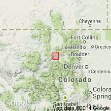
Named as a member in the middle part of Pierre Shale for exposures at Muddy Buttes about 1 mi north of Kremmling, Grand Co, CO in North Park basin. Type locality is in NW1/4 sec 8 and NE1/4 sec 7, T1N, R80W. Is a thin-bedded ledge-forming sandstone about 150-200 ft above Kremmling Sandstone Member. Composed of very fine grained and shaly sandstone that weathers yellowish-brown. Bedding planes are covered by ripple marks and animal trails. Ranges from 5 to 30 ft in thickness. Lower contact placed where silty shale grades up into silty shale; upper contact placed where sandstone changes to silty shale. Overlies and underlies unnamed parts of Pierre. Is in the Range Zone of BACULITES PERPLEXUS. Assigned to late Campanian or Late Cretaceous.
Source: GNU records (USGS DDS-6; Denver GNULEX).
For more information, please contact Nancy Stamm, Geologic Names Committee Secretary.
Asterisk (*) indicates published by U.S. Geological Survey authors.
"No current usage" (†) implies that a name has been abandoned or has fallen into disuse. Former usage and, if known, replacement name given in parentheses ( ).
Slash (/) indicates name conflicts with nomenclatural guidelines (CSN, 1933; ACSN, 1961, 1970; NACSN, 1983, 2005, 2021). May be explained within brackets ([ ]).