

- Usage in publication:
-
- Mount Tabor shale member
- Modifications:
-
- Original reference
- Dominant lithology:
-
- Shale
- Silt
- AAPG geologic province:
-
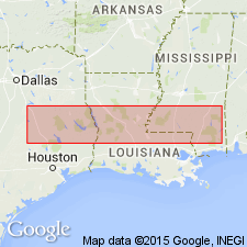
- Gulf Coast basin
Summary:
Pg. 20 (table), 151-154, 159. Mount Tabor shale member of Crockett formation. Name applied to uppermost member of Crockett formation. Consists of interbedded silts and shales in upper part and chiefly brown shales in lower part. Thickness varies from 45 feet at type locality to as much as 100 feet in easter part of area. Overlies Spiller sand member (new) with contact transitional; underlies Yegua formation with boundary placed where sands become more abundant than shales. [Age is middle Eocene (Claiborne).]
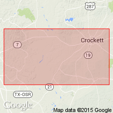
Type locality: in east ditch of U.S. Highway 75, on slope north of Mount Tabor School, Madison Co., eastern TX.
Source: US geologic names lexicon (USGS Bull. 1200, p. 2642).
- Usage in publication:
-
- Mount Tabor shale member
- Modifications:
-
- Revised
- AAPG geologic province:
-
- Gulf Coast basin
Summary:
Pg. 859 [1940]. Mount Tabor shale member of Crockett formation. Includes Serbin sand lentil (new) at top. [Age is middle Eocene (Claiborne).]
Source: US geologic names lexicon (USGS Bull. 1200, p. 2642).
- Usage in publication:
-
- Mount Tabor shale member
- Modifications:
-
- Revised
- AAPG geologic province:
-
- East Texas basin
Summary:
Pg. 1664, 1665, 1671 (fig. 3). Mount Tabor shale member of Cook Mountain Formation. Reallocated to member status in Cook Mountain formation. [Age is middle Eocene (Claiborne).]
Source: US geologic names lexicon (USGS Bull. 1200, p. 2642).

- Usage in publication:
-
- Mount Tabor Member
- Modifications:
-
- Areal extent
- AAPG geologic province:
-
- Gulf Coast basin
Summary:
Mount Tabor Member of Cook Mountain Formation. Top member of Cook Mountain. Clay and marly sand, gray to brown. Thickness about 50 feet. Lies above Spiller Member of Cook Mountain and below Yegua Formation. Marine megafossils. Age is Eocene.
Not separately mapped. (Cook Mountain [undivided] mapped in southeastern corner of map sheet in Madison and Leon Cos., eastern TX.)
Source: Publication.
For more information, please contact Nancy Stamm, Geologic Names Committee Secretary.
Asterisk (*) indicates published by U.S. Geological Survey authors.
"No current usage" (†) implies that a name has been abandoned or has fallen into disuse. Former usage and, if known, replacement name given in parentheses ( ).
Slash (/) indicates name conflicts with nomenclatural guidelines (CSN, 1933; ACSN, 1961, 1970; NACSN, 1983, 2005, 2021). May be explained within brackets ([ ]).