- Usage in publication:
-
- Mount Belknap rhyolite*
- Modifications:
-
- First used
- Dominant lithology:
-
- Rhyolite
- AAPG geologic province:
-
- Wasatch uplift
Summary:
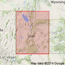
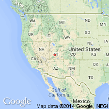
Intent to name and derivation of place name not stated. No type locality designated. Both the locality and the geologic name spelled as Mt. Belknap. Forms a lenticular body in the Tushar Mountains, Wasatch uplift, UT. Two facies distinguished: 1) red tuffaceous rhyolite, mostly a flow breccia with fragments of dark or light gray, and 2) gray rhyolite that has prominent flow-banding. Each facies has a maximum thickness of about 2,000 ft. Is younger than Roger Park basaltic breccia; is older than Dry Hollow latite. Assigned to the later Tertiary.
Source: GNU records (USGS DDS-6; Denver GNULEX).
- Usage in publication:
-
- Mount Belknap rhyolite*
- Modifications:
-
- Age modified
- AAPG geologic province:
-
- Wasatch uplift
Summary:
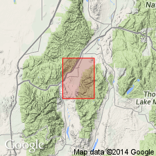
Age changed from Tertiary to Pliocene?. No specific reason stated, except that unit shown as younger than Pliocene? Dry Hollow formation and as older than Pliocene? Joe Lott tuff. Exposures in quadrangle lie in Sevier Co, UT on the Wasatch uplift. Detailed lithologic description.
Source: GNU records (USGS DDS-6; Denver GNULEX).
- Usage in publication:
-
- Mount Belknap Volcanics
- Modifications:
-
- Age modified
- Areal extent
- AAPG geologic province:
-
- Great Basin province
- Wasatch uplift
Summary:
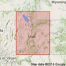
Age modified from Pliocene? to Miocene. Age estimated at about 20 m.y. Shown on a correlation chart as a unit younger than the "older basalt flows" and the Horse Valley Formation. Is also shown on correlation chart as present in the northern Black Mountains, Iron Co, UT, Great Basin province, the Tushar Mountains, Piute Co, UT on the Wasatch uplift, southern Sevier Plateau, Garfield Co, UT in the Paradox basin. Correlation chart; fence diagram; measured sections.
Source: GNU records (USGS DDS-6; Denver GNULEX).
- Usage in publication:
-
- Mount Belknap Volcanics*
- Modifications:
-
- Overview
- Redescribed
- Dominant lithology:
-
- Lava
- Tuff
- Rhyolite
- AAPG geologic province:
-
- Wasatch uplift
- Great Basin province
Summary:
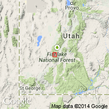
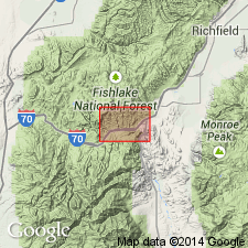
Redescribed from Mount Belknap Rhyolite to Mount Belknap Volcanics. Erupted from two source areas: 1) viscous rhyolite lava flows and ash-flow tuffs from Red Hills caldera to east, and 2) ash-flow tuffs from Mount Belknap caldera to west. Includes outflow and intracaldera facies. Outflow facies divided into lower heterogeneous member, Joe Lott and Red Hills Tuff Members, crystal-rich and upper red tuff members, porphyritic lava flows, Gray Hills Rhyolite Member, upper gray tuff member. Intracaldera facies divided into lower tuff member, Blue Lake Rhyolite Member, middle tuff member, Mount Baldy Rhyolite Member, volcanic breccia member and young intrusive rocks. [Definition of members in companion Bulletin 1469.] Covered more than 600 sq km in west-central UT, Piute Co on the Wasatch uplift and Beaver Co on the Great Basin province. Deposited unconformably on Bullion Canyon Volcanics between 21-18 m.y. ago. Stratigraphic diagrams. Small geologic map. Chemical analyses.
Source: GNU records (USGS DDS-6; Denver GNULEX).
- Usage in publication:
-
- Mount Belknap Volcanics
- Modifications:
-
- Revised
- AAPG geologic province:
-
- Wasatch uplift
- Great Basin province
Summary:
Between 21 and 18 m.y. ago (Miocene) two source areas -one in the Tusbar Mountains (Mount Belknap caldera) and one in Antelope Range (Red Hills caldera), Piute Co, Wasatch uplift -were the source areas of repeated rhyolitic eruptions. Extends into Beaver Co, Great Basin province. Consist of highly silicic, phenocryst-poor alkali rhyolite. Rocks of the Mount Belknap caldera divided into: lower tuff member, Blue Lake Rhyolite Member (new), middle tuff member, Mount Baldy Rhyolite Member (new), and an interleaved sedimentary breccia member of the Mount Belknap Volcanics. Rocks of the Red Hills caldera divided into: Joe Lott Tuff Member (reduced in stratigraphic rank and assigned to Mount Belknap), Red Hills Tuff Member (new) and its equivalent the crystal rich member, upper red-tuff member, Gray Hills Rhyolite Member (formally designated), and the upper gray tuff member of the Mount Belknap Volcanics. Upper gray yielded age of 18.0 +/-0.8 m.y. Crystal rich member yielded ages of 15.3 +/-0.8, 16.1 +/-0.7, and 17.1 +/-0.8 m.y. Lower member yielded age of 20.9 +/-1.1 m.y.
Source: GNU records (USGS DDS-6; Denver GNULEX).
- Usage in publication:
-
- Mount Belknap Volcanics*
- Modifications:
-
- Principal reference
- AAPG geologic province:
-
- Wasatch uplift
Summary:
Intracaldera and outflow facies recognized. Principal reference section designated for Joe Lott Tuff Member of the outflow facies along Clear Creek, Sevier Co, UT in the southern parts of T25S, Rs 4 1/2 and 5W, on the Wasatch uplift. Joe Lott divided into four units; their equivalence to members of the intracaldera facies is: lower unit = lower tuff member, middle unit = middle tuff member, pink and upper units = upper tuff member. The intervening Blue Lake Rhyolite Member, Mount Baldy Member, and volcanic breccia member of the intracaldera fill have no equivalents in the Joe Lott. Derived from a western source, Mount Belknap caldera and an eastern source, Red Hills caldera.
Source: GNU records (USGS DDS-6; Denver GNULEX).
For more information, please contact Nancy Stamm, Geologic Names Committee Secretary.
Asterisk (*) indicates published by U.S. Geological Survey authors.
"No current usage" (†) implies that a name has been abandoned or has fallen into disuse. Former usage and, if known, replacement name given in parentheses ( ).
Slash (/) indicates name conflicts with nomenclatural guidelines (CSN, 1933; ACSN, 1961, 1970; NACSN, 1983, 2005, 2021). May be explained within brackets ([ ]).

