

- Usage in publication:
-
- Mount Athos formation
- Modifications:
-
- Named
- Dominant lithology:
-
- Schist
- Quartzite
- AAPG geologic province:
-
- Piedmont-Blue Ridge province
Summary:
Mount Athos formation named [probably for Mount Athos]. Outcrops is narrow synclinal belts frequently interrupted by normal faults. Consists of quartzite and schist. Thickness is 200 ft. Principal quartzite member, usually less than 100 ft thick, occurs generally near middle of formation and is enclosed by micaceous and talcose schists. Overlies basaltic lava flows (oldest exposed rocks), now altered to epidote-chlorite-hornblende greenstone, between Lynchburg and Howardsville. Overlain by Cockeysville marble.
Source: GNU records (USGS DDS-6; Reston GNULEX).
- Usage in publication:
-
- Mount Athos quartzite
- Modifications:
-
- Revised
- Overview
- AAPG geologic province:
-
- Piedmont-Blue Ridge province
Jonas, A.I., 1932, Kyanite in Virginia: Virginia Geological Survey Bulletin, no. 38, 52 p.
Summary:
Used as Mount Athos quartzite. In region east of Lynchburg, VA, basic volcanic rocks occur under Mount Athos quartzite and are oldest rocks exposed in that area. Mount Athos may be equivalent to Setters quartzite and underlies marble that is probably equivalent to Cockeysville marble. Included in Glenarm series. Age is Precambrian.
Source: GNU records (USGS DDS-6; Reston GNULEX).
- Usage in publication:
-
- Mount Athos formation
- Modifications:
-
- Revised
- Redescribed
- AAPG geologic province:
-
- Piedmont-Blue Ridge province
Summary:
Mount Athos formation assigned to Evington group (new). Consists of quartzite (commonly conglomeratic), mica schist, and white, gray, and pink marble [previously unmentioned lithology]. Marble occurs as discontinuous lenses. Thickness is 100 to 800 ft. Chronologic sequence of formations in James River synclinorium found to be reverse of that interpreted by Furcron. Underlies Slippery Rock greenstone (new), overlies Pelier schist (new), both of Evington group. Age is Paleozoic(?).
Source: GNU records (USGS DDS-6; Reston GNULEX).
- Usage in publication:
-
- Mount Athos formation*
- Modifications:
-
- Revised
- AAPG geologic province:
-
- Piedmont-Blue Ridge province
Summary:
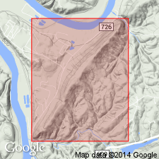
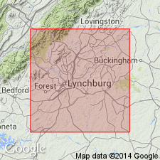
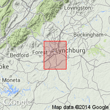
Mount Athos formation revised to include white marble previously placed in underlying Cockeysville marble. Overlies Archer Creek formation (new). Name derivation given as Mount Athos, east of Lynchburg, along James River, central VA.
Source: GNU records (USGS DDS-6; Reston GNULEX).
- Usage in publication:
-
- Mount Athos formation
- Modifications:
-
- Revised
- Age modified
- AAPG geologic province:
-
- Piedmont-Blue Ridge province
Summary:
Lower schist phase of Mount Athos formation (as defined by Furcron) separated and named Pelier schist. Age in columnar section given as early Paleozoic(?).
Source: GNU records (USGS DDS-6; Reston GNULEX).
- Usage in publication:
-
- Mount Athos formation
- Modifications:
-
- Overview
- AAPG geologic province:
-
- Piedmont-Blue Ridge province
Summary:
Mount Athos formation included in Evington group (mapped undivided). Age is Paleozoic.
Source: GNU records (USGS DDS-6; Reston GNULEX).
- Usage in publication:
-
- Mount Athos Formation
- Modifications:
-
- Age modified
- AAPG geologic province:
-
- Piedmont-Blue Ridge province
Summary:
In central VA, rocks of Evington Group immediately below Arvonia Slate are equivalent to Early Cambrian(?) Chopawamsic Formation. [By inference, Evington Group is Early Cambrian(?) and Mount Athos Formation is therefore Early Cambrian(?).]
Source: GNU records (USGS DDS-6; Reston GNULEX).
For more information, please contact Nancy Stamm, Geologic Names Committee Secretary.
Asterisk (*) indicates published by U.S. Geological Survey authors.
"No current usage" (†) implies that a name has been abandoned or has fallen into disuse. Former usage and, if known, replacement name given in parentheses ( ).
Slash (/) indicates name conflicts with nomenclatural guidelines (CSN, 1933; ACSN, 1961, 1970; NACSN, 1983, 2005, 2021). May be explained within brackets ([ ]).