

- Usage in publication:
-
- Miser Gravel*
- Modifications:
-
- Named
- Dominant lithology:
-
- Gravel
- AAPG geologic province:
-
- Permian basin
Summary:
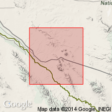
Named as basal formation (of 5) of gravel of Quaternary age on surfaces of erosion in Hudspeth Co, TX in the Permian basin. Type locality designated on Miser Arroyo along southwest edge of southern part of Quitman Mountains. Consists of a gravel of chiefly limestone, sandstone, and quartzite fragments from nearby parts of Quitman Mountains. Size and shape of fragments are sand to boulders, angular to subangular with commonly smoothed edges. Ranges in thickness from 1 to 20 ft. Lies 200 to 300 ft above arroyos. Overlies basalt of Quaternary age; underlies Madden Gravel (new). Stratigraphic table. Geologic maps.
Source: GNU records (USGS DDS-6; Denver GNULEX).
For more information, please contact Nancy Stamm, Geologic Names Committee Secretary.
Asterisk (*) indicates published by U.S. Geological Survey authors.
"No current usage" (†) implies that a name has been abandoned or has fallen into disuse. Former usage and, if known, replacement name given in parentheses ( ).
Slash (/) indicates name conflicts with nomenclatural guidelines (CSN, 1933; ACSN, 1961, 1970; NACSN, 1983, 2005, 2021). May be explained within brackets ([ ]).