

- Usage in publication:
-
- Miners Delight Formation*
- Modifications:
-
- Named
- Dominant lithology:
-
- Graywacke
- Conglomerate
- Schist
- AAPG geologic province:
-
- Northern Rocky Mountain region
Summary:
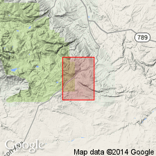
Named for exposures in general vicinity of Miners Delight Mine, sec 32, T30N, R99W (its type locality), Fremont Co, WY in Northern Rocky Mountain region. Includes chiefly feldspathic and micaceous graywacke (turbidites), conglomerate, and mica schist. Rocks are light-brown to black, some are thin- and some are thick-bedded. Andalusite-mica schist common. Thickness probably more than 5,000 ft. Three members mapped: 1) ellipsoidal and nonellipsoidal meta-andesite; 2) mixed member, chiefly mafic lava flows and graywacke conglomerate, sheared, metamorphic, gneissic; and 3) graphitic schist member, mainly black sheared schistose rocks with abundant quartz veins. Relationship to older Roundtop Mesa Greenstone (new) uncertain. Assigned to early Precambrian.
Source: GNU records (USGS DDS-6; Denver GNULEX).
- Usage in publication:
-
- Miners Delight Formation*
- Modifications:
-
- Age modified
- Geochronologic dating
- AAPG geologic province:
-
- Northern Rocky Mountain region
Summary:
Miners Delight, Roundtop Mountain, and Goldman Meadows Formations shown with the oldest of the Archean rocks in a map unit called "Metasedimentary and metavolcanic rocks." Also shown as equivalent to map unit called "clinopyroxene-hornblende-biotite quartzofeldspathic gneiss" which bears a date of 3,358 +/-30 m.y. (Zr), and older than two Late Archean units which bear dates of 2,504 +/-40 m.y to 2,575 +/-50 m.y. (using U-Pb subscript x Zr, Rb-Sr, Th-Pb, Pb-Pb and U-Pb methods) and of 2,620 +/-27 m.y. to 2,642 +/-13 m.y. (using U-Pb subscript x Zr, Rb-Sr, Th-Pb, Pb-Pb and U-Pb methods).
Source: GNU records (USGS DDS-6; Denver GNULEX).
- Usage in publication:
-
- Miners Delight Formation*
- Modifications:
-
- Geochronologic dating
- AAPG geologic province:
-
- Northern Rocky Mountain region
Summary:
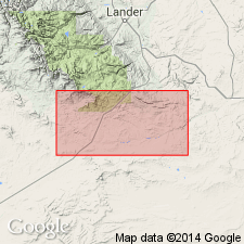
Has been dated by Z. E. Peterman, oral communication, 1982, by Rb-Sr method as 2800 +/-100 Ma. Formation is known in the Atlantic City area, Fremont Co, WY in the Northern Rocky Mountain region.
Source: GNU records (USGS DDS-6; Denver GNULEX).
- Usage in publication:
-
- Miners Delight Formation
- Modifications:
-
- Overview
- Dominant lithology:
-
- Schist
- Amphibolite
- Chert
- Marble
- Andesite
- Dacite
- AAPG geologic province:
-
- Northern Rocky Mountain region
Summary:
Is the youngest of four formations belonging to the South Pass greenstone belt. Contact with the older Roundtop Mountain Greenstone of the South Pass greenstone belt is a fault. Mapped (geologic map) over a large area of southern part of study area, Fremont Co., WY in the Northern Rocky Mountain region. Consists predominantly of fine-grained, finely bedded feldspathic and biotitic metagraywacke interbedded with mica schist. [More detailed description of the lithology given here than in naming paper.] Eight units mapped: 1.) metagraywacke, and mica schist; 2.) graphitic schist -black to gray, fine-grained; 3.) mafic amphibolite -fine to medium-grained, dense, black, weakly to strongly foliated, 4.) mixed member -metagraywacke, metabasalt, amphibolite, metaconglomerate, tremolite actinolite schist, chlorite schist, rare grunerite schist, quartzofeldspathic gneiss; 5.) metachuthard, banded, massive, gray to black, rings when struck with a hammer; 6.) marble, 7.) meta-andesite interfingered with metaconglomerate and metatuff; 8.) metadacite -primary minerals are plagioclase and green hornblende. Most of the metagraywacke is distal facies; coarse grained proximal facies metagraywacke with channels and cross-bedding occurs locally. Deposited probably in a moderately deep oceanic basin with shallow water fan along edge of basin. The associated calcalkaline volcanics with the proximal facies imply island arc was located in region of the greenstone belt. Archean age.
Source: GNU records (USGS DDS-6; Denver GNULEX).
For more information, please contact Nancy Stamm, Geologic Names Committee Secretary.
Asterisk (*) indicates published by U.S. Geological Survey authors.
"No current usage" (†) implies that a name has been abandoned or has fallen into disuse. Former usage and, if known, replacement name given in parentheses ( ).
Slash (/) indicates name conflicts with nomenclatural guidelines (CSN, 1933; ACSN, 1961, 1970; NACSN, 1983, 2005, 2021). May be explained within brackets ([ ]).