

- Usage in publication:
-
- Milladore Volcanic Complex*
- Modifications:
-
- Named
- Geochronologic dating
- AAPG geologic province:
-
- Lake Superior region
Summary:
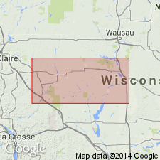
Named from town of Milladore in sec 36, T25N, R5E, Wood Co, WI, Lake Superior region. Exposures in Milladore Township, Wood Co, and in Portage and Marathon Cos, WI south of Eau Pleine shear zone designated as type area. Consists of eight, discontinuous, intertonguing map units of greenschist metamorphic grade whose thickness is not known because of intense deformation and poor exposures. Unconformably overlies Archean basement rocks. Confined to map area in central WI, and on basis of lithologic similarity and age is tentatively correlated with felsic metavolcanic and metasedimentary rocks exposed in Eau Claire River, in northwest part of map area and in adjacent river valleys. Isotopic dating of subvolcanic tonalite intercalated with complex yields U-Pb zircon age of 1860+/-7 Ma, and interpreted as approximate age of the succession. Mapped units: metagabbro --dark gray, medium to coarse grained; metadiorite--gray, medium grained; ultramafic rocks--talc-, serpentine-, and actinolite-bearing schist; felsic and intermediate metavolcanic rocks--gray, fine- to medium-grained biotite and quartz-sericite schist and phyllite; mafic and intermediate metavolcanic rocks--dark gray, fine- to medium-grained hornblende and actinolite schist; dacitic porphyry--dark gray, mottled, medium-grained foliated and lineated rock; interbedded quartzite, chert, conglomerate, and minor argillite --lumped, poorly exposed; and argillite. Early Proterozoic.
Source: GNU records (USGS DDS-6; Reston GNULEX).
For more information, please contact Nancy Stamm, Geologic Names Committee Secretary.
Asterisk (*) indicates published by U.S. Geological Survey authors.
"No current usage" (†) implies that a name has been abandoned or has fallen into disuse. Former usage and, if known, replacement name given in parentheses ( ).
Slash (/) indicates name conflicts with nomenclatural guidelines (CSN, 1933; ACSN, 1961, 1970; NACSN, 1983, 2005, 2021). May be explained within brackets ([ ]).