

- Usage in publication:
-
- Milk Creek Beds
- Modifications:
-
- First used
- Dominant lithology:
-
- Conglomerate
- Sandstone
- Siltstone
- Tuff
- Basalt
- AAPG geologic province:
-
- Basin-and-Range province
Summary:
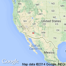
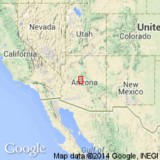
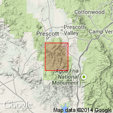
First? published description for unit in Walnut Grove basin, about 29 mi northwest of Rock Springs, Yavapai Co, AZ, Basin-and-Range province. Separated from newly named Pliocene Rock Springs Beds by Bradshaw Mountains. Rock Springs and Milk Creek Beds equivalents. Consists of about 2,600+ feet of fluviatile and lacustrine rocks interbedded with several layers of tuff and a thick basalt flow. Composite measured section (Yavapai Co) of 3 units. Lower unit (496 feet thick) measured in SE1/4 SW1/4 sec 17, NE1/4 NW1/4 sec 20, T11N, R2W, consists mostly of conglomeratic sandstone that is tan, gray, coarse with pebbles and cobbles of granite, gneiss, phyllite, schist, poorly sorted in sand matrix; some fragments subangular to subround, and 1) silty tan to gray, poorly sorted, tuffaceous sandstone, 2) tan siltstone and mudstone. Middle unit (1,062 feet thick) measured in W1/2 W1/2 sec 16, SE1/4 SE1/4 sec 17, T11N, R2W, mostly tan to gray tuffaceous siltstone, brown sandstone, white tuff, and some clay and mudstone. Upper unit (747 feet thick) measured in W1/2 sec 5, NE1/4 NE1/4 sec 7, NW1/4 NW1/4 sec 8, T11N, R2W of interbedded gray, tan, medium- to coarse-grained to conglomeratic sandstone and gray-green and tan siltstone. Middle, lower units separated by 300 feet of basalt. Deposited on an erosion surface of Precambrian rocks or on Tertiary dacite. Upper 300-400 feet has Clarendonian vertebrates. Assumed to be Pliocene; may be Miocene and Pliocene.
Source: GNU records (USGS DDS-6; Denver GNULEX).
- Usage in publication:
-
- Milk Creek Formation*
- Modifications:
-
- Geochronologic dating
- AAPG geologic province:
-
- Basin-and-Range province
Summary:
Two samples of biotite from latite flows in the Milk Creek Formation have yielded K-Ar ages of 14.6 +/-0.5 and 14.8 +/-0.5 m.y. Age of Miocene and Pliocene assigned. Three lithologic types (of same age)--1) latite flows, 2) olivine basalt flows, and 3) gravels, sandstone, siltstone, and tuffaceous sediments--in Milk Creek mapped (geologic maps) in Kirtland and Mount Union quads, Yavapai Co, AZ in Basin-and-Range province. Is in contact with Precambrian igneous rocks in central part of Kirtland quad and in southwest part of Mount Union quad, and with Precambrian to Mesozoic rocks to northeast in Mount Union quad. Considered equivalent to the Hickey Formation to northeast in Mount Union and adjacent quads.
Source: GNU records (USGS DDS-6; Denver GNULEX).
- Usage in publication:
-
- Milk Creek Formation*
- Modifications:
-
- Revised
- AAPG geologic province:
-
- Basin-and-Range province
Summary:
zzzzzName changed from Milk Creek beds to Milk Creek Formation. Milk Creek includes both sedimentary and volcanic rocks. Type locality [not described] stated to be on Milk Creek, Yavapai Co, AZ in the Basin-and-Range province. Mapped at southwest corner of quad. Divided into three mapped units that are equivalent--1) coarse gravels at east margin that grade westward into sandstone and shale that were deposited on Precambrian granite, 2) olivine basalt flows intercalated with fine-grained sedimentary rocks, 3) grayish-tan vesicular latite with hornblende and biotite phenocrysts replaced largely by magnetite in a groundmass of augite and feldspar microlites in a microcrystalline base. Thought to be correlative with the Hickey Formation in the central part of the quad. Assigned a Miocene and Pliocene age.
Source: GNU records (USGS DDS-6; Denver GNULEX).
For more information, please contact Nancy Stamm, Geologic Names Committee Secretary.
Asterisk (*) indicates published by U.S. Geological Survey authors.
"No current usage" (†) implies that a name has been abandoned or has fallen into disuse. Former usage and, if known, replacement name given in parentheses ( ).
Slash (/) indicates name conflicts with nomenclatural guidelines (CSN, 1933; ACSN, 1961, 1970; NACSN, 1983, 2005, 2021). May be explained within brackets ([ ]).