

- Usage in publication:
-
- Milburn-Strawn series
- Modifications:
-
- Overview
- Dominant lithology:
-
- Clay
- Shale
- Limestone
- Coal
- AAPG geologic province:
-
- Bend arch
Summary:
Pl. 3, p. lxvi. Milburn-Strawn series. [=Milburn division of Tarr (1890) and Strawn division of Cummins (1891).] Alternating clays and shales and thin-bedded limestones, with fire clay and coal, overlying Richland-Gordon sandstones and underlying Brownwood-Ranger series. In Colorado coal field (south) only one coal seam known. In Brazos coal field (north) six seams noted; these constitute the Strawn series. Study area in central basin, approximately from Colorado River north to Red River, north-central Texas. Age is Carboniferous (Coal Measures).
Source: US geologic names lexicon (USGS Bull. 896, p. 487); supplemental information from GNU records (USGS DDS-6; Denver GNULEX).
- Usage in publication:
-
- Milburn shales
- Modifications:
-
- Named
- Dominant lithology:
-
- Shale
- Sandstone
- Clay
- Coal
- AAPG geologic province:
-
- Llano uplift
Summary:
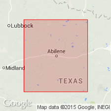
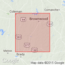
Named, probably for Milburn, McCulloch Co, TX on Llano uplift, where well exposed. No type locality designated. Also called Milburn "division." The southwestern extension of these shales is hidden beneath the Cretaceous of Brady Mountains. Underlies limestone of newly named Brownwood division [also called Beds]; overlies Rochelle Conglomerate Bed of Richland Sandstone [also called division] (both new). Near the head of Deep Creek the lower layer is shaly sandstone 60 ft thick. This shale grades from the conglomerate below to an argillaceous shale above, and is overlain by a deposit of clay 15 ft thick, with scattered nodules of clay ironstone; some gypsum present in this layer. Above this is 3 inches of fire clay and a stratum of carbonaceous shale 1 ft thick, with laminae of true coal. The shale is composed of clay filled with casts of plants. Above this comes 25 ft of sandy shale--in places a true sandstone, but in its upper and lower layers a true shale. Section measured near Milburn, in a well 62 ft deep. Thickens to northeast. Deposited in quiet water conditions. Is of Late Carboniferous age.
Source: GNU records (USGS DDS-6; Denver GNULEX).
- Usage in publication:
-
- Milburn beds*
- Modifications:
-
- Revised
- AAPG geologic province:
-
- Bend arch
- Llano uplift
- Strawn basin
Summary:
Milburn revised; assigned to Brownwood division in this report. At close of Richland time, slight subsidence of sea floor resulted in deposition of deeper sea deposits (=Milburn clays). Carboniferous and Permo-Carboniferous divisions in Colorado River Valley area are (descending):
-----------------------------------------
TARR (1890)
Coleman division (Permo-Carboniferous)
Waldrip division (Carboniferous)
Brownwood division
Milburn division
Richland division
"lower limestone"
-----------------------------------------
CUMMINS (1890, 1891)
Albany division (Permo-Carboniferous)
Cisco division (Carboniferous)
Canyon division
" "
Strawn division
Bend division
-----------------------------------------
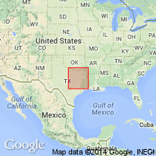
The "lower limestone" of Tarr (1890) may be Marble Falls limestone. Divisions are present adjacent to the Colorado River in Brown and Lampasas Counties (Bend arch) and San Saba County (Llano uplift), south of Callahan Divide, central Texas. North of Callahan Divide, from northwestern Throckmorton County (Bend arch) to western Hood County (Strawn basin) the divisions continue; thickness differs, and basal portion of section is concealed by greater overlap of Cretaceous formations to the east. Relations to north cannot be stated at present.
Source: Modified from GNU records (USGS DDS-6; Denver GNULEX).

- Usage in publication:
-
- Milburn formation
- Modifications:
-
- Not used
Summary:
Milburn and Brownwood formations of Tarr (1890) shown on chart as equivalent to Canyon division of Pennsylvanian age. Name Milburn not used. Name Brownwood assigned to Graford formation (new). In Colorado River Valley (on Bend arch and Llano uplift) Graford formation includes (ascending): 1) Rochelle conglomerate [member], 2) Capps limestone lentil (new) of Brownwood shale, and 3) Adams Branch limestone [member]. To north, in the Brazos River Valley (on Bend arch), Graford includes (ascending): 1) Oran sandstone lentil (new) of Brownwood shale [member], and 2) Adams Branch limestone [member]. Measured sections, areal extent maps, stratigraphic charts.
Source: GNU records (USGS DDS-6; Denver GNULEX).
For more information, please contact Nancy Stamm, Geologic Names Committee Secretary.
Asterisk (*) indicates published by U.S. Geological Survey authors.
"No current usage" (†) implies that a name has been abandoned or has fallen into disuse. Former usage and, if known, replacement name given in parentheses ( ).
Slash (/) indicates name conflicts with nomenclatural guidelines (CSN, 1933; ACSN, 1961, 1970; NACSN, 1983, 2005, 2021). May be explained within brackets ([ ]).