

- Usage in publication:
-
- Michaud Gravel*
- Modifications:
-
- Original reference
- Dominant lithology:
-
- Sand
- Gravel
- AAPG geologic province:
-
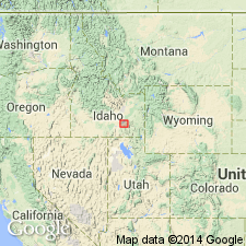
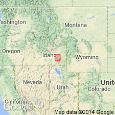
- Snake River basin
Summary:
Pg. B164-B166; GSA Bull., v. 72, no. 12, p. 1742, 1961. Michaud Gravel. Deltaic sand and gravel that contains boulders as much as 8 feet in diameter at Pocatello; size diminishes abruptly westward to small cobbles at Michaud and to sand with a few small pebbles northeast of American Falls. Thickness 5 to 50 feet. Overlies American Falls Lake Beds.
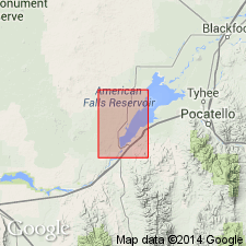
Type locality: in gravel pits on south side of Union Pacific RR at Michaud, about 8 mi west of Pocatello, Power Co., southeastern ID.
Source: US geologic names lexicon (USGS Bull. 1350, p. 486).
- Usage in publication:
-
- Michaud gravel*
- Modifications:
-
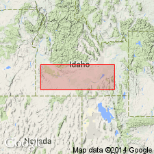
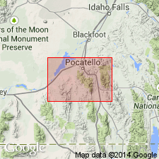
- Areal extent
- AAPG geologic province:
-
- Snake River basin
Summary:
Mapped northeast of American Falls above the American Falls lake beds. Is a marginal remnant of unconsolidated pebbly silt and sand averaging about 15 ft thick. At Michaud is mainly cobbles. At Pocatello is mostly large boulders. Is probably a deltaic unit deposited along the shore of American Falls lake by water from Lake Bonneville. Has a fresh-water molluscan fauna. Assigned to the Pleistocene in this quad, Power Co., ID, Snake River basin.
Source: GNU records (USGS DDS-6; Denver GNULEX).
- Usage in publication:
-
- Michaud Gravel*
- Modifications:
-
- Overview
- AAPG geologic province:
-
- Snake River basin
Summary:
Is formation along upper Snake River Plain in vicinity of Pocatello, southeast ID, Snake River basin; deposition attributed to the Bonneville Flood on the Snake River in the late Pleistocene. Consists of bouldery debris 50-80 ft thick that was dumped on the bottom of a temporary lava-dammed lake at the mouth of lower Portneuf River canyon when flood met slack water. Largest pieces carried into the lake range from 8-ft boulders at Pocatello to cobbles at a distance of some 10 mi. Gravel bars containing 20-ft boulders of local basalt were built across the mouth of some lake spillways. Is correlated with Melon Gravel westward along Snake River Plain. Age given as late Pleistocene.
Source: GNU records (USGS DDS-6; Denver GNULEX).
- Usage in publication:
-
- Michaud Gravel
- Modifications:
-
- Geochronologic dating
- AAPG geologic province:
-
- Snake River basin
Summary:
Six radiocarbon dates from Michaud in Snake River basin range from 21,500 to greater than 38,000 yrs B.P. Shells from Michaud yielded ages of 29,700 yrs B.P. Bone yielded ages of 21,500 and 31,300 yr B.P. Peat yielded age of greater than 38,000 yrs B.P. All these dates are from materials now thought to have been transported and reworked by the Bonneville flood. Michaud thought to be a deposit of the Bonneville flood which occurred 14,000 to 15,000 B.P.
Source: GNU records (USGS DDS-6; Denver GNULEX).
- Usage in publication:
-
- Michaud Gravel*
- Modifications:
-
- Mapped
- AAPG geologic province:
-
- Snake River basin
Summary:
Michaud Gravel. Recognized in Bannock County, southeastern Idaho. Thickness 50 to 80 feet (15 to 24 m). Deposited during Bonneville Flood about 14,500 years ago (late Pleistocene). (Follows Trimble, 1976, USGS Bull. 1400.)
Source: Publication.
For more information, please contact Nancy Stamm, Geologic Names Committee Secretary.
Asterisk (*) indicates published by U.S. Geological Survey authors.
"No current usage" (†) implies that a name has been abandoned or has fallen into disuse. Former usage and, if known, replacement name given in parentheses ( ).
Slash (/) indicates name conflicts with nomenclatural guidelines (CSN, 1933; ACSN, 1961, 1970; NACSN, 1983, 2005, 2021). May be explained within brackets ([ ]).