

- Usage in publication:
-
- Mescal limestone*
- Modifications:
-
- Named
- Dominant lithology:
-
- Limestone
- Dolomite
- AAPG geologic province:
-
- Southwestern Basin-and-Range region
Summary:
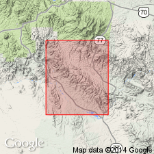
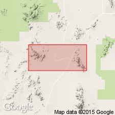
Named as a formation in the Apache group for exposures in the Mescal Mountains, Ray quad, Gila Co, AZ in the Southwestern Basin-and-Range region. Present also in Globe quad in many fault blocks, and in the Sierra Ancha and Santa Catalina Range. Composed of thin beds of gray or white, buff, rusty-brown cherty limestone. Part of the formation is dolomite. Siliceous material forms layers parallel to bedding surfaces. These layers stand out on weathered surfaces. Overlies Dripping Spring quartzite of Apache group. Is older than the newly named Troy quartzite, upper formation of the Apache, but is separated from the Troy by a 75 to 100 ft thick decomposed vesicular basalt. Has been extensively intruded by diabase sheets. In some area it is represented by detached masses of [limestone] included in the diabase. Mescal and Troy were thought to be part of the Dripping Spring quartzite in previously published literature. Average thickness of Mescal in Ray quad is 225 ft. Is identical to the Abrigo limestone of the Bisbee area. No identifiable fossils found in Apache group. Provisionally assigned to the Cambrian.
Source: GNU records (USGS DDS-6; Denver GNULEX).
- Usage in publication:
-
- Mescal limestone*
- Modifications:
-
- Areal extent
- AAPG geologic province:
-
- Southwestern Basin-and-Range region
Summary:
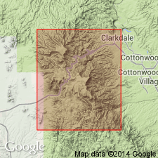
Extended to Roosevelt Dam, the Sierra Ancha, Salt River Canyon, and the Santa Catalina Mountains, AZ in the Southwestern Basin-and-Range region. Is of Cambrian? age.
Source: GNU records (USGS DDS-6; Denver GNULEX).
- Usage in publication:
-
- Mescal limestone*
- Modifications:
-
- Areal extent
- AAPG geologic province:
-
- Southern Rocky Mountain region
Summary:
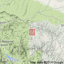
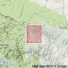
Extended to Canyon Creek in Navajo Co, AZ in the Southern Rocky Mountain region. Is Precambrian or Cambrian?.
Source: GNU records (USGS DDS-6; Denver GNULEX).
- Usage in publication:
-
- Mescal limestone*
- Modifications:
-
- Revised
- AAPG geologic province:
-
- Southwestern Basin-and-Range region
Summary:
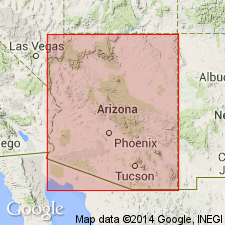
Term Troy quartzite removed as upper formation of Apache group. Troy has Middle Cambrian fossils in lower and upper beds of the same type as have been found in the Abrigo [formation]. Apache, therefore, stratigraphically restricted to unconformably underlying Mescal limestone and older rocks ([descending: Dripping Spring quartzite, Barnes conglomerate, Pioneer shale, Scanlan conglomerate]). As thus revised, Apache which is considered Algonkian bears a resemblance to the Chuar and Unkar groups of the Grand Canyon area that also are Algonkian, have an unconformity at the top, and are overlain by a quartzite with Middle and Upper Cambrian fossils. [Occurs in the Southwestern Basin-and-Range region of AZ.]
Source: GNU records (USGS DDS-6; Denver GNULEX).
- Usage in publication:
-
- Mescal limestone*
- Modifications:
-
- Areal extent
- AAPG geologic province:
-
- Southwestern Basin-and-Range region
Summary:
Extended to Slate and Vekol Mountains, Southwestern Basin-and-Range region, AZ. Is formation of Apache group. Is of Precambrian age.
Source: GNU records (USGS DDS-6; Denver GNULEX).
- Usage in publication:
-
- Mescal Formation*
- Modifications:
-
- Redescribed
- AAPG geologic province:
-
- Southern Rocky Mountain region
Summary:
Redescribed as Formation rather than Limestone in Chediski Peak quad, Navajo Co, AZ in Southern Rocky Mountain region. Is late Precambrian.
Source: GNU records (USGS DDS-6; Denver GNULEX).
- Usage in publication:
-
- Mescal Limestone*
- Modifications:
-
- Reference
- AAPG geologic province:
-
- Southwestern Basin-and-Range region
Summary:
Is a formation of Apache Group, considered as of younger Precambrian age. Detailed lithologic description and thickness variations given. Reference section measured and designated on slope of Pendelton Mesa, NW1/4 SW1/4 sec 11, T7N, R14E, Pinal Co, AZ in Southwestern Basin-and-Range region, where it can be separated into the lower, algal, and argillite members. Is 418 ft thick at the reference section. Classified as younger Precambrian in age. Shown only in Southwestern Basin-and-Range region.
Source: GNU records (USGS DDS-6; Denver GNULEX).
- Usage in publication:
-
- Mescal Limestone
- Modifications:
-
- Overview
Summary:
Probably deposited in open water of lower intertidal zone, and later in upper intertidal and perhaps supratidal zones. Is Proterozoic.
Source: GNU records (USGS DDS-6; Denver GNULEX).
- Usage in publication:
-
- Mescal Limestone*
- Modifications:
-
- Age modified
Summary:
Is of Precambrian Y age.
Source: GNU records (USGS DDS-6; Denver GNULEX).
For more information, please contact Nancy Stamm, Geologic Names Committee Secretary.
Asterisk (*) indicates published by U.S. Geological Survey authors.
"No current usage" (†) implies that a name has been abandoned or has fallen into disuse. Former usage and, if known, replacement name given in parentheses ( ).
Slash (/) indicates name conflicts with nomenclatural guidelines (CSN, 1933; ACSN, 1961, 1970; NACSN, 1983, 2005, 2021). May be explained within brackets ([ ]).