


- Usage in publication:
-
- Markley Formation
- Modifications:
-
- First used
- Dominant lithology:
-
- Mudstone
- Sandstone
- Conglomerate
- Limestone
- Coal
- AAPG geologic province:
-
- Bend arch
- Fort Worth syncline
Summary:
First used as a formation in middle part of Bowie Group (first used). Neither source of geographic name nor type locality designated. Mapped in southeast part of sheet from south to east edges in Young and Archer Cos (Bend arch), Clay and Jack Cos, TX (Fort Worth syncline). Overlies Thrifty Formation, [tentatively?] assigned to Bowie Group. Underlies first used Archer City Formation, upper formation of Bowie Group. Ranges from 310 to 440 ft thick; thickens northward. Is equivalent to Harpersville and overlying Pueblo Formations of Cisco Group; cutoff for use of Harpersville and Pueblo in southwest Young and southeast Throckmorton Cos, a very small part of map area. Rocks to north and east assigned to Markley. Lithologies in Markley include: mudstone that is gray, tan, maroon, green, red-brown, has ferruginous nodules, and is silty and gypsiferous locally in lower part; sandstone that is red-brown, fine to coarse grained, massive, cross-bedded, shows soft-sediment deformation, has mudstone clasts, ferruginous nodules deposited as lentils and as sheets; limestone- and chert-pebble conglomerates; sub-bituminous coal ["Newcastle Coal"]; two thin [unranked] limestones--"Breckenridge Limestone" at base, and "Crystal Falls Limestone" in lower part. Of Virgil and Wolfcamp age.
Source: GNU records (USGS DDS-6; Denver GNULEX).
- Usage in publication:
-
- Markley Formation
- Modifications:
-
- Named
- Dominant lithology:
-
- Sandstone
- Mudstone
- Conglomerate
- Coal
- AAPG geologic province:
-
- Bend arch
- Fort Worth syncline
Summary:
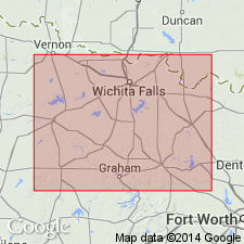
Named as basal of two formations of Bowie Group (all named in this report). Stratotype designated from base of road cut on north side of Farm Road 1769 about 2.7 mi west of Farm Road 1769's intersection with TX Hwy 16 at Markley (source of name) in northeastern Young Co, TX. Overlies Pennsylvanian Canyon Group; underlies Archer City Formation (new) of Bowie. Markley includes continental and minor paralic strata that are approximately equivalent to the middle and upper parts of Thrifty and Graham Formations (undivided) and all of Harpersville and Pueblo Formations (both revised) of Cisco Group. Present in Young, northern Jack, southern Clay, and southwestern Montague Cos, TX on Bend arch and Fort Worth syncline. In easternmost part of outcrop fluvial and minor fluvial-deltaic sandstones and chert-pebble conglomerates form marker beds. Markley contains 15 sandstone members, which occur as mappable zones of thick (20-50 ft) stacked sandstone bodies and as thinner (5-15 ft) horizontally contiguous belts. Component bodies are separated by thin zones of mudstone: light-brown to gray in lower part, dark-reddish-brown with calcareous mudstone in upper part. There are thin beds of highly weathered and fissile subbituminous coal in lower part--this is equivalent to lower part of Harpersville. Ranges in thickness from 320 to 600 ft; thickens to northeast. Is Late Pennsylvanian (Virgilian) to Early Permian (Wolfcampian) in age. Mapped.
Source: GNU records (USGS DDS-6; Denver GNULEX).

- Usage in publication:
-
- Markley Formation
- Modifications:
-
- Mapped 1:250k
- Dominant lithology:
-
- Mudstone
- Shale
- Sandstone
- Conglomerate
- AAPG geologic province:
-
- Fort Worth syncline
Summary:
Pamphlet [p. 10-11]. Markley Formation of Bowie Group. [Mudstones and shales, up to 45 feet thick, with sandstones and conglomerates, and in places coal and limestone. Total thickness 550 to 600 feet. Includes separately mapped units, descending: (1) in upper part, ss14 to ss12, and in middle to lower parts, ss10 to ss5, sandstones and conglomerates, 10 to 50 feet thick, ss5 possibly = Avis Sandstone, exposed west of map sheet; (2) in lower part, ls, argillaceous, sandy, sparsely fossiliferous limestone probably = ls1 of Thrifty and Graham Formations, undifferentiated, of Cisco Group; and (3) in basal part, ss4 to ss1, sandstones and conglomerates, 5 to 25 feet thick, ss4 chert-pebble conglomerate. Lower part of formation (below ss6) = middle and upper parts of Thrifty and Graham, undifferentiated. Lies above Colony Creek Shale of Canyon Group and below Archer City Formation of Bowie Group. Age is tentatively Late Pennsylvanian to Early Permian (Virgilian to Wolfcampian, boundary possibly at or near base of ss12). Mapped in Bowie area, in Clay, Jack, Montague, and Wise Cos., central northern TX; central western edge of map sheet. Rocks previously (1967 ed. of map) included in "Permian rocks above Graham Formation." See also Hentz, 1988, and adjacent Wichita Falls-Lawton sheet, Texas Geol. Atlas, 1987.]
Source: Publication.
For more information, please contact Nancy Stamm, Geologic Names Committee Secretary.
Asterisk (*) indicates published by U.S. Geological Survey authors.
"No current usage" (†) implies that a name has been abandoned or has fallen into disuse. Former usage and, if known, replacement name given in parentheses ( ).
Slash (/) indicates name conflicts with nomenclatural guidelines (CSN, 1933; ACSN, 1961, 1970; NACSN, 1983, 2005, 2021). May be explained within brackets ([ ]).